Weather to Skiweathertoski.co.ukDetailed snow report for 26 February 2026 covering the Alps, other European ski resorts, and North American (US and Canada) ski resorts, including current snow depths,
conditions, and forecasts.
The weather in the Alps has turned very warm this week, with record-breaking February temperatures in places, including an eye-catching 21˚C in Chamonix (1035m) yesterday, 11.6˚C in Tignes (2100m)
and 8.4˚C on the Pisaillas Glacier (3100m) above Val d’Isère.
It hasn’t been warm and sunny across the Alps the whole time this week though. Weather fronts crossed the north-eastern Alps (especially Austria) earlier this week, bringing significant
quantities of snow at altitude (e.g. Obertauern, Kitzsteinhorn glacier) and rain lower down, making for some very soggy skiing in the lower resorts of regions like the Tirol and Salzburgland.
Since Wednesday, however, most regions have been sunny. This has led to clear skies at night across the Alps, and “freeze-thaw” conditions, whereby snow becomes hard or frozen at night due to
radiative cooling (the air temperature doesn’t have to necessarily dip below freezing for the surface to freeze) but then melts later, the rate of melt depending on many factors, not least aspect and
altitude. Low south- and east-facing slopes tend to soften first, followed by those west-facing and finally north-facing (if at all, of course).
Bear in mind that it is still only February and, while the sun is much stronger than it was just a few weeks ago, it is not nearly as strong as it will be by the end of the season. This means
that, as long as skies are clear at night, many north-facing slopes should stay reasonably firm above about 1800-2000m or so, even if the temperature is several degrees above freezing. Humid, rainy,
foggy, windy conditions are far more damaging to the snowpack and snow quality than warm, calm sunny weather.
In short, there is still a lot of good skiing on offer across all parts of the Alps, especially on higher north-facing slopes, but also lower down if you know how to follow the sun and appreciate
the different snow states.
As for snow depths, they remain above average across the entire French Alps, especially in the middling 1500-2000m zone where they were close to record-breaking in places last week. In the Swiss
Alps, they are generally close to or a bit above average in the west (e.g. Vaud, Valais), but close to or a bit below average further east.
In Austria, snow depths are about where you would expect them to be in the far west (e.g. Arlberg) but are generally still below par elsewhere, albeit better than they were earlier in the season.
In Italy, snow depths are mostly above average in the west (e.g. La Thuile, Prato Nevoso) and about average further east (e.g. Dolomites) where they have seen plenty of snow this February, after a
very lean early season.
A quick note regarding the avalanche situation which remains high in many places in the Alps due to a complex evolution of risk factors including last week’s exceptional snowfalls and this week’s
sudden onset of spring: our advice is to always ski with a qualified local guide if skiing off-piste.
Across the pond, western Canadian and eastern US resorts remain in better shape than most resorts in the western US…
Austria
Snow Report: Austria – 26 February 2026This section covers the 26 February 2026 snow report for Austria, including current snow depths at key ski resorts, the condition of slopes and pistes, which ski areas are open, and a
brief forecast of snow over the next few days.
Austria got off to a tricky start this week, with heavy snow at altitude but lots of rain lower down. It has now joined the rest of the Alps in spring-sunshine though, which means freeze-thaw
conditions for most ski resorts, with the best (or most consistent) snow conditions in higher resorts like Obergurgl (115/140cm) and Zürs (100/245cm).
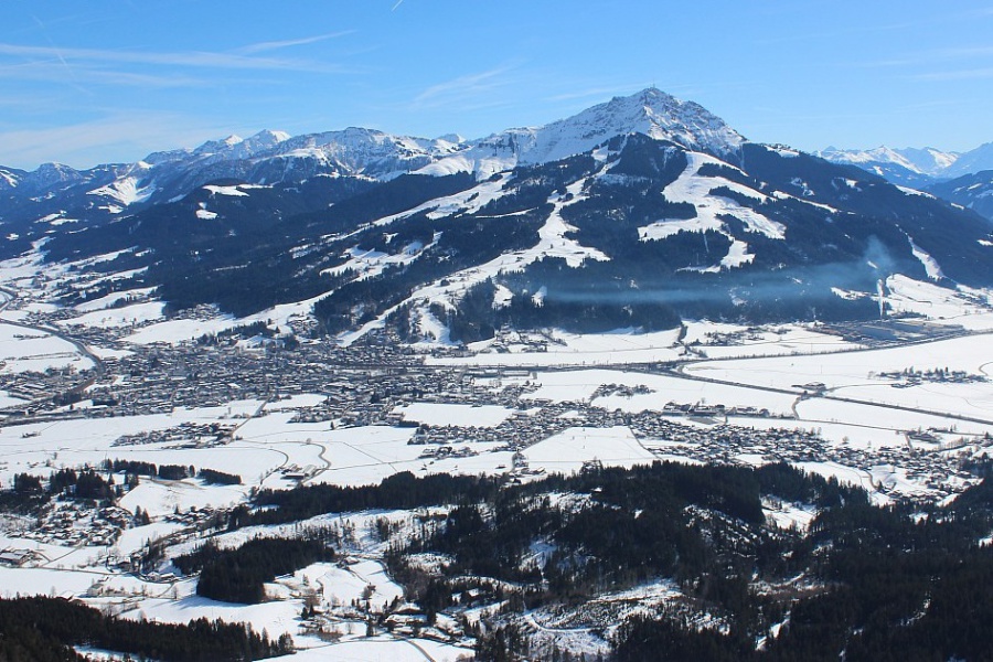
Lower down, there will be more slush earlier in the day, but you can still find some good skiing in the likes of St Johann in Tirol (70/95cm).
It will also turn a bit cooler over the weekend, which will moderate the freeze-thaw process.
Still plenty of snow across most of the Austrian Tirol. This is St Johann in Tirol – 26 February 2026 – Photo: foto-webcam.eu, 26 February 2026
France
Snow Report: France – 26 February 2026This
section covers the 26 February 2026 snow report for France, including current snow depths at key ski resorts, the condition of slopes and pistes, which ski areas are open, and a brief forecast of
snow over the next few days.
Snow depths remain very impressive across the entire French Alps even if it has turned much warmer this week with spring-snow lower down.
For the most consistent and wintry snow conditions you need to be in a resort with plenty of high north-facing terrain, like Val d’Isère (160/260cm).
That said, there is some excellent skiing on offer at lower altitudes, in the likes of Les Gets (60/240cm), you just have to accept that the slopes will turn slushier later in the
day.
Over the weekend, the weather will turn cooler in the French Alps, but there is no significant snow in the forecast any time soon.
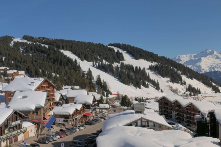
Warm sun but deep snow still in Les Saisies in the Savoie – 26 February 2026 – Photo: lessaisies.com
Italy
Snow Report: Italy – 26 February 2026This
section covers the 26 February 2026 snow report for Italy, including current snow depths at key ski resorts, the condition of slopes and pistes, which ski areas are open, and a brief forecast of snow
over the next few days.
Spring has sprung across the Italian resorts, as it has elsewhere in the Alps.
There is lots of great skiing on offer across all regions, with the most consistent snow conditions at altitude in the likes of Cervinia (100/150cm) and Livigno
(75/100cm).
Lower down, the freeze-thaw process is more noticeable in the likes of Sauze d’Oulx (35/80cm) but there is also lots of fun to be had here, and it will turn that bit cooler over
the weekend.
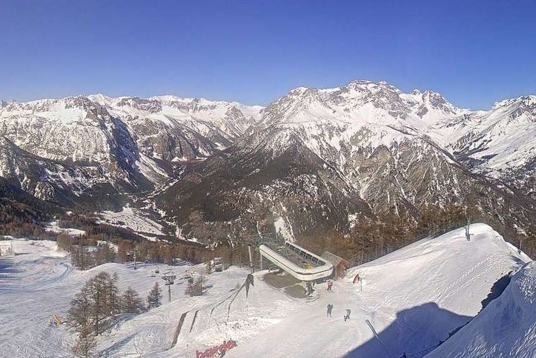
Fabulous spring skiing right now in Bardonecchia – 26 February 2026 – Photo: bardonecchia.it
Switzerland
Snow Report: Switzerland – 26 February 2026This section covers the 26 February 2026 snow report for Switzerland, including current snow depths at key ski resorts, the condition of slopes and pistes, which ski areas are open, and
a brief forecast of snow over the next few days.
There is lots of good skiing to be had across Switzerland right now. However, as elsewhere in the Alps, it is warm, and the most consistent snow conditions are to be found in higher resorts like
Zermatt (85/135cm) and Zinal (65/165cm).
Lower down, and in resorts more exposed to the sun, like Villars (45/160cm), there is still plenty of snow, but spring conditions are much more prominent.
It will turn a bit cooler over the weekend, but there is no significant snow on its way to the Swiss Alps any time soon.
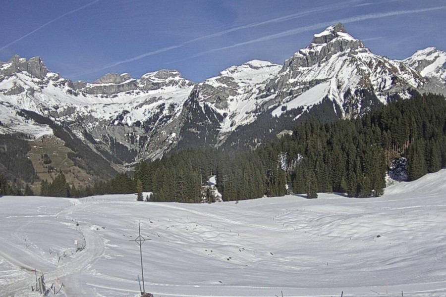
Spring has sprung in Engelberg but there remains a lotof good skiing – 26 February 2026 – Photo: engelberg.ch
Rest of Europe
Snow Report: Rest of Europe – 26 February 2026This section covers the 26 February 2026 snow report for European ski resorts outside of the Alps, including current snow depths at key resorts, the condition of slopes and pistes,
which ski areas are open, and a brief forecast of snow over the next few days.
Spring has also sprung across the Pyrenees! Snow depths remain very impressive, especially at altitude, but freeze-thaw conditions have been increasingly prevalent this week as temperatures have
risen. It will turn a bit cooler over the weekend, but no significant fresh snow is expected any time soon. Right now, Andorra’s Soldeu has settled snow depths of 260/290cm while
France’s La Mongie has 110/190cm.
There is a lot of good skiing on offer across Scandinavia after a very cold, but not notably snowy, first half of the season. Most runs are open in Norway’s largest ski area,
Trysil, where base depths are 60/80cm. Across the border Sweden’s Sålen (50/100cm) is also in decent shape, as you would expect at this time of year.
Scottish ski areas have lost some snow in recent days with wind also hampering lift operations. Some skiing will be possible when the weather allows, but it is becoming more limited – check with
individual areas for updates on conditions and openings.
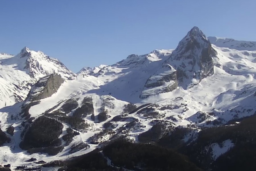
Warm sun but still huge amounts of snow in Gourette in the western French Pyrenees – 26 February 2026 – Photo: gourette.com
USA
Snow Report: USA – 26 February 2026This
section covers the 26 February 2026 snow report for the USA, including current snow depths at key ski resorts, the condition of slopes and pistes, which areas are open, and a brief forecast of snow
over the next few days.
Spring snow conditions have returned to California, although snow depths remain healthy in Mammoth (310cm upper base) which saw a lot of snow fall last week.
Snow depths remain considerably below par though across much of Colorado and Utah. While you can still find some reasonable piste-skiing in the likes of Breckenridge, its 80cm
base remains very modest for February, and there is no significant new snow in the forecast.
Canada
Snow Report: Canada – 26 February 2026This
section covers the 26 February 2026 snow report for Canada, including current snow depths at key ski resorts, the condition of slopes and pistes, which areas are open, and a brief forecast of snow
over the next few days.
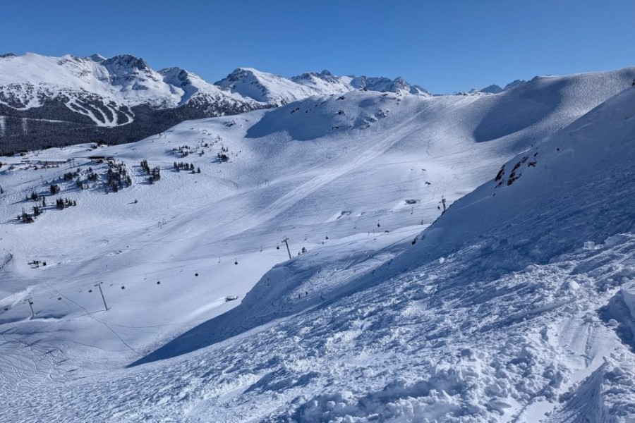
Whistler (249cm mid-mountain base) has seen lots of fresh snow this week and is in great shape right now, with sunny skies also expected this weekend.
Fresh snow is also falling today further inland in Lake Louise (185cm upper base) where they have had an excellent season to date. Expect sunny skies here too by Sunday and into
the first part of next week.
Whistler is in great shape right now – 26 February 2026 – Photo: Elena Gerenelova