Weather to Skiweathertoski.co.ukDetailed snow report for 19 February 2026 covering the Alps, other European ski resorts, and North American (US and Canada) ski resorts, including current snow depths,
conditions, and forecasts.
It’s been an eventful half-term week in the Alps, with huge snowfalls in the west where it has snowed every day and there has been next to no sunshine.
These big snowfalls have led to considerable disruption to infrastructure and ski areas where the off-piste remains highly dangerous.
Once things settle down though, the prospects of great late season skiing conditions look excellent in these western regions, with above average snow depths across all French ski resorts, western
Italian ski resorts (e.g. Sestriere, La Thuile) and many northern and western Swiss ski resorts (e.g. Engelberg, Portes du Soleil, Villars).
Indeed, snow depths in some French resorts (including Alpe d’Huez, La Rosière and Avoriaz) can be considered exceptional, especially in the context of recent years.
Further east, there has been more in the way of sunshine this week and snow depths are much more modest, but that doesn’t mean there isn’t plenty of good skiing on offer, with fresh snow also
falling across much of Austria and the Dolomites today.
It will turn warmer over the next few days though, with spring snow conditions starting to show across some lower ski areas almost anywhere in the Alps.
Across the pond, huge storms have disrupted ski resort operations in California…
Austria
Snow Report: Austria – 19 February 2026This section covers the 19 February 2026 snow report for Austria, including current snow depths at key ski resorts, the condition of slopes and pistes, which ski areas are open, and a
brief forecast of snow over the next few days.
All Austrian ski resorts have seen some new snow this week, albeit in more modest quantities than many other parts of the Alps.
In the far west of Austria, Lech has done better than most with impressive base depths of 119/250cm and plenty more snow falling today. Further east, lower ski areas like the
Ski Welt (65/95cm) have more modest bases but can also plenty of good piste-skiing at higher altitudes – just watch out for some rain close to resort level over the next few
days.
More generally, it will turn warmer this weekend and into next week, with spring snow conditions starting to prevail at lower altitudes across Austria.
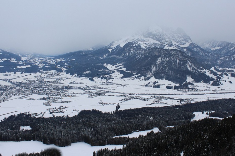
Reasonable snow cover in the lower resorts of the Austrian Tirol but it will turn warmer over the weekend. This is St Johann in Tirol – 19 February 2026 – Photo: foto-webcam.eu
France
Snow Report: France – 19 February 2026This
section covers the 19 February 2026 snow report for France, including current snow depths at key ski resorts, the condition of slopes and pistes, which ski areas are open, and a brief forecast of
snow over the next few days.
The whole of the French Alps has highly impressive snow cover right now, with most ski resorts having seen snow falling every day this half-term week.
For now, the avalanche danger remains critical and off-piste skiing is highly discouraged. There have also been some challenges in recent days on-piste, due to limitations on the amount of terrain
that resort authorities have been able to safely open, especially in resorts at higher altitude.
Once things settle down – which they will do over the next few days – snow conditions will be epic, although warmer weather will lead to spring-snow conditions in some lower areas. La
Rosière currently has base depths of 270/330cm while Les Gets has 70/270cm.
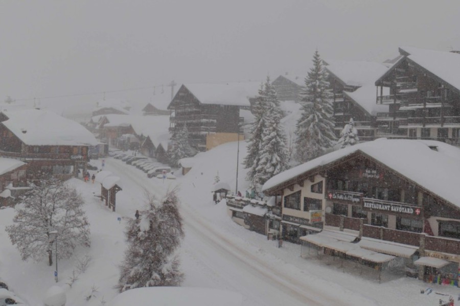
Yet more heavy snowfalls today in Les Saisies, as there have been on most days this week – Photo: lessaisies.com, 19 February 2026
Italy
Snow Report: Italy – 19 February 2026This
section covers the 19 February 2026 snow report for Italy, including current snow depths at key ski resorts, the condition of slopes and pistes, which ski areas are open, and a brief forecast of snow
over the next few days.
All Italian ski resorts have seen fresh snow this week, with huge falls in north-western ski resorts including La Thuile (90/350cm), where the off-piste remains extremely
dangerous.
Further east, as views of the Winter Olympics will have seen, Livigno (60/85cm) and Cortina (55/100cm) have also seen multiple snowfalls, albeit in less
disruptive quantities.
All in all, this bodes well for the coming weeks, even if the weather is forecast to warm up considerably next week with spring snow conditions likely at times lower down.
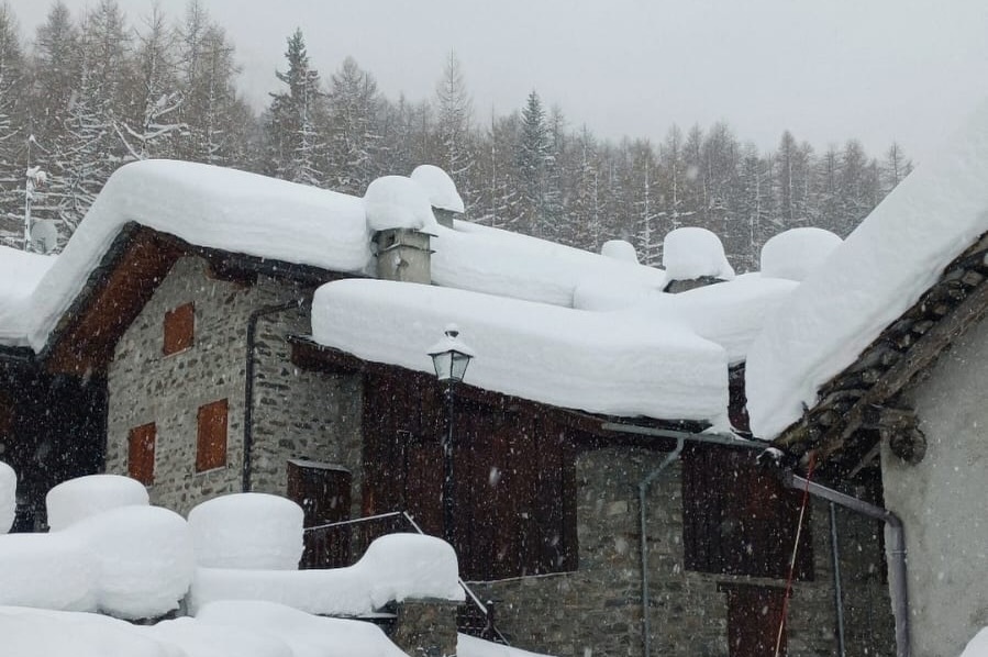
Impressive snow depths in the Aosta valley. This is Rhêmes – 19 February 2026 – Photo: Meteo Valle d’Aosta
Switzerland
Snow Report: Switzerland – 19 February 2026This section covers the 13 February 2026 snow report for Switzerland, including current snow depths at key ski resorts, the condition of slopes and pistes, which ski areas are open, and
a brief forecast of snow over the next few days.
All Swiss ski resorts have seen fresh snow this week, with very significant snowfall accumulations in many cases, especially in the west where Villars now has settled snow depths
of 40/160cm, and in the north, where Engelberg has 30/245cm.
As in France, this snow has hampered some lift operations and made the off-piste very dangerous, although warmer, sunnier weather will slowly stabilise the snowpack over the coming days.
In the eastern Swiss Alps, snowfalls have been more moderate, with settled depths of 100/110cm in high-altitude Arosa.
Expect warmer weather in Switzerland next week, with spring snow conditions likely at times low down.
Big snowfalls this week in Engelberg in the northern Swiss Alps, especially at higher altitudes – 19 February 2026 – Photo: titlis.ch
Rest of Europe
Snow Report: Rest of Europe – 19 February 2026This section covers the 13 February 2026 snow report for European ski resorts outside of the Alps, including current snow depths at key resorts, the condition of slopes and pistes,
which ski areas are open, and a brief forecast of snow over the next few days.
Recent storms have further added to the already exceptional snowpack across the Pyrenees. The weather is expected to settle down now, but with much warmer and sunnier conditions on the way for the
weekend and into next week. Right now, Spain’s Baqueira Beret has base depths of 210/230cm while Pas de La Casa has a massive 260/310cm.
Snow conditions in Scandinavia are generally very good – unsurprisingly given that it has been exceptionally cold for over a month now. It is finally becoming less cold, but with some significant
snow forecast for Voss (75/105cm) in western Norway. Further inland, Sweden’s Sålen (50/100cm) will see no more than a few flurries but here too the snow quality
remains excellent.
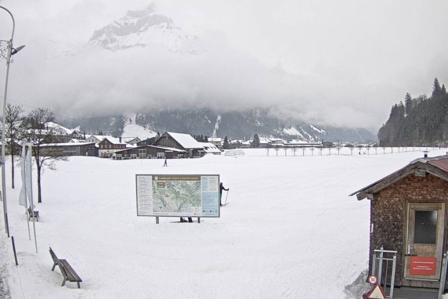
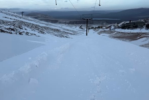
Scotland continues to impress (relative to recent seasons) with decent snow cover across all 5 main ski areas, including Cairngorm (pictured below) although rain will become more of an issue over
the next few days.
Scotland continues to offer plenty of options for skiing. This is Cairngorm – 19 February 2026 – Photo: Cairngorm Mountain Resort
USA
Snow Report: USA – 19 February 2026This
section covers the 19 February 2026 snow report for the USA, including current snow depths at key ski resorts, the condition of slopes and pistes, which areas are open, and a brief forecast of snow
over the next few days.
California’s Mammoth (270cm upper base) has seen around 1.5m of fresh snow in the last few days, with more forecast today. Snow conditions will be fantastic here once the weather
settles down but, for now, much of the mountain is closed and the off-piste is highly dangerous.
Utah has also seen huge snowfalls this week, with well over 1m in Snowbird where the mid-mountain base is around 245cm deep.
Colorado has generally seen less snow overall, but the 15cm that has fallen in the past 48-hours in Breckenridge (74cm mid-mountain base) will help freshen up the pistes after
what has been a disappointing season so far.
Canada
Snow Report: Canada – 19 February 2026This
section covers the 19 February 2026 snow report for Canada, including current snow depths at key ski resorts, the condition of slopes and pistes, which areas are open, and a brief forecast of snow
over the next few days.
Whistler (214cm mid-mountain base) has seen some modest top-ups this week (with around 30cm since we last reported), and has more snow forecast over the weekend, meaning that snow
conditions should be good for anyone coming out here next week.
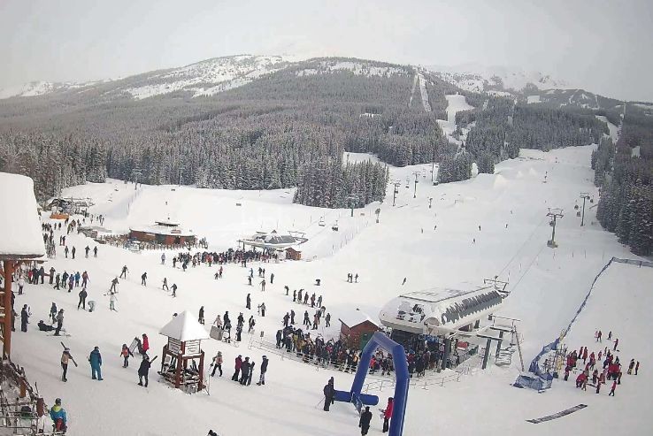
Similar amounts of snow have also been reported further inland in Lake Louise (180cm upper base), which is still in great shape and has a dusting of snow forecast late on
Sunday.
Snow conditions are excellent right now in Lake Louise – 19 February 2026 – Photo: skiLouise.com