Weather to Skiweathertoski.co.ukDetailed snow report for 13 February 2026 covering the Alps, other European ski resorts, and North American (US and Canada) ski resorts, including current snow depths,
conditions, and forecasts.
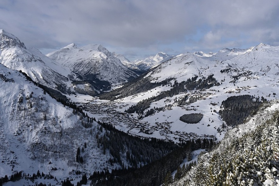
The big storm is over, leaving huge quantities of fresh snow across much of the western Alps on the eve of half-term.
The really eye-catching storm totals have been confined to a relatively narrow portion of the Alps, including France (especially the north, e.g. L’Espace Killy, Paradiski, Chamonix Valley,
Avoriaz), the far north-west of Italy (e.g. Courmayeur, La Thuile) and the far west of Switzerland (e.g Glacier 3000). These areas have all seen more than 1m of new snow above 2000m since Tuesday,
with closer to 1.5m in some spots.
Although skiing in these regions might look incredibly inviting today, given the better weather and all the fresh snow, be warned that the risk of avalanche remains sky-high, and it will take a
while before the authorities can make the ski areas safe. This includes large swathes of on-piste terrain, let alone the off-piste, which should be avoided at all costs for the time being.
Generally, the further east you are in the Alps, the less snow has fallen this week, although most areas have seen at least some.
So, right now, snow depths are very healthy and generally above average in the French Alps, some western Italian regions and the far west of Switzerland. Just about everywhere else snow depths
remain below average, however. This doesn’t mean there isn’t some perfectly good piste skiing on offer though – most holiday makers don’t need massive snow depths to have a good time on the
slopes!
In any case, there is more snow on the way to the Alps, first in the south-western Alps tonight (e.g. Isola 2000, Prato Nevoso), then across the northern Alps on Saturday (e.g. Avoriaz, Engelberg,
Lech), albeit in modest quantities. More importantly, we are expecting another big storm on Sunday night/Monday with 50cm or more possible across a wider swathe of the Alps, including parts of
Switzerland and Austria - where it is most needed.
Across the pond, the eastern US resorts continue to lead the way!
Austria
Snow Report: Austria – 13 February 2026This section covers the 13 February 2026 snow report for Austria, including current snow depths at key ski resorts, the condition of slopes and pistes, which ski areas are open, and a
brief forecast of snow over the next few days.
Austrian ski resorts have missed the heaviest of the snow that has fallen further west in recent days.
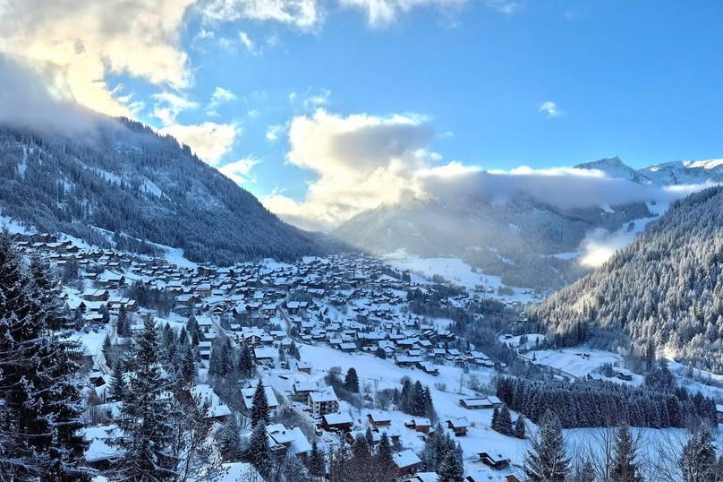
That said, the Arlberg region has seen some useful top-ups, including 15cm yesterday in Lech, which is skiing pretty well right now and has settled snow depths of 70/165cm
depending on altitude.
Further east, you can also find some decent piste skiing in lower resorts like Zell am See (30/65cm), although snow depths remain below par across most of Austria. One exception
is the far south, where Carinthia’s Nassfeld (30/170cm) saw a lot of snow last week.
Lech has seen more snow than most Austrian resorts this week and is skiing pretty well right now – 13 February 2026 – Photo: lechzuers.com
France
Snow Report: France – 13 February 2026This
section covers the 13 February 2026 snow report for France, including current snow depths at key ski resorts, the condition of slopes and pistes, which ski areas are open, and a brief forecast of
snow over the next few days.
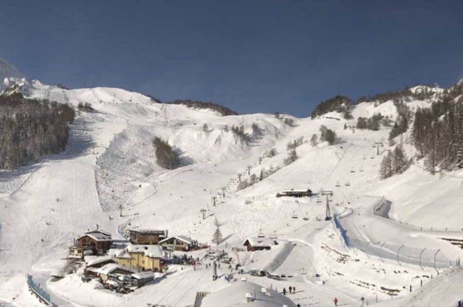
Snow conditions are potentially incredible across much of the French Alps following days of heavy snow. In the short term, however, the snowpack is extremely unstable, with sky-high avalanche
danger off-piste.
The biggest snowfalls were in the Savoies, where the likes of Val d’Isère (125/195cm), La Rosière (195/300cm) and Avoriaz (185/255cm) have seen
over 1m of new snow this week and will be offering incredible skiing once everything is made safe.
Lower down, there has been some rain in the mix at times, but even in Les Gets (30/170cm) the net result has been a very positive one with huge amounts of snow at altitude.
Only the far southern French Alps missed out on serious quantities of snow from this storm, but Isola 2000 (150/190cm) is already in great shape and will get its own “southern”
storm on Friday night when 20-30cm is expected.
Bright skies and deep snow in Châtel this morning – 13 February 2026 – Photo: Guillaume Rodiere
Italy
Snow Report: Italy – 13 February 2026This
section covers the 13 February 2026 snow report for Italy, including current snow depths at key ski resorts, the condition of slopes and pistes, which ski areas are open, and a brief forecast of snow
over the next few days.
The western Italian Alps have seen significant fresh snow this week, with the heaviest falls in the far north-west where La Thuile (160/200cm) and Courmayeur
(60/150cm) have both seen over 1m at altitude and will be in superb shape once the ski areas have been made safe.
Further east, any recent snowfalls have been lighter and patchier but there is a lot of good piste skiing on offer in both Madonna di Campiglio (70/80cm) and Selva di Val
Gardena (60/90cm).
Sun and snow this morning in Courmayeur – 13 February 2026 – Photo: courmayeur-montblanc.com
Switzerland
Snow Report: Switzerland – 13 February 2026This section covers the 13 February 2026 snow report for Switzerland, including current snow depths at key ski resorts, the condition of slopes and pistes, which ski areas are open, and
a brief forecast of snow over the next few days.
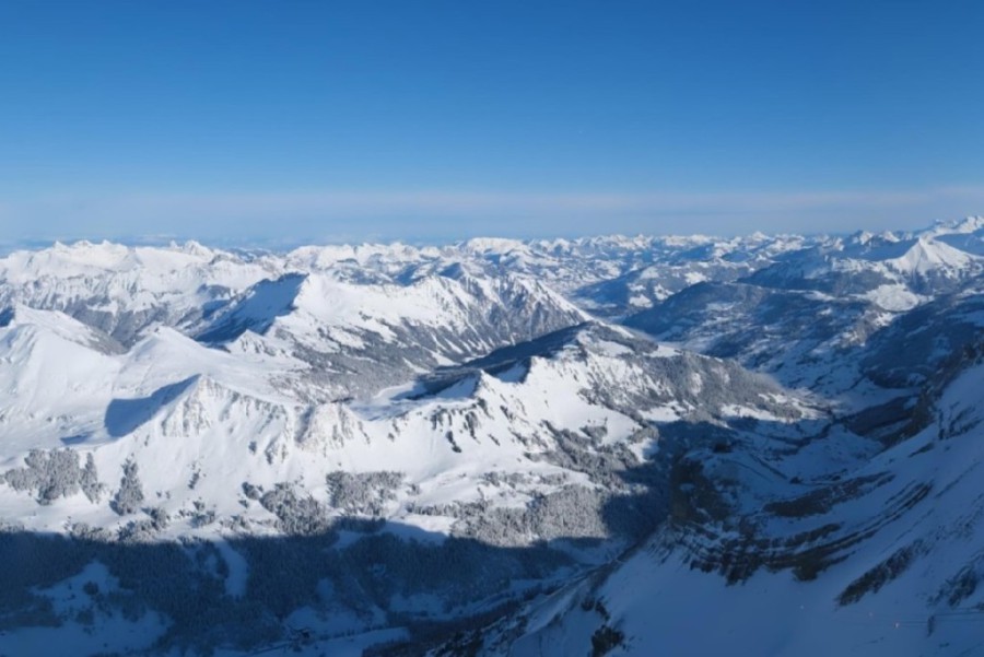
The western Alps have seen significant snow in recent days, including in Verbier (65/180cm), which will be skiing superbly once the area has been made safe.
Zermatt (35/90cm) has also seen some useful new snow, albeit not in quite the same quantities as resorts close to the French border.
Further east, snowfall has been a bit patchier in Laax (5/70cm) but, here too, snow conditions are pretty good as we go into the busy half term week, even if snow depths remain
modest.
Blue skies in western Switzerland this morning, following over 1m of fresh snow at Glacier 3000 – 13 February 2026 – Photo: glacier3000.ch
Rest of Europe
Snow Report: Rest of Europe – 13 February 2026This section covers the 13 February 2026 snow report for European ski resorts outside of the Alps, including current snow depths at key resorts, the condition of slopes and pistes,
which ski areas are open, and a brief forecast of snow over the next few days.
The weather has been pretty wild in the Pyrenees this week, with a mix of heavy snow, heavy rain for a time and some very high winds. There is a lot of snow at altitude, with record-breaking
amounts in places, meaning that snow conditions will potentially be excellent once things calm down – which they should, temporarily at least on Sunday following another big dump on Saturday. Right
now, Andorra’s Arcalis has settled snow depths of 260/320cm while France’s Les Angles has 100/180cm.
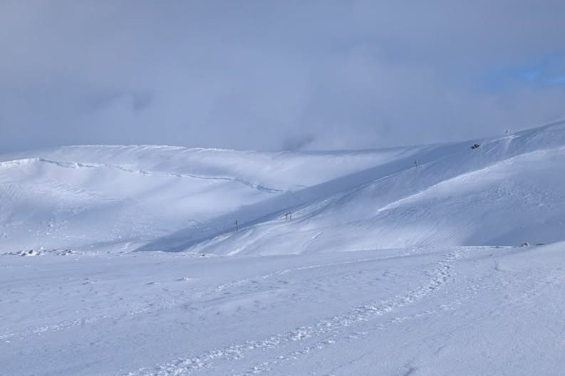
The weather has been very unsettled in Scotland too with further snow (and some rain) from time to time this week which means that skiing is possible in all 5 main ski centres. Some of the best of
this is in Glenshee where 14 lifts were open on Friday.
It remains very cold across most of Scandinavia, though there hasn’t been a huge amount of fresh snow for most regions in recent days. However, there is some excellent piste skiing on offer in
both Norway’s Hemsedal (45/75cm) and Sweden’s Sälen (50/95cm).
Excellent snow cover in Scotland’s Glenshee – 13 February 2026 – Photo: facebook.com/glensheeskicentre
USA
Snow Report: USA – 13 February 2026This
section covers the 13 February 2026 snow report for the USA, including current snow depths at key ski resorts, the condition of slopes and pistes, which areas are open, and a brief forecast of snow
over the next few days.
Some western US ski resorts have seen fresh snow this week, but snow levels remain below par.
Jackson Hole (155cm mid mountain) has done better than most, with 30-40cm of new snow in the last couple of days. Snowbird has also improved a little following
30cm in 48hrs, but much more snow is still needed in both resorts to bring them closer to where they should be at this time of year.
Vail (90cm upper base) is also struggling with only around 70cm of its terrain open and no game-changing snowfall imminent.
For now, the eastern U.S resorts are offering the better snow conditions, with 150cm mid-mountain at Jay Peak where it has been relentlessly cold in recent weeks.
Canada
Snow Report: Canada – 13 February 2026This
section covers the 13 February 2026 snow report for Canada, including current snow depths at key ski resorts, the condition of slopes and pistes, which areas are open, and a brief forecast of snow
over the next few days.
Whistler (203cm mid-mountain base) has seen around 30cm of snow in the last week is and is in pretty good shape overall, with further flurries and relatively cool temperatures
forecast this weekend.
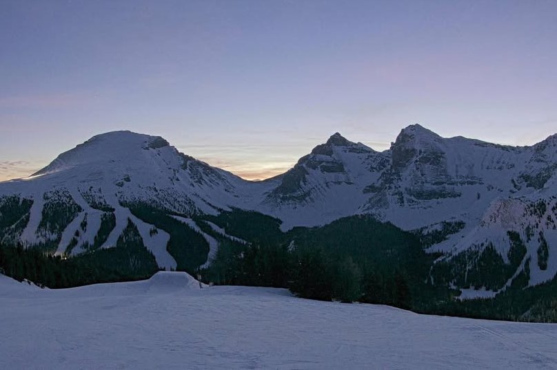
Further inland, there has also been fresh snow this week in the Banff/Lake Louise area, which had seen a lengthy dry spell after a record-breaking start to their season. Base
depths in Lake Louise are now a very healthy 122/160cm, with flurries also forecast over the next few days, meaning that snow conditions are likely to be very favourable.
Sunny skies and great skiing in Sunshine Village yesterday – 12 February 2026 – Photo: facebook.com/sunshinevillageresort