


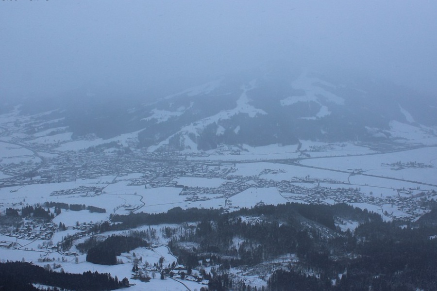
After nearly 6 weeks without any significant snow for much of the northern and western Alps, the much anticipated 3-day storm cycle is finally underway! But while this fresh snow will be very welcome – with up to 1m possible by evening in some north-western parts of the Alps – the storm will not come without complications!
Firstly, the rain/snow limit during this storm is extremely hard to predict, at least during the early part of the storm , as so much cold air is already entrenched across the Alps. The arrival of a warm front will increase the rain/snow limit to 1400–1700m this afternoon in the more exposed western and north-western parts of the Alps (e.g. Portes du Soleil) but it will remain lower for longer in the more enclosed valleys (e.g. upper Chamonix valley, Swiss Valais).
This will lead to significant variations in snowfall totals at lower altitudes across the western Alps. On the whole, the further south-east you are, the lower the impact of the warm sector of the storm, with the upper limit of any rain unlikely to be much above 1000m from the eastern half of Switzerland eastwards, at least away from the northern edges of the Alps.
Then, on , it will start to turn colder again from the north-west with snow initially falling above 1000–1200m or so in the western Alps, then lowering to 600–800m later in the day and then back into the lowest valleys by Friday night and into .
Secondly, with many parts of the Alps having such a meagre base, which is often hard-packed and icy, any serious accumulations of snow will quickly become unstable and liable to sliding. Wind and, in places rain, will further complicate the situation, all leading to highly dangerous off-piste conditions, especially in the north-western Alps. In short, it is recommended that you stay on-piste for the foreseeable future, at least until the storm has died down and the risk of avalanche has been thoroughly assessed by local authorities.
When all is said and done, by night we can expect somewhere close to 1 metre of fresh snow having accumulated above 1800m in some north-western parts of the Alps, especially in France (e.g. Val Thorens, Tignes, La Rosière, Flaine), with significant snow also accumulating across many other parts of France, north-western Italy, Switzerland and, later, the west of Austria.
The further south-east you are, the less snow will fall, with some southern parts of the Alps (e.g. Livigno, Dolomites, Isola 2000) not seeing much at all...
Austria
The rest of will be mostly cloudy in the Austrian Alps, with flurries or longer spells of mainly light snow, a bit heavier in the west later in the day and overnight. The rain/snow limit will generally be very low but will possibly rise to around 1000m in the Arlberg overnight. The southern Austrian Alps (Osttirol) will remain mostly dry with a few brighter spells.
will again be mostly cloudy in Austria, with intermittent snowfall in most regions before it brightens up in the west later. The rain/snowfall limit may temporarily rise to 1000–1200m close to the northern edge of the Alps before falling again later. In the inner valleys it will remain below 1000m.
will be colder, with further mostly light flurries to very low levels in the northern and western Austrian Alps, heaviest in the Arlberg (e.g. Lech).
Some flurries will linger to low levels in the north (e.g. Lech, Kaprun) for a while on , but for many regions some sunny spells will develop, more widely in the south.
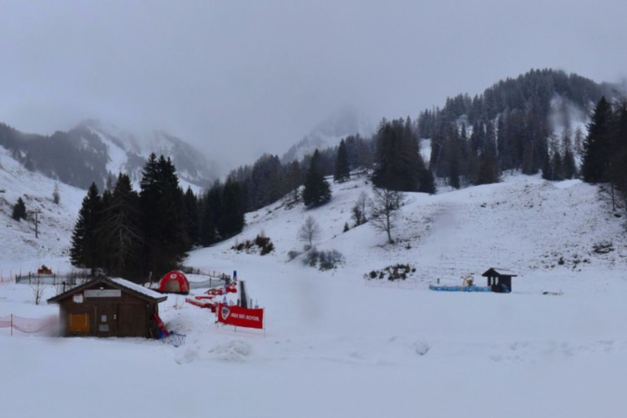
 Light snow this afternoon in the northern Austrian Alps. This is St Johann in Tirol – 8 January 2026 – Photo: foto-webcam.eu
France
The rest of will be mostly cloudy in the French Alps, with only the extreme south (e.g. Isola 2000) seeing any breaks. Heavy snow will turn increasingly to rain up to around 1400–1700m later today and overnight, with narrow internal valleys holding on to snow at lower levels for longer. Later tonight, the snowline will drop again to reach around 1000–1200m by morning.
will continue to see intermittent snowfall. This will be heavy at times with the rain/snow limit dropping to reach 600m or so later in the day. The far south (e.g. Isola 2000) will see less precipitation and some brighter spells.
It will continue to snow in many areas away from the far south on night and into , by which time the snowline will be back into the lowlands. Over the course of , though, the snow should become a bit lighter, especially later in the day, before dying out on Saturday night.
On any residual clouds should break up to leave a bright but cold day in the French Alps.
 Heavy snow this afternoon in La Rosière, one of the resorts that could see 1 metre of snow by Saturday night – Photo: larosiere.com, 8 January 2026
Italy
The rest of will see snow across the western Italian ski resorts (e.g. Courmayeur, Cervinia), heaviest in the north-west and spreading a bit further east on Thursday night but becoming lighter and more showery in the process. The rain/snow limit will generally be low but could rise to 1000m or higher in the west on Thursday night as the milder air attempts to mix in.
will see variable cloud in the Italian Alps, with further snowfalls in the west and north-west, especially close to the French and Swiss border areas and heaviest in the upper Aosta (e.g. Courmayeur, La Thuile). There will also be some flurries in the Dolomites on Friday, however, some central Italian areas (e.g. Livigno) as well as the far south-west (e.g. Prato Nevoso) will largely miss out. The rain/snow limit will be around 1000m but will drop in the north-west later.
will see further snow showers to low levels in the north-western Italian Alps (e.g. Courmayeur, La Thuile). Elsewhere, there will be fewer flurries with some sunshine in the far south and further east (e.g. Dolomites).
should be mostly fine but cold everywhere in the Italian Alps.
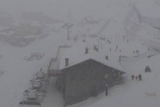 Snowing hard in this afternoon Courmayeur, a ski resort that should do as well as any in Italy from the current storm cycle – 8 January 2026 – Photo: courmayeur-montblanc.com
Switzerland
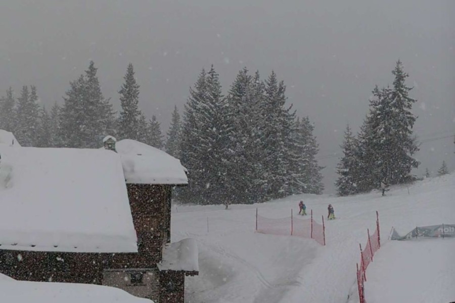
The rest of Thursday will be mostly cloudy in the Swiss Alps, with heavy snowfall in the west, which will move further east later and overnight, but turning more intermittent in the south-east (e.g. St Moritz). The rain/snow limit will remain low for some time in the more enclosed valleys, but will rise to 1500m or higher in the more exposed parts of the north and west (e.g. Portes du Soleil). Some parts of the far south (Ticino) will stay mostly dry.
Friday will see further snow at times across much of the Swiss Alps, heaviest in the north and west (e.g. Portes du Soleil, Verbier) with a rain/snow limit between 1200 and 1400m early on, though this will drop steadily during the day to reach 600m or so later. Parts of the far south will again stay dry.
Saturday will see further flurries or longer periods of snow to very low altitudes, heaviest along the northern side of the Alps (e.g. Engelberg, Mürren).
Sunday will be cold in the Swiss Alps, with flurries lingering for a time across the north and east (e.g. Braunwald, Flumserberg) before moving away later. Skies will be brighter in the far west and south, and will reach most parts later in the day.
 Snow turning to rain lower down this afternoon in the Portes du Soleil, but it will turn back to snow early on Friday. This is Torgon – 8 January 2026 – Photo: torgon.ch
Outlook:
It will turn milder across the Alps early next week. Many regions will stay dry, but some showers are possible across the northern and north-western Alps on , where the rain/snow limit will start low but rise to 1500–1800m later in the day.

Our next detailed weather & snow forecast will be
on Friday 23 January 2026
If you enjoy reading our updates - please feel free to support us: