


The weather in the Alps is changing, with a very mild tropical-maritime airmass set to move in from the west , which will remain in place across western Europe next week.
will also see some rain (to 2300m in places) but only in the northern and western Alps, and it will have moved off eastwards by .
From on we are expecting several days (perhaps even a week) of mostly fine and exceptionally mild weather, with freezing levels often well above 3000m.
While this warmer weather will lead to something of a thaw, especially in areas that see rain , the warm and sunny weather won’t be quite as detrimental to the general snow cover as you might expect due to the low sun angle at this time of year…
Austria
will start mostly dry in the Austrian Alps, but cloud will thicken across the western and northern Alps bringing some rain or snow later in the day and overnight. The rain/snow limit will rise from 1500m to around 2200m on , with about 10–15cm of fresh snow expected at 2300m . The southern Austrian Alps will remain mostly dry, however.
will start cloudy across the northern Austrian Alps with some showers (snow above 2300m), but these should die out with some sunny spells later. The southern Austrian Alps should be mostly sunny, but it will feel very mild everywhere with freezing levels rising to 3000m or so.
will be very mild and mostly sunny in Austria, with freezing levels well above 3000m in most places.
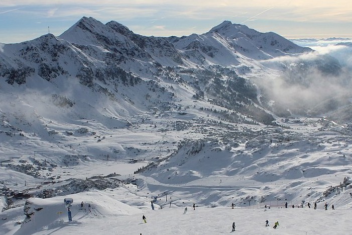 Bright today in Obertauern where a little light snow (and possibly rain at resort level) is forecast tomorrow night – Photo: foto-webcam.eu, 6 December 2025
France
Except for in the far southern French Alps (e.g. Isola 2000), most of the French Alps will be cloudy on , with rain or snow showers becoming more persistent. The rain/snow limit will quickly rise to around 2300m, with the bad weather persisting into the evening before moving away . Around 20–30cm of fresh snow can be expected at 2500m across the northern half of the French Alps (e.g. Chamonix).
On , any early cloud cover should clear to leave a fine day with plenty of sunshine across the French Alps, but with very mild temperatures and freezing levels higher than 3000m.
The weather will continue fine and very mild in the French Alps on .
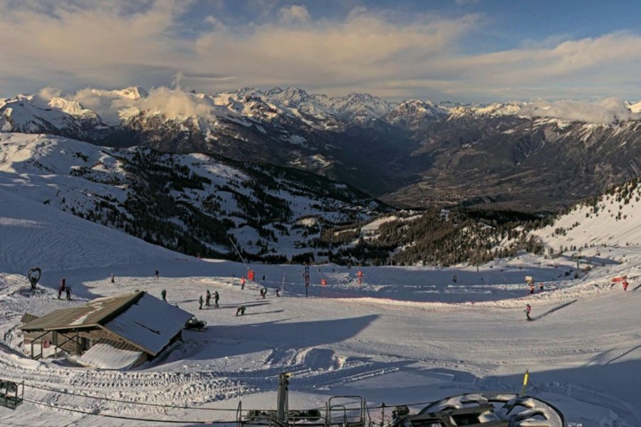 Bright today, if rather hazy, in Risoul in the southern French Alps, where little if any precipitation is expected from the warm front that will arrive in the Alps tomorrow – Photo: risoul.com, 6 December 2025
Italy
will be mostly cloudy in the north-west of Italy, with rain or snow, especially later in the day and heaviest in the upper Aosta region (e.g. La Thuile, Courmayeur). The rain/snow limit will rise from 1500m to around 2100m later in the day.
Apart from some light snow close to the high border regions between Italy and Switzerland, most other parts of the Italian Alps will be dry, with some sunshine even in the far south-west (e.g. Prato Nevoso) and the far east (e.g. Dolomites).
and will be mostly sunny and very mild across the Italian Alps, with freezing levels higher than 3000m.
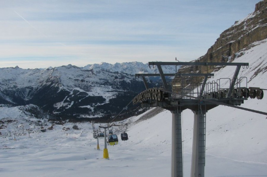 Mostly fine today in Madonna di Campiglio in the western Dolomites, where it should remain dry throughout the weekend – Photo: funiviecampiglio.it, 6 December 2025
Switzerland
will be mostly cloudy in the Swiss Alps, with only the far south (Ticino) likely to see any brighter spells. Elsewhere, showers will give way to heavier and more persistent precipitation, first in the west, before spreading further east later, with a rain/snow limit rising from 1500m to around 2300m. This precipitation will continue for a while overnight before dying away from the west later. Around 20–30cm of fresh snow can be expected at 2500m.
will see some residual cloud in the Swiss Alps early in the day, which will give way to increasing sunshine. It will be very mild with freezing levels around or above 3000m.
will be mostly sunny in Switzerland with just a little high cloud at times. It will again be very mild, with freezing levels above 3000m.
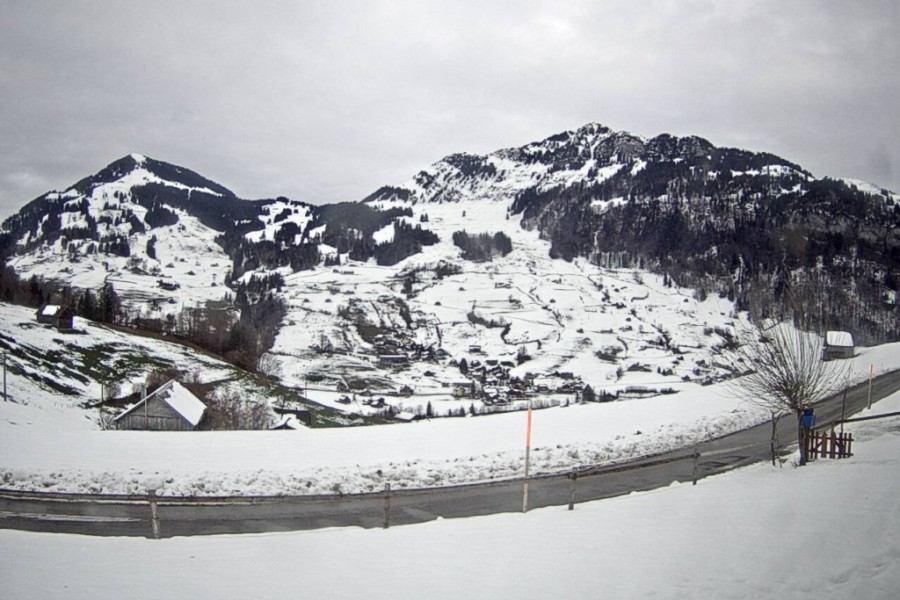 Cloudy skies today over Toggenburg in eastern Switzerland, where some rain or snow is expected later tomorrow – Photo: snoweye.com, 6 December 2025
Outlook:
The rest of next week is likely to remain dry in the Alps, with plenty of sunshine and very mild temperatures.

Our next detailed weather & snow forecast will be
on Friday 12 December 2025
If you enjoy reading our updates - please feel free to support us: