


The weather in the Alps is stuck in a bit of a rut, with lots of snow set to fall in some south-western regions over the next few days, with extreme snowfall forecast in the southern Piemonte (e.g. Prato Nevoso, Limone Piemonte). Many northern and eastern areas will again miss out.
From the middle of next week, temperatures will become noticeably colder but with snow flurries remaining localised, mostly to pockets of the southern Alps.
Over the next 4 days, weather models are predicting over 2m of snow in parts of the southern Piedmont (e.g. Prato Nevoso) and, while this must be taken with a big pinch of salt, this area will clearly see some exceptional snowfall totals. Other ski resorts that will see significant snow over the next few days include Isola 2000, Auron, Sestriere, Prali and Alagna, to name just a few.
Bigger name resorts like Zermatt, Saas-Fee, Val Cenis and even Val d’Isère/Tignes may also see useful falls.
In general, the northern Alps (e.g. Chamonix, Avoriaz, Verbier, Wengen, Engelberg, Davos, Lech, Saalbach, Kaprun) will see little (if any) snowfall over the next few days.
This is likely to also be the case for the eastern Italian Alps (Dolomites), although this region may pick up some flurries mid-week. …
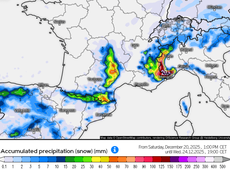 Extreme snowfalls are forecast in some of the south-western Alps over the next few days, with some models predicting accumulations of over 2m in the southern Piemonte by Wednesday – Image: kachelmannwetter.com, 20 December 2025
Austria
will be mostly sunny at altitude in the Austrian Alps, but with fog or low cloud persisting in the northern lowlands. It will be mild with a light to moderate Foehn wind developing across central and northern regions. The max temperature at 2000m will be around 4˚C.
On , it will remain mostly sunny in the mountains but with increasing veils of high cloud. The max temperature at 2000m will remain at around 4˚C.
On , low cloud will become more prevalent, especially in the eastern Alps where sunshine will be increasingly confined to higher altitudes. It will generally be sunnier in the western Alps (e.g. Vorarlberg).
On , a strengthening easterly airflow will see lower temperatures and far more cloud, with only the west (Vorarlberg, Tirol) likely to see sunny breaks. There may even be a few light flurries in the eastern Austrian Alps (e.g. Schladming, Obertauern). Freezing levels will fall to as low as 600m in the east.
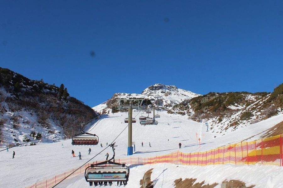 Sunny today in Obertauern, where little (if any) snow is expected over the coming days – Photo: obertauern.com, 20 December 2025
France
will be mostly sunny at altitude in the Austrian Alps, but with fog or low cloud persisting in the northern lowlands. It will be mild with a light to moderate Foehn wind developing across central and northern regions. The max temperature at 2000m will be around 4˚C.
On , it will remain mostly sunny in the mountains but with increasing veils of high cloud. The max temperature at 2000m will remain at around 4˚C.
On , low cloud will become more prevalent, especially in the eastern Alps where sunshine will be increasingly confined to higher altitudes. It will generally be sunnier in the western Alps (e.g. Vorarlberg).
On , a strengthening easterly airflow will see lower temperatures and far more cloud, with only the west (Vorarlberg, Tirol) likely to see sunny breaks. There may even be a few light flurries in the eastern Austrian Alps (e.g. Schladming, Obertauern). Freezing levels will fall to as low as 600m in the east.
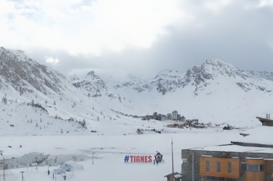 High cloud masking the sun at times today in Tignes, where some snow could spill over the Italian border early next week – Photo: tignes.net, 20 December 2025
Italy
will see flurries in the western Italian Alps, especially in the Piemonte. These will be heaviest later in the day in the south (e.g. Prato Nevoso). The rain/snow limit will start at around 1400–1700m but will drop later in the day during the heaviest of the snow. The central and eastern Italian Alps will remain mostly dry with the best of the sunshine the further east you are.
will see snow (800–1000m) for much of the day in the Piemonte, heaviest again in the far south where accumulations will become significant. Other parts of the western Italian Alps (i.e. Aosta) will also see flurries, though these will generally be lighter in nature, while the eastern Italian Alps (e.g. Dolomites) will again stay mostly dry with some sunny spells.
will see further flurries (800–1200m) in the western Italian Alps, mostly in the Piemonte, although these may not be as heavy as on Monday. The eastern Italian Alps will again stay mostly dry with variable cloud cover.
, temperatures will turn noticeably colder with snow flurries possible to low levels right across the Italian Alps.
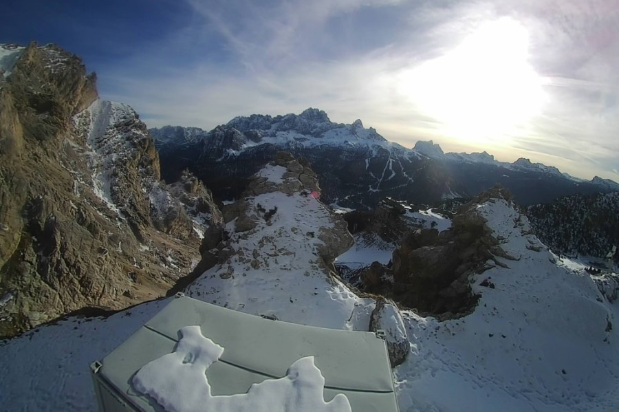 Bright skies today in Cortina, where very little snow is expected over the next few days – Photo: dolomitisuperski.com, 20 December 2025
Switzerland
should start mostly fine in the Swiss Alps, with sunny spells above any valley fog, although cloud will increase later in the day, especially in the south, with a few showers or flurries (1300m) in places, particularly in the border regions between Zermatt and the Simplon region. With the Foehn blowing, it will feel milder in the northern valleys (e.g. Jungfrau region) where freezing levels will remain above 2000m.
will see further showers in the far south of Switzerland, especially to the east of Zermatt/Saas-Fee and around the Simplon region, with snow above 1200m. Elsewhere, there will be variable cloud and a few sunny spells with freezing levels close to or just above 2000m.
will see fewer showers or flurries, this mostly confined to the Ticino region. Elsewhere, there will again be variable cloud but with some good sunny spells at altitude.
will start to feel noticeably colder as the easterly flow strengthens and brings more in the way of low and medium-level cloud across Switzerland. There may also be a few flurries to relatively low levels in the east and south later in the day.
 Engelberg is unlikely to see any snow over the next few days – Photo: engelberg.ch, 20 December 2025
Outlook:
On both and the Alps will be under the influence of a cold easterly airflow, with a few flurries to low levels in places, these most likely in the southern Alps. The driest and sunniest weather will be in the northern Alps.

Our next detailed weather & snow forecast will be
on Thursday 8 January 2026
If you enjoy reading our updates - please feel free to support us: