


A major storm is about to hit the western Alps which, despite not lasting long, will be punchy, with over 1m of snow falling in less than 36 hours in a few favoured spots!
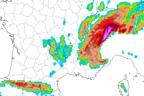 Over 1m of fresh snow is possible by Sunday morning in some parts of the Alps, shown by the brighter purple/pink colours – Image: meteociel.com, 13 March 2026
The origin of this extreme snowfall is in a mass of polar maritime air that will follow an active cold front, which is expected to hit the western Alps later tonight.
This front is anchored by an area of low pressure to the north but will also spawn a secondary low in the northern Mediterranean as the cold air interacts with the warm sea. Anchored by lows to both the north and the south, the cold front will stall over the central-western Alps, drawing in lots of energy off the Mediterranean.
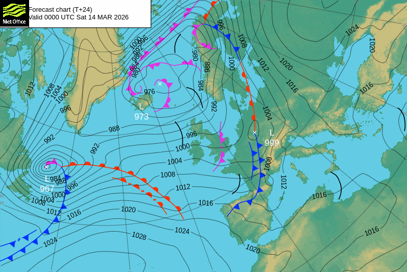 The cold front is approaching the Alps from the west tonight, with the first signs of a secondary low (closing isobars) starting to form in the western Golfe du Lion – Image: metoffice.co.uk, 13 March 2026
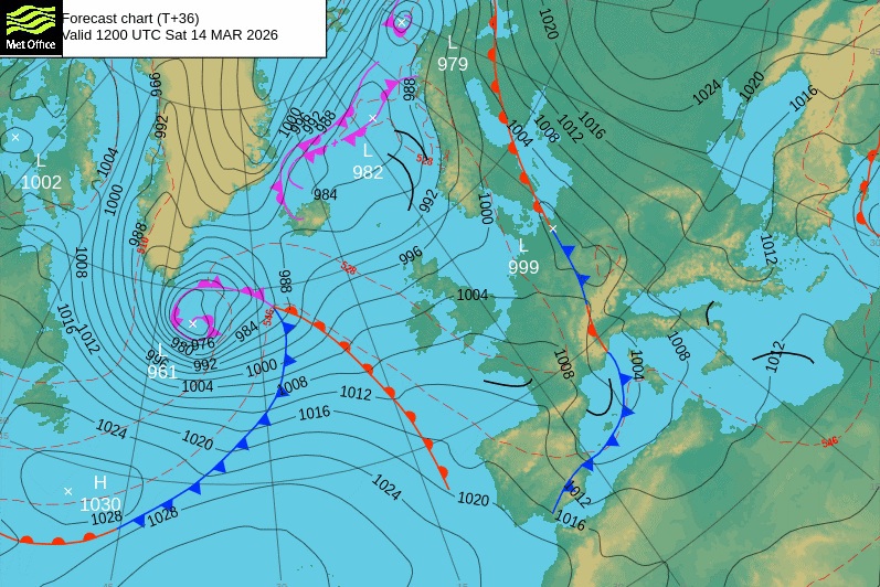 By midday on Saturday the secondary low, now in the eastern Golfe du Lion, has almost formed (closing isobars) as the front, now anchored by two lows, slows and draws energy back north from the Mediterranean – Image: metoffice.co.uk, 13 March 2026
Areas most likely to see extreme snowfall from this storm are the eastern Aosta (e.g. Gressoney), the northern Piemonte (e.g. Alagna, Macugnaga) and the border regions of the Haut-Valais above Zermatt, Saas-Fee and the Simplon region. These regions are likely to see 1m or more snow (with some models predicting up to 1.5m) above 2000m in just 36 hours between Friday night and Sunday morning.
Elsewhere in the western Alps, most French, Swiss and western Italian resorts should see 20-60cm above 1600m or so, with the snow falling to very low levels (400-500m) for a time in the north-west on Saturday morning.
The central Italian Alps (e.g. Livigno) should also see a decent snowfall, though there will generally be a bit less in the Dolomites, and less still (or virtually nothing) in parts of northern and eastern Austria.
Austria
will remain mostly dry in the Austrian Alps, but with increasing cloud in the far west and south later on.
, the northern Austrian Alps will be protected by the Foehn and remain mostly dry and bright, although some precipitation will edge into the west later (Arlberg) with a rain/snow limit initially around 1000m. Closer to the Italian border (e.g. Obergurgl), and more generally in the southern Austrian Alps, it will be cloudier all day with outbreaks of snow above 1000–1400m, heaviest further west.
will be mostly cloudy with a few light showers or flurries here and there, with snow above 800–1300m (north to south), but no significant falls are expected.
Between and we can expect 10–20cm of fresh snow in some south-western parts of the Austrian Alps close to the Italian border (e.g. Obergurgl).
The Arlberg (e.g. Lech) may also see around 10cm on otherwise most parts of Austria will only see a few centimetres here and there at best, with almost nothing getting through to the north-east (e.g. Schladming).
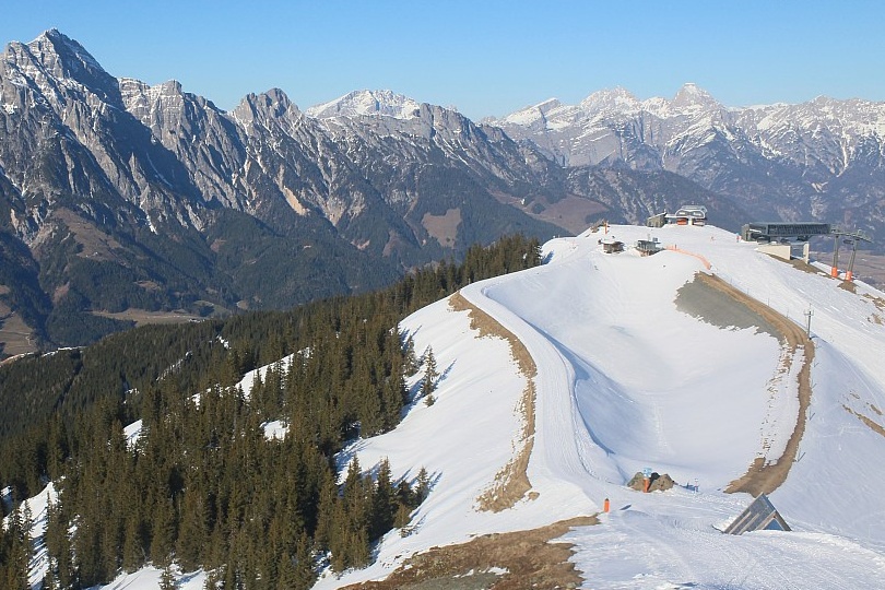 Still fine this evening in the Austrian Alps, which will miss the brunt of this latest storm – This is Leogang – 13 March 2026 – Photo: foto-webcam.eu
France
, rain or snow will hit the western foothills of the French Alps in the early hours, reaching all areas by dawn.
will be mostly cloudy, with persistent rain or snow turning more showery later. The rain/snow limit in the northern French Alps will start at around 1000–1200m but quickly drop to 400–600m on . The milder air will hang on a bit longer in the southern Alps, with snow around 1000–1500m early on before dropping to below 1000m later in the day.
The snow will ease leaving quite a lot of residual cloud in places on , but also some sunny spells, with the zero-degree isotherm recovering to around 1500m.
Between and we can expect 20–40cm of fresh snow above 1600m, with 10–15cm possible at 1000m in some northern French resorts.
 Cloudy skies in Chamrousse in the western French Alps, where snow is expected later tonight – Photo: chamrousse.com, 13 March 2026
Italy
will see showers start to break out across some of the western Italian Alps, first in the eastern Aosta and northern Piemonte then, by , across many other western parts.
, the precipitation in the western Italian Alps will intensify, especially in the eastern Aosta and northern Piemonte regions, while also spreading further east. However, it will be much weaker by the time it reaches the Dolomites late on . The rain/snow limit will generally be around 1200–1500m at first, but descending later in the west, and under the more intense precipitation.
On , snow (900–1400m) will continue to fall in many regions, including in the east (Dolomites) albeit much lighter here.
, the weather will turn drier and brighter in the eastern Italian Alps but snow will continue for a time (1000–1500m) further west, especially in the Piemonte regions (both north and south).
Between and , we can expect over 1m of fresh snow above 1800m in parts of the eastern Aosta and northern Piemonte (e.g. Monte Rosa, Macugnaga), 30–60cm in most of the rest of the western Italian Alps, 20–35cm in parts of the central Italian Alps (e.g. Livigno, Passo Tonale), and 5–20cm in the Dolomites.
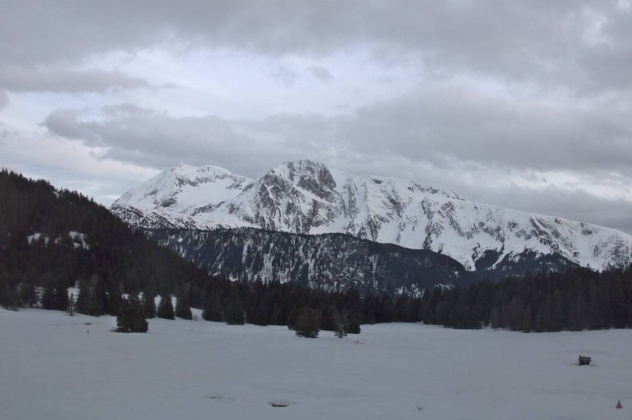
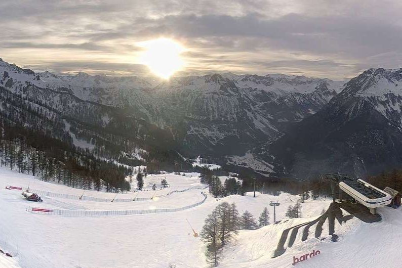 Clouding up this evening in Bardonecchia, where snow is expected tomorrow – Photo: bardonecchia.it, 13 March 2026
Switzerland
The bad weather will reach the western Swiss Alps later on Friday n, with a rain/snow limit starting at around 1200–1400m, and will spread to all but some eastern valleys by .
will see widespread rain or snow across most of the Swiss Alps, perhaps turning a bit showery in places later but remaining persistent near the Italian border areas of the Valais and in Ticino. The rain/snow limit will quickly fall to between 400–700m, except in the far south where it is likely to remain above 1000m for much of the day.
will see some flurries at first (500m–800m in the north, 1000m in the south), which will gradually die away to allow some sunny spells to develop.
Between and we are expecting 20–40cm of fresh snow above 1500m across most of the Swiss Alps, with 50–70cm in some central districts (e.g. Andermatt) and as much as 1m in the border regions above Zermatt, Saas Fee, the Simplon region and into Ticino.
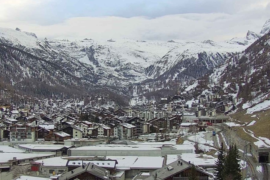 Cloud starting to pile up on the Swiss-Italian border, ahead of the incoming storm – Photo: zermatt.ch, 13 March 2026
Outlook:
will see a few showers across parts of the northern Alps (snow 1000m). Otherwise, there will be plenty of dry and sunny weather across the Alps , although the far south may see a few flurries .

Our next detailed weather & snow forecast will be
on Friday 20 March 2026
If you enjoy reading our updates - please feel free to support us:
Follow us on:


