



Welcome to our first detailed weather and snow forecast for the 2026-27 Alpine ski season!
A very powerful westerly airflow is aimed directly at the Alps this week, bringing with it a succession of active storms off the Atlantic.
This very potent storm cycle will continue until and even through the weekend, with the greatest rain and snowfall totals in the north-western Alps. This includes the northern French Alps (e.g. 3 Valleys, Val d’Isère-Tignes, Chamonix valley), the far north-western Italian Alps (e.g. Courmayeur, La Thuile) and the western Swiss Alps (e.g. Portes du Soleil, Verbier).
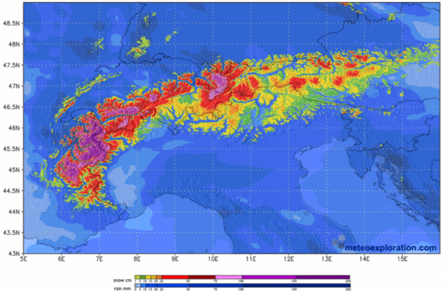 100-150cm of fresh snow is possible at high altitude in the western Alps this week – Image: meteoexploration.com, 17 November 2026
On the whole, the further south-east you are in the Alps, the fewer impacts this week’s storms will have, with relatively little precipitation getting through to the Dolomites, for example.
Back to today, we have a powerful warm front crossing the Alps with heavy snow at high altitude, especially in the north-western Alps, and lots of rain lower down. A short lull is expected during the course of the afternoon. The rain/snow limit will be as high as 2600-2800m in some western parts of the Alps today before lowering towards 2000m this evening or overnight.
By Wednesday morning we are likely to see up to 50cm of very windblown snow above 2700m in some of north-western areas, but more typically 10-30cm across the northern Alps as a whole. With winds gusting at up to 130km on exposed peaks the snow will be very unevenly distributed, which will lead to a significant risk of avalanches at altitude. Lower down, expect some localised flooding or even mudslides in places.
The weather will continue very unsettled for the rest of the week with the heaviest precipitation generally still in the north-west. The rain/snow limit will gradually come down, typically to between 1400m and 2000m on Wednesday and Thursday, then towards 1000-1400m by the end of the week.
Storm totals this week have been revised upwards recently with over 150cm of fresh snow possible above 2800m between last Sunday and Saturday.
More generally across the northern and western Alps we will see 30-80cm by Saturday. Further to the south-east the impacts from this storm will be much less significant…
Austria
The rest of will be mostly cloudy in Austria, with outbreaks of rain spreading across the northern half of the Austrian Alps with snow above about 2000m. South of the main alpine ridge it will be drier with some brighter spells and just a few showers later in the day, although it will become very windy at altitude in all regions.
will continue unsettled with further showers in the northern and western Austrian Alps, and a few centimetres of snow above 1500-1800m. In the south (Carinthia, Osttirol) it will again be drier with sunny spells. It will remain windy, especially at altitude.
will see further showers and a few more centimetres of snow above 1500m in the northern Alps. A few showers will also get through to the southern Austrian Alps but with snow only falling above 1900m.
should turn drier in the southern Austrian Alps but showers will persist further north, with snow falling above 1500m leading to further, generally modest, accumulations.
Between and , we are likely to see another 10-40cm above 1800m across the northern Austrian Alps, with the greatest amounts in the far west (e.g. Lech).
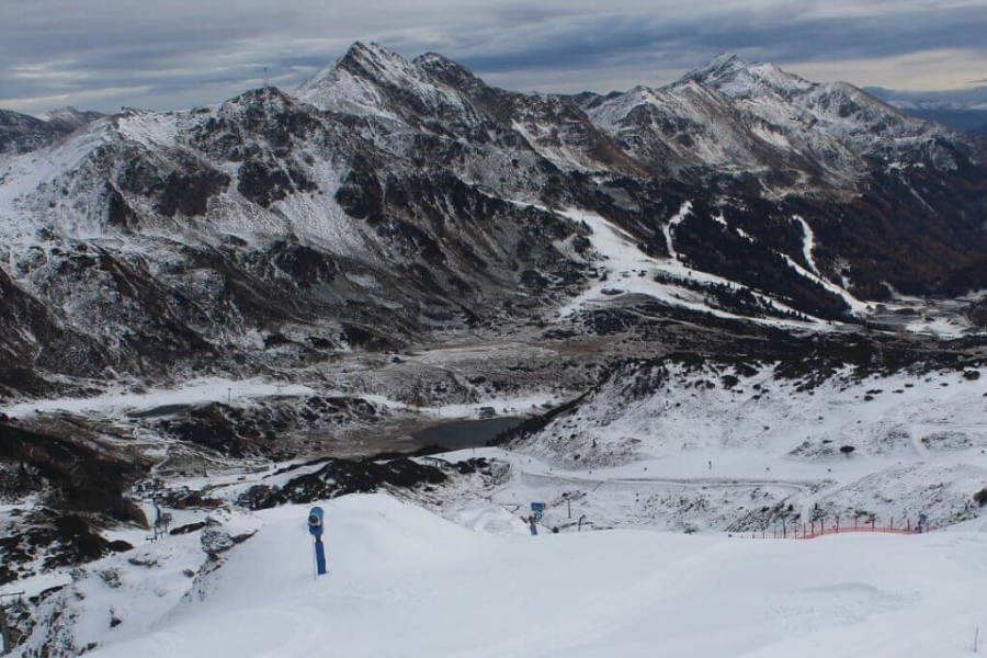 Obertauern in the eastern Austrian Alps will escape the worst of today’s weather – Photo: foto-webcam.eu, 17 November 2026
France
The rest of will be mostly cloudy in the French Alps with rain or high-altitude snow, albeit with a short lull during the afternoon before renewed precipitation tonight. Only some parts of the far south will escape the worst of the weather. The heaviest precipitation will fall in the northern half of the Alps but with snow only above 2400-2800m, dropping towards 2000m .
Above 2800m we will see 20-40cm of very windblow snow in most areas by , and perhaps as much as 50cm in some favoured areas (e.g. Mont Blanc region). It will be very windy at altitude.
will remain unsettled with further showers in most areas, heaviest in the north where it will snow above 1600-2000m. It will remain very windy at altitude.
will remain very changeable, with further spells of rain or snow above 1500-1900m or so, though showers and flurries should be lighter in the southern Alps.
The weather in the French Alps will remain broadly similar on with further significant precipitation in the north, although the snowline will fall to 1200-1500m later in the day.
Between and we should see an additional 40-80cm of snow above 2000m in the northern French Alps, and 10-50cm in the southern French Alps.
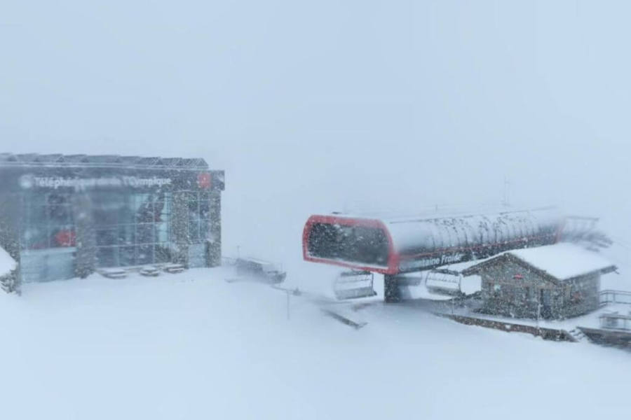 Heavy snow and high winds above 2500m today in Val d’Isère – Photo: valdisere.com, 17 November 2026
Italy
The rest of will see heavy rain and high-altitude snow (2000-2500m) in the western Italian Alps, especially in the upper Aosta close to the French border, where 40-50cm or more of very wind-blown snow is likely above 2700m by . Some rain and snow will make it further east but will become lighter and patchier as it does, with the Dolomites seeing just a few light showers later in the day (snow around 2100m).
will see further showers or longer spells of rain/snow in the western Italian Alps, again heaviest in the far north-west (e.g. La Thuile, Courmayeur) with a rain/snow limit around 1700-2200m. Once again, the weather will be better the further east you are, with some brighter spells and only a few light showers getting through the central (e.g. Livigno) and eastern Italian Alps (Dolomites).
will see some heavier snow for a time in the north-western Italian Alps with the rain/snow limit as low as 1400m in the upper Aosta before the weather brightens up later in the day, at least away from the border areas.
Elsewhere in the Italian Alps, some rain and snow (1500-1700m) will also get through to parts of Lombardy, but in more modest quantities. The eastern Alps and the Dolomites will again stay mostly dry with bright spells.
By the showery activity will be increasingly confined to the north-western Italian Alps, especially close to the border (e.g. La Thuile, Courmayeur) with the rain/snow line around 1400m.
Between and an additional 40-70cm of snow is likely above 2000m in the far north-western Alps (Courmayeur, La Thuile), but more generally 20-40cm in the western Alps (e.g. Cervinia, Sestriere). However, there will be no more than a few centimetres here and there further east in eastern Lombardy and across the Dolomites.
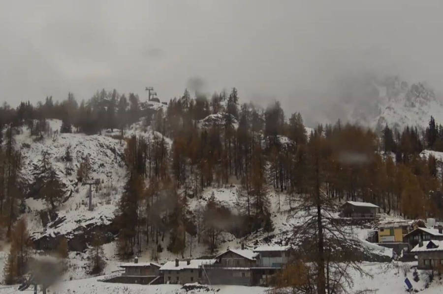 Rain lower down but snow above about 2300m today in Courmayeur – Photo: courmayeur-montblanc.com, 17 November 2026
Switzerland
The rest of will be very wet across much of Switzerland with the heaviest rain in the west and snow only falling above 2400-2800m, before descending to around 2000m . By the end of we can expect 20-40cm of very windblown snow above 2800m, with even more in places close to the French border (e.g. Dents du Midi).
will see further showers or longer spells of rain or snow (1600-1800m), heaviest in the north and especially in the west (e.g. portes du Soleil), but lighter and patchier in the south-east (e.g. St Moritz).
and won’t see much change in the weather in the Swiss Alps, with further spells of rain or snow, always heaviest in the north and west with the rain/snow limit typically around 1500-1700m but lowering towards 1200m later on . The driest weather will always be in the south-east where there should be some brighter spells from time to time.
Between and an additional 40-70cm of snow is likely to have fallen above 2000m in the northern and western Swiss Alps (e.g. Mürren, Verbier).
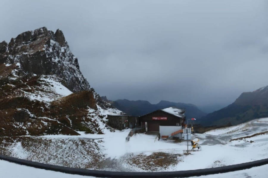 Rain falling to around 2600m today in Engelberg – Photo: engelberg.ch, 17 November 2026
Outlook:
The weather in the Alps will remain changeable over , with snow lingering for a while in the north-eastern Alps (chiefly Austria) on while the western Alps benefit from a brief respite.
However, new weather fronts will bring further snow into the west later on , before moving further east on . The rain/snow limit over will be in the region of 1200-1400m.
Our next detailed weather & snow forecast will be
on Friday 20 November 2026
If you enjoy reading our updates - please feel free to support us:

Follow us on:


 Print