

Today in the Alps...
Updated: 11.40am Thursday 25 April 2024 - Best snow conditions of the season in the Alps?
The exceptionally cold spell of weather for late April is finally coming to an end, with temperatures set to climb steadily in the Alps over the next few days.
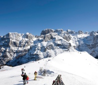
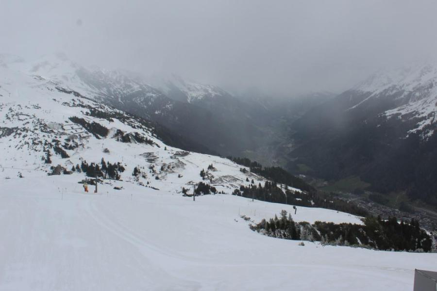
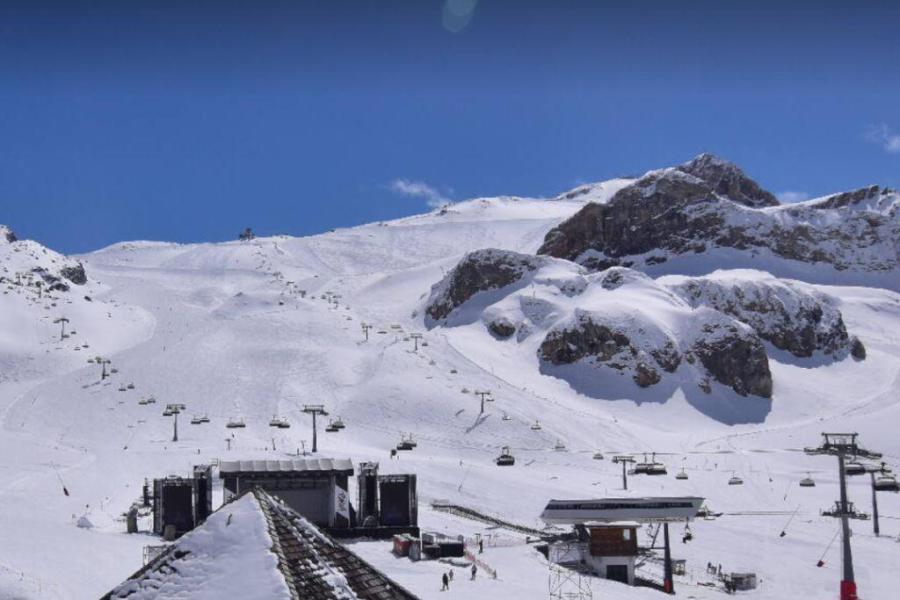 Snow conditions are as good as they have been all season in the high bowls in Ischgl – 25 April 2024 – Photo: ischgl.com
Over the last week or so, temperatures in the northern Alps have been around 10°C below normal, about as cold a spell of late season weather that we can remember, at least in recent years.
There has been plenty of snow too, at least across the northern Alps where storm totals (since last weekend) have hit well over 1m in a number of areas, including at altitude in Engelberg, the Arlberg region and the Stubai glacier. The snow level has also been very low for late April, with dustings down to 300m in places.
Needless to say, snow conditions have been amazing in the few resorts still open, including Val d’Isère/Tignes, Zermatt, Engelberg, Ischgl and Sölden.
If you enjoy reading our updates - please feel free to support us:
Our Snow reports and Snow forecasts
will return in Autumn 2024...
Our latest blog
Bad Gastein: 5 reasons why you should visit this 'forgotten' Austrian gem
Bad Gastein dropped off the radar for a while with British skiers but is now making a comeback. Here are 5 reasons why you should consider it for your next ski trip...
Our complete guide to:
Early season snow conditions in the Alps
Who got the most snow in the Alps in 2022-23?
The 2022-23 alpine ski season was relatively snowless and exceptionally mild, although some resorts fared better than others.
Read our full review of the 2022-23 ski season and find out who got the most snow in the Alps...

Who got the most snow in North America in 2022-23?
The 2022-23 North-American ski season saw record-breaking snowfall in California and Utah, but close to or below average snowfall in most other regions.
Read our full review of the 2022-23 ski season, and find out who got the most snow in North America...
Top 10 late season ski resorts in the Alps
Our complete guide to:
Weather and snow conditions in Scotland
Our blog...

Bad Gastein: 5 reasons to visit this 'forgotten' Austrian gem
23 March 2024
Bad Gastein dropped off the radar for a while with British skiers but is now making a comeback. Here are 5 reasons why you should consider it for your next ski trip...
Top 5 pistes in Les Arcs
8 June 2022
Les Arcs boasts some of the finest and most famous pistes in the Alps. Here are five of our favourites...
Top 5 early season ski resorts - Italy
22 October 2020
Here are our top 5 ski resorts for an early season ski holiday in Italy...
Our complete guide to...
Snowfall patterns in the French Alps
16 September 2020
Ever wondered why some areas of the French Alps get more snow than others?
This month so far in the Alps...
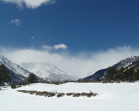
Updated: 11.50am Saturday 20 April 2024 - Winter is firmly back in control and here to stay!
The Alps are under the influence of a cold northerly airflow which is bringing significant quantities of snow to many northern parts of the Alps.
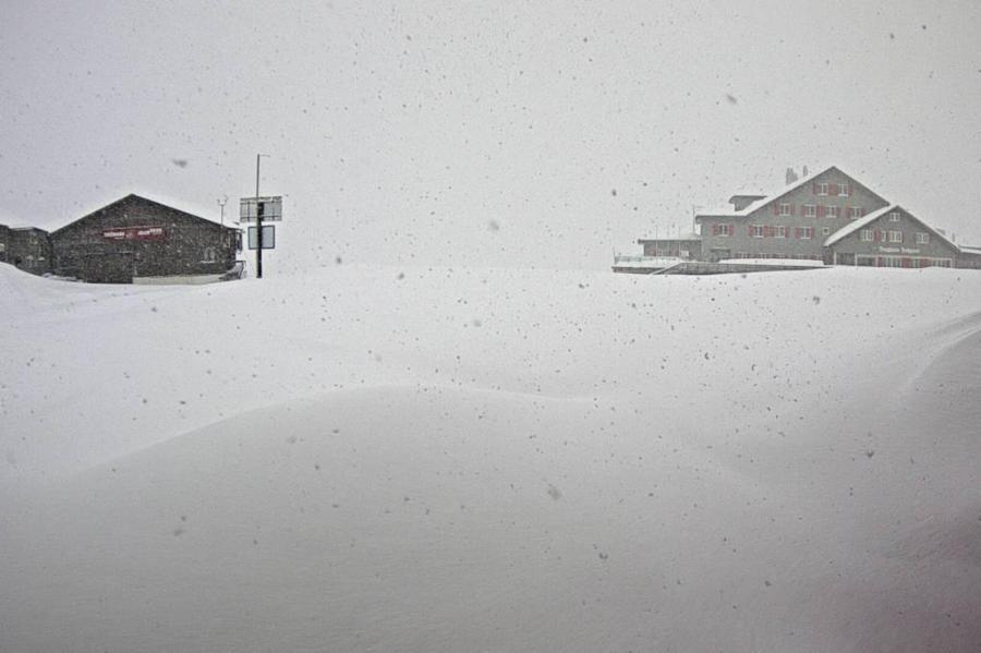 Engelberg has seen huge snowfalls at altitude this week – Photo: titlis.ch, 20 April 2024
It has already been snowing on and off for a few days across the northern Alps, and an active front accentuated this snowfall last night, especially in the northern Swiss and western Austrian Alps (e.g. Engelberg, St Anton) where 3 day storm totals are now close to 1m at altitude.
Today and tomorrow it will continue to snow to very low altitudes across the northern Alps, heaviest again in Switzerland and Austria which will see further significant accumulations. The southern Alps will miss the heaviest of any snow but will also see some flurries, especially on Sunday.
Next week will remain cold, with further flurries in places, the focus for the heaviest of the snow this time turning towards the south-western Italian Alps and some adjacent border areas in France (e.g. Val d’Isere).
Needless to say, this weekend’s snow conditions are fantastic in the northern half of the Alps, including the resorts of Val d’Isère, Engelberg, St Anton and Ischgl, to name just a few…
Updated: 10.30am Thursday 18 April 2024 – Significant snow for the northern Alps…
As expected, winter has made a return to the Alps, with significant snow falling in places, mostly in the north. Unlike the very short wintry spells in recent weeks, this is set to last longer, with further important snowfalls due over the next few days, especially (again) in the north.
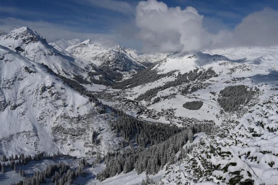 Fresh snow today in Lech, with lots more to come over the next couple of days – Photo: foto-webcam.eu, 18 April 2024
Indeed, Lech (pictured) could see an additional 50cm+ between now and the weekend, when the resort is scheduled to close. What’s more, the snow will fall to low levels, making for some of the best skiing yet this season.
Next week will remain cold, with the heaviest of the snow shifting towards the western Italian and southern French Alps, with a possible ‘Retour d’Est’ which would also include the Val d’Isère/Tignes area.
If you are planning a late season trip to the Alps next week, some of the best bets include: Ischgl and, Sölden in Austria, Cervinia in Italy, Engelberg and Zermatt in Switzerland, and Val d’Isère, Tignes and Val Thorens in France.
Update: 1pm Tuesday 16 April 2024 - A late taste of winter in the Alps…
After another very warm spell in the Alps, which saw two separate record-breaking April heatwaves with temperatures hitting 30°C in some lower valleys and as high as 17°C at 2000m, the weather broke again yesterday with cold unstable air flooding down from the north. This unstable polar airstream has already delivered some snow across the higher parts of the northern Alps, with further snow forecast to increasingly low altitudes both today and over the next few days.
 Snow will fall to increasingly low levels in St Anton over the next few days – Photo: foto-webcam.eu, 16 April 2024
Most of this snow will again fall across the northern half of the Alps, where 15-30cm is expected by Thursday evening above 1800m in the northern French and western Swiss Alps (e.g. Tignes, Verbier), with 50cm+ in the central-eastern Swiss and western Austrian Alps (e.g. Engelberg, St Anton). The rain/snow limit will be low for the time of year, typically between 800m and 1200m, but as low as 500m at times, especially on Thursday.
The southern Alps will see much less (if any) snow over the next few days, although some significant accumulations are still possible in high resorts close to the main Alpine ridge, including Cervinia.
Needless to say, you will still have to aim high if you are planning a late season trip to the Alps but, conditions should be excellent in the coming days in those resorts still open, at least in the northern Alps and if you can find a break in the weather.
Updated: 8.30am Monday 8 April 2024 – Exceptional temperatures recorded in the Alps for early April…
Over the last few days, the weather has been exceptionally warm in the Alps, with freezing levels as high as 4000m and unprecedented temperatures for early April (of close to 30°C) recorded in several lower valleys, especially those affected by the Foehn.
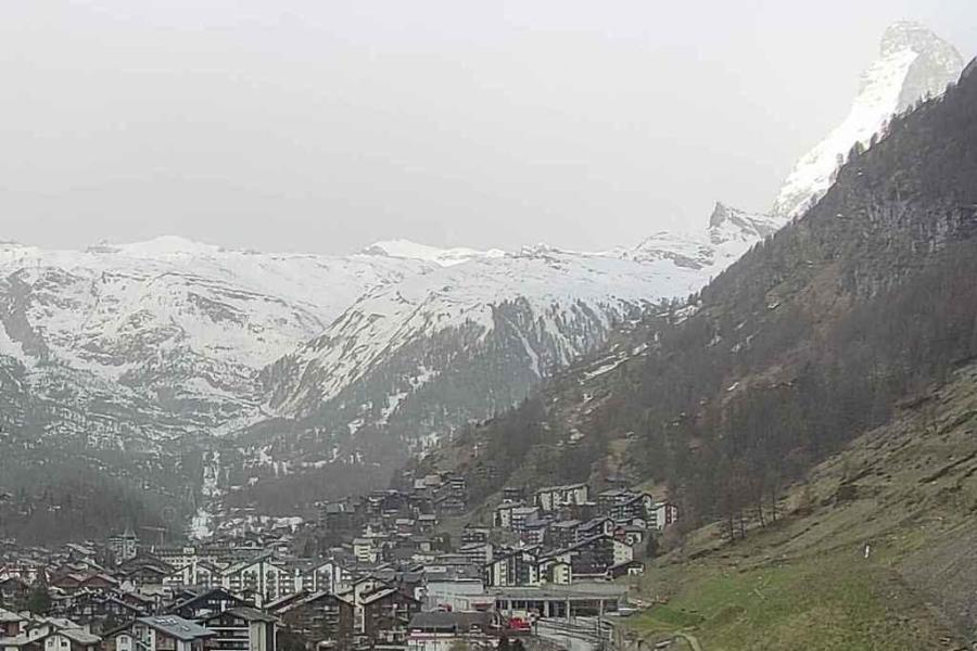 Saharan dust creating hazy skies this morning above Zermatt, where colder, snowier weather is due later tomorrow – Photo: zermatt.ch, 8 April 2024
Needless to say, this has seriously impacted snow conditions across the Alps, not helped by the amount of Saharan dust in the atmosphere which, once deposited on the snow, accelerates the melt. This has led it to become increasingly difficult to find anything like “wintry” snow, with soft spring-like conditions for much for the day, and even on some of the glaciers by afternoon.
After another very warm day today (close to 30°C again in some parts of the Alpine lowlands) it will turn cooler on Tuesday and Wednesday, with some snow forecast to fall in many regions, which will improve conditions considerably.
Late on Tuesday the rain/snow limit will drop quickly to between 1200m and 1500m, and even lower in places on Wednesday. With significant accumulations of between 20-50cm at altitude, conditions will improve considerably in the higher resorts that remain open, including Val d’Isère, Val Thorens, Cervinia and Zermatt. These, alongside Tignes and Saas-Fee, will be our picks for the best snow conditions in the Alps later this week.
Later in the week it will then turn sunnier and warmer again everywhere, but without such crazily high temperatures this time around.