

ARCHIVE
Today in the Alps - September 2015
Updated: 11am Wednesday 30 September 2015 - Cool, variable cloud
Squeezed between high pressure to the north and low pressure over the Mediterranean, the Alpine weather is stuck in a rut this week with a brisk and relatively cool north-easterly airflow affecting all areas.
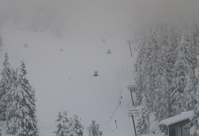
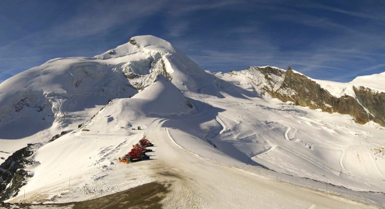
 Decent conditions on the Mölltal glacier today - Photo: foto-webcam.eu
Most places will be dry today, but there are areas of cloud floating about which may produce the odd shower here and there, these most likely later in the day and close to the Italian border regions - particular the Swiss-Italian border (snow 1800m). The best of the sunshine will be at altitude and in the northern half of the Alps.
Right now you can ski on nine Alpine glaciers. In Austria, this means Hintertux, Stubai, Sölden, Pitztal and Mölltal. In Italy, there are two options - Passo Stelvio and Val Senales, as there are in Switzerland with Zermatt and Saas-Fee. There is no lift-served skiing currently available in France, but Tignes will open its Grande Motte glacier on Saturday (3 October).
Generally speaking, skiing conditions are good, especially in Austria and Italy, which saw the heaviest snowfalls last week (50cm at Hintertux and Passo Stelvio).
That said, settled snow depths (on the glaciers) are still generally below par after one of the hottest summers on record, and further snowfalls would be welcome.
There is an outside chance that a deepening Mediterranean Low could bring heavy snow to the Grande Motte glacier in Tignes on Friday (a day before opening), otherwise no widespread or significant snow is expected in the Alps for the foreseeable future.
Updated: 9.40am Tuesday 29 September 2015 – A little snow for the south-western Alps
By popular demand, "Today in the Alps" is now back for the 2015-16 ski season - providing you with a daily overview of weather and snow conditions in the Alps.
Yesterday we mentioned the possibility of showers affecting some south-western parts of the Alps this week, with a few cm of snow possible above 2200m. Sure enough, this morning a dusting of snow is evident in parts of the Italian Piedmont (e.g. Sestriere), the northern Aosta (e.g. Cervinia), the southern Savoie (e.g. Val d’Isère) and the Haute Alpes (e.g. Vars).
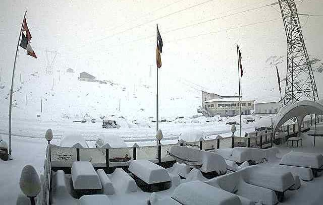
 A dusting of snow in Sestriere this morning - Photo: vialattea.it
Generally speaking, we are only talking about a sprinkling here and there, but it has settled to 1800m in one or two spots, and there are reports of 10cm+ above 2500m - on the Italian side of the Milky Way, for example.
Today, further showers may affect these same areas from time to time but, for the majority of the Alps, it’s another dry day with variable cloud and the best of any sunshine at altitude in the north.
 Fresh snow at the bottom of the Pissaillas glacier in Val d’Isère - Photo: valdisere.com
Right now you can ski on nine Alpine glaciers. In Austria, this means Hintertux, Stubai, Mölltal, Sölden and Pitztal. In Italy, you can ski at Val Senales and Passo Stelvio, while in Switzerland, Zermatt and Saas-Fee are open.
Conditions range from excellent in resorts that saw significant snow last week (Austria and Italy) to good (but not out of the ordinary) in Switzerland, where there was only a dusting.
Update: 11am Monday 28 September 2015 – Excellent skiing on the Alpine glaciers
Following last week’s big storm (that delivered 50cm of snow to some Austrian and Italian glaciers, such as Hintertux and Passo Stelvio) the weather in the Alps is somewhat less exciting this week…
 Fabulous skiing on the Hintertux glacier right now - Photo: facebook.com/Becknaphoto
Sandwiched between high pressure to the north and low pressure over the Mediterranean, the Alps will be subjected to a rather cool but mostly dry easterly airflow for much of the week.
There will be a few showers around over the next few days, largely in the Italian Piedmont region (e.g. Sestriere), but perhaps spilling over the border into parts of France (particularly the Haute Alpes and Haute Maurienne). These showers won’t amount to very much but, given the relatively cool airmass, may deliver a few cm of snow as low as 2200m here and there.
Elsewhere in the Alps, the coming days will be mostly dry but sometimes quite cloudy in the valleys, with the best of any sunshine at altitude. Temperatures will also be on the cool side, at least at first, recovering across the board towards the weekend.
Right now, you can ski on nine Alpine glaciers. In Austria, this means Hintertux, Stubai, Mölltal, Sölden and Pitztal. In Italy, you can ski at Val Senales and Passo Stelvio, while in Switzerland, Zermatt and Saas-Fee are open.
Conditions range from excellent in the resorts that saw significant snow last week in Austria and Italy, to good (but not out of the ordinary) in Switzerland, where there was only a dusting.
Updated: 10.20am Thursday 24 September 2015 – September storm aftermath
Yesterday’s “big storm” played out pretty much as expected, with 20-40cm of snow falling quite widely (at altitude) across the central and eastern Alps, and 50cm+ in one or two favoured locations.
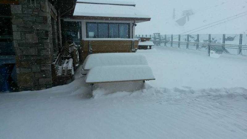
 Half a metre of new snow on the Hintertux glacier - Photo: hintertuxgletscher.at
The highest official snowfall figures that we know of are in Hintertux (Austria) and Passo Stelvio (Italy) with 50cm on each of their glaciers. However, it is likely that some remote spots in the Osttirol and western Carinthia will have seen as much 60-70cm of snow at high altitude. Whatever the case, this is great news for the glaciers of the eastern Alps, which will be offering epic snow conditions once skies clear.
 Heavy snow to relatively low altitudes in Carinthia yesterday. This is Turracher Höhe - Photo: turracherhoehe.at
Right you can ski in four resorts in Austria – Hintertux, Sölden, Mölltal and Pitztal with Stubai planning to join the fray tomorrow (25 September).
In Italy, you can ski on the glaciers at Passo Stelvio and, as of tomorrow (25 September), Val Senales.
In Switzerland, skiing is limited to the glaciers above Zermatt and Saas-Fee, which missed the heaviest of the snow this time around, but are still in pretty good nick considering it is only September.
In France, there is no lift-served skiing open at the moment, but Tignes plans to open its Grande Motte glacier on 3 October. Tignes also missed the heaviest of the snow from this recent storm, but the 5-10cm it did receive will have been welcome all the same.
So what’s next?
There is still a little snow falling at high altitude in the far eastern Alps this morning, otherwise it’s a much brighter picture further west. The Alps will then settle into an easterly airflow with plenty of sunshine at altitude but areas of cloud plaguing some of the lower valleys. A few showers may also continue to skirt the eastern Austrian Alps with a more pronounced deterioration of the weather possible around the middle of next week (TBC).
However, given that it is still September, and that the sun is relatively strong, it won’t be long before the snow-line scurries back up the mountain and more “normal” Autumnal conditions take hold of the Alps.
We must also reiterate that the recent dumps (exciting as they may have been) will have no bearing whatsoever as to how early season snow conditions will pan out more generally…
Updated: 1.25pm Wednesday 23 September 2015 - First big snow of the Autumn!
The much anticipated first big dump of the autumn has arrived on cue, with 40cm of snow reported in come central and eastern parts of the Alps, where it is still snowing above 1300-1800m this afternoon.
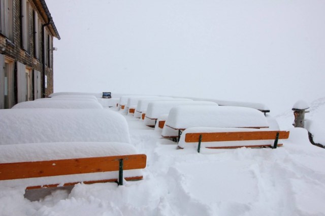
 Passo Stelvio has been hit as hard as anywhere from this storm, with around 60cm of new snow expected by the end of the day - Photo: passostelvio.com
The snow has been heaviest in southern and south-western Austria (e.g. Sölden, Obergurgl) and central and eastern Italy (e.g. Val Senales, Passo Stelvio) where up to 60cm is possible above 2500m by the end of play today.
 Snowing hard in Obergurgl (south-west Austria) - Photo: obergurgl.at
Other parts of the Alps have also seen snow but, as expected, in more modest quantities with, for example, just a few cm at altitude in the big French resorts such as Tignes and Val Thorens.
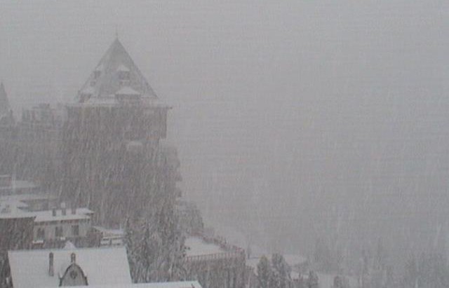 Whiteout this morning in St Moritz - Photo: snow-eye.com
So what does this all mean? Well, very little in terms of how early season conditions might pan out in general. It is good news for the glaciers though, especially the eastern ones such as Hintertux, Mölltal, Pitztal, Sölden and Passo Stelvio, all of which should offer superb skiing conditions once skies clear.
 40cm of new snow (and counting) on the Hintertux glacier - Photo: hintertuxgletscher.at
As for the weather, further showers (and a little snow at altitude) may continue to affect the far eastern Alps over the next couple of days, but for most of the Alps it’s an improving picture for the rest of this week.
Updated: 12.20pm Tuesday 22 September 2015 - Heavy snowfall forecast for central & eastern Alps
Regular followers of weathertoski will know that a significant snowfall (for September at least) is on the cards mid-week as a cold front moves in from the north-west.
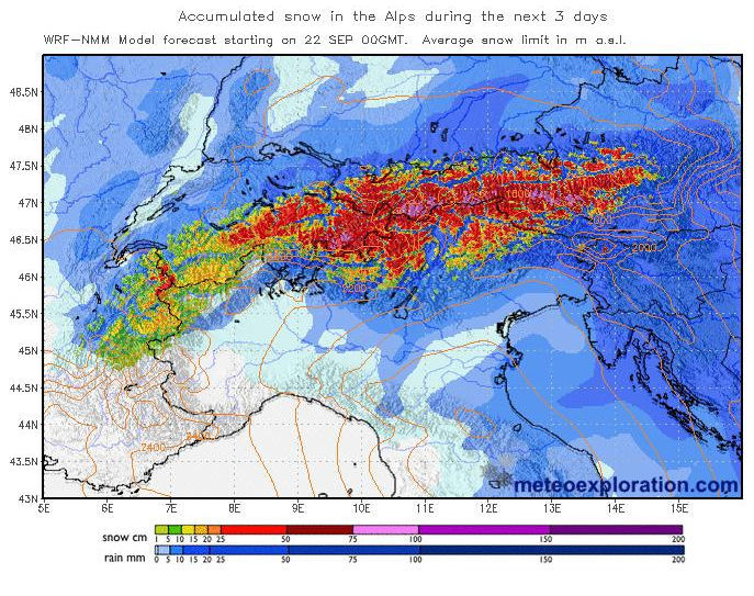 Predicted snowfall totals in the Alps over the next three days - Image: meteoexploration.com
This front will drag a cold and unstable polar maritime air mass across the Alps, which will further destabilise on coming into contact with the warm Mediterranean sea.
Why is this important? Because it will help create a secondary (Genoan) low which will send energy back up towards the central-southern and south-eastern Alps.
We are therefore expecting the highest snowfall totals from this storm to be in the south-eastern Swiss Alps (from Andermatt eastwards towards St Moritz), the southern and south-western Austrian Alps close to the Italian border (e.g. Sölden, Obergurgl, Nassfeld) and parts of the central and eastern Italian Alps (e.g. Val Senales, Passo Stelvio). Above 2500m, these areas have the potential to see 50cm+ between now and Thursday, with a dusting as low as 1300-1500m.
Many other parts of the Alps are also likely to see at least a little snow to mid-level elevations, with only some southern French and south-western Italian resorts set to miss out completely.
In terms of the resorts that are actually open, it will be the Austrian and Italian glaciers that will do best from this early Alpine snowfall, including Passo Stelvio (Italy) and Hintertux, Mölltal, Sölden and Pitztal (Austria), all of which should see 20-40cm (locally more).
Zermatt and Saas-Fee (Switzerland) will see less snow – perhaps only a few cm - but every little helps! In France, the Grande Motte glacier above Tignes will also only see a modest snowfall, but has been steadily improving after the exceptionally hot summer. It expects to open its lifts on 3 October.
One final word of caution. While this is great news for the glaciers – especially the eastern ones – this week’s snowfall is still far too early to have any bearing at all on how early season conditions will pan out more generally…
Watch this space!
Updated: 9.45am Monday 21 September 2015 - A taste of winter mid-week?
September has been relatively unsettled across the Alps with occasional high altitude snowfalls. These have helped freshen up some (though not all) of the glaciers, after what was one of the hottest summers on record. Things are set to get more interesting this week as a pool of cold and unstable polar maritime air moves down from the north-west, bringing some significant snow to some areas on Tuesday and Wednesday.
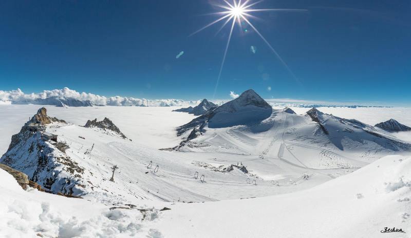
 Saas-Fee remains one of the better options for skiing in the Alps in September - Photo: saas-fee.ch
We should stress that regardless of how much snow falls this week, is still FAR too early to be getting excited about early season skiing conditions in general.
Nevertheless, it is welcome news for the glaciers, some of which are already operational, with others planning to open over the coming weeks.
Right now there is no lift-served skiing available in France, though there have been several dustings in recent days on the Grande Motte glacier in Tignes (due to open 3 October), with a little more expected mid-week.
In Switzerland, you can ski on the glaciers above Zermatt and Saas-Fee. Like most other Alpine glacier areas they have benefited from several (mostly small) snowfalls in September and are due another top-up mid-week.
In Italy, the only option right now is Passo Stelvio, where the glacier is recovering nicely from the summer heatwave. Val Senales might be joining it this weekend (TBC), helped by further snow forecast mid-week.
Austria has four skiing options right now - Hintertux (by far the most extensive), Sölden, Pitztal and Mölltal. Austrian glaciers are also likely to be the ones seeing the most snow from the mid-week storm, with 20-40cm possible in places according to computer models (locally more). Watch this space!
Updated: 10am Monday 14 September 2015 - Significant new snow for western glaciers
There has been further snow in the Alps, heaviest this time in the west (French Alps) where 20cm+ has been reported at high altitude.
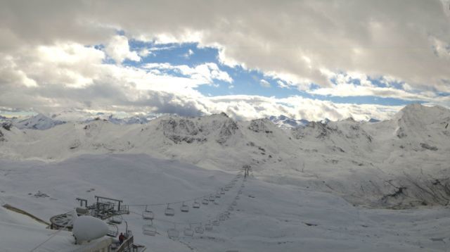
 Significant fresh snow on the Grande Motte glacier above Tignes (not yet open for skiing) - Photo: tignes.net
The snow was part of a very active weather front that brought torrential rain, thunder, lightning and a big drop in temperature to the western Alps last night, with a dusting of snow as low as 2400m. Up on the glaciers (e.g. Tignes) there was significant snow (for September) - good news in the wake of the heatwave that gripped the Alps for much of the summer.
 Fresh snow to 2400m in L'Espace Killy this morning - Photo: tignes.net
Today, the eastern Alps will catch the worst of the weather, with some new snow for the glaciers here as well. It will also remain changeable for the next few days, with another active front expected to deliver heavy rain (and snow at high altitude) mid-week. Stay tuned!
In the meantime, weather permitting, you can ski on six Alpine glaciers. The majority of these are in Austria - Hintertux, Mölltal and Sölden. In Switzerland you can ski in Zermatt and Saas-Fee, while in Italy you can ski in Passo Stelvio.
Updated: 9.30am Sunday 6 September 2015 – A taste of winter in the eastern Alps
Eastern parts of the Alps have experienced an early taste of winter with up to 25cm of new snow on the glaciers and a dusting as low as 1600m in places!
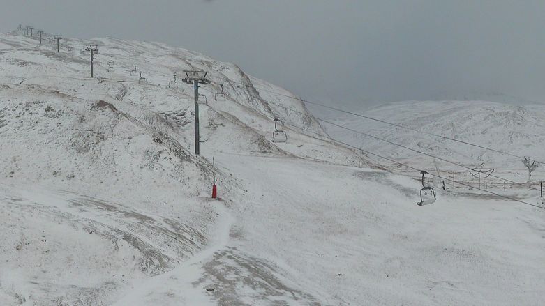
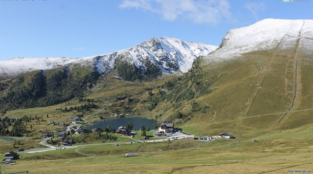 Snow to relatively low levels in parts of Austria this morning, but it won't last long. This is Heidi Alm in Austria - Photo: heidialm.at
The ski areas that have benefited most are Passo Stelvio in Italy, and the Hintertux and Mölltal glaciers in Austria. Further west, in Switzerland, Zermatt and Saas-Fee only saw a dusting of snow but are also skiing well thanks to the colder weather.
Will the cold snap last? In a word, no! Some showers will persist in the eastern Alps over the next couple of days but sunnier skies further west will extend to all areas as the week progresses. It will gradually warm up too.
Updated: 9.30am Thursday 3 September 2015 - A taste of Autumn
Summer was an exceptionally warm one in the Alps (July was the hottest ever in many parts) but, with September upon us, temperatures have cooled off considerably. There is even a little fresh snow at high altitude, especially in the east, with further flurries likely over the next few days.
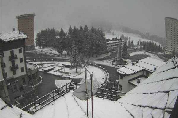
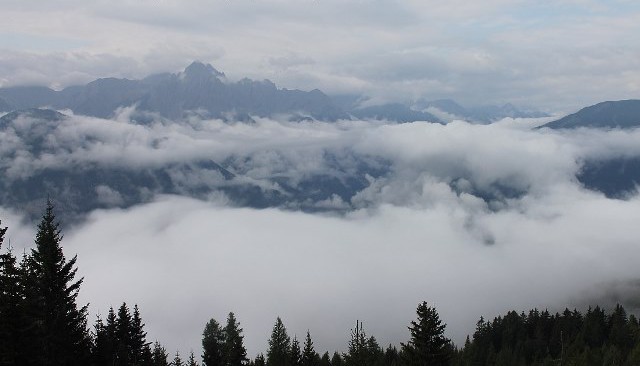 Feeling distinctly autumnal in the Austrian Alps this morning - Photo: foto-webcam.eu
This more Autumnal weather is good news for the glaciers which have taken a hammering from the heat over the last few months and, generally speaking, are in very poor condition. We are not expecting significant snow - indeed some western glaciers will see next to nothing - but at the very least it will arrest the melting process which has been near constant now since June.
As for current skiing conditions, the best of these are likely to be on the glaciers at Hintertux, Mölltal (Austria) and Passo Stelvio (Italy), once the weather improves early next week. All three areas are forecast to see 10-20cm of new snow by then. There may even be a few flakes as low as 1600-1800m in Austria on Saturday.
Further west, Zermatt and Saas Fee (Switzerland) are the only other Alpine options (once Cervinia closes on Sunday) also with improving conditions thanks to the colder weather.