

ARCHIVE
Today in the Alps - November 2015
Updated: 9.20am Monday 30 November 2015 - Turning milder
The weather in the Alps is warming up and the early wintry onslaught is officially over. Many places will be dry today, but showers or longer spells of rain/snow are still affecting some north-eastern parts of the Alps, especially Austria. Watch out for strong winds at altitude, particularly in the western Alps.
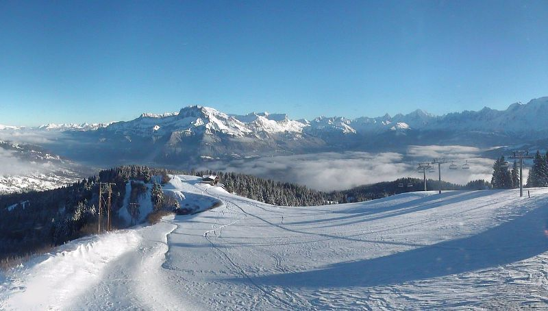
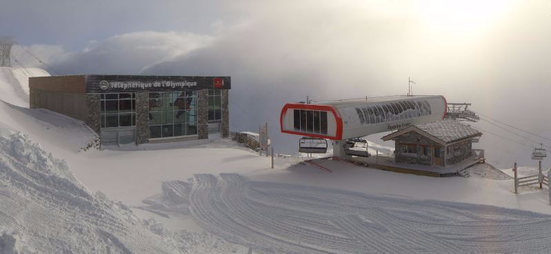
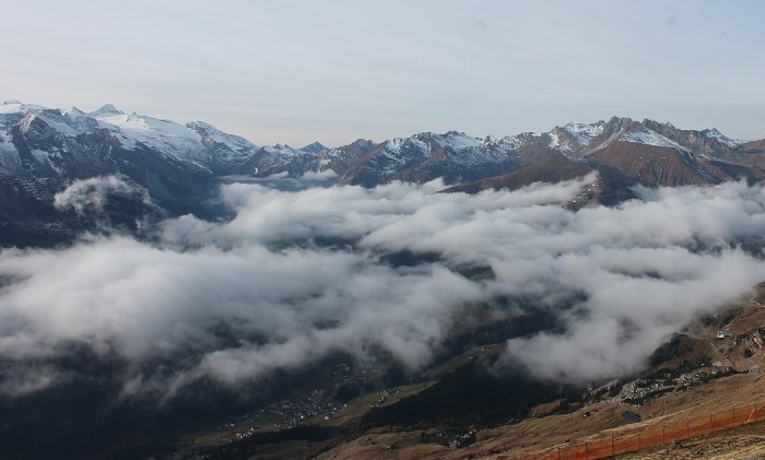
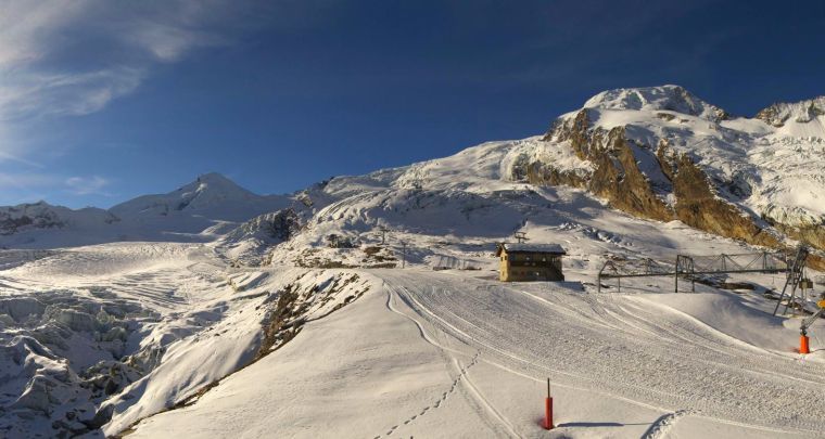
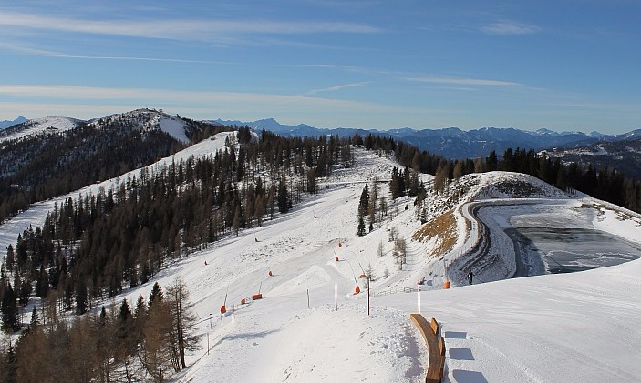 Mostly sunny in the southern Alps today, this is Bad Kleinkirchheim - Photo: badkleinkirchheim.at
The milder weather comes courtesy of a warm front that brought further snow to some northern parts of the Alps yesterday (especially Switzerland and western Austria). The rain/snow limit started quite low, but rose to between 1000m and 1400m in most places by the end of the day.
Today, Monday, the weather in most of the Alps is fine, but showers or longer spells of rain will continue to affect northern and western Austria, as well as parts of north-east Switzerland. The rain/snow limit will continue to rise, generally reaching 1400-1700m as the day progresses, higher even in places.
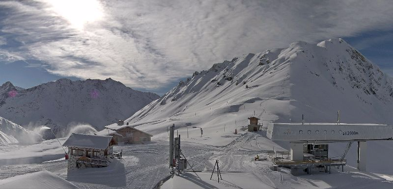
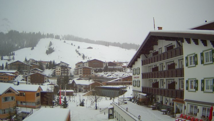 Cloudier in the northern Austrian Alps with a mixture of rain and snow - Photo: lech-zuers.at
As we mentioned earlier, however, most of the Alps will be dry with plenty of sunshine the further south and west you go.
Tomorrow, Tuesday, will be something of a repeat performance, with further rain/snow across some north-eastern parts of the Alps, but lots of fine weather again further south and west. Then finally, on Wednesday, it looks like all parts of the Alps will get to see the sun.
See our latest season progress report for an overview of where snow levels are at in the Alps right now.
Updated: 10.10am Sunday 29 November 2015 - Windy with further snow for some northern parts
It’s snowing again across many northern parts of the Alps this morning, from the northern French Alps (e.g. Avoriaz), through Switzerland (e.g. Mürren), creeping into some western parts of Austria (e.g. St Anton). These regions are also very windy.
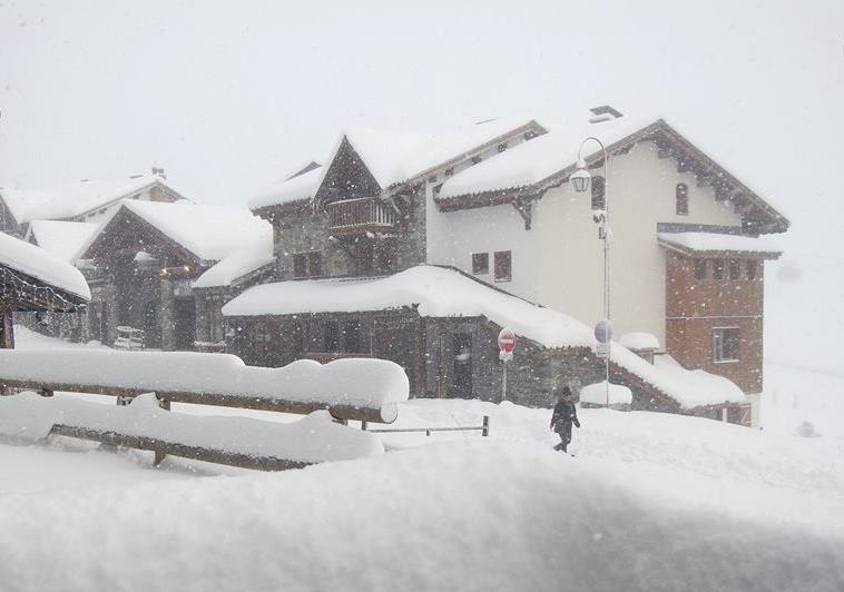
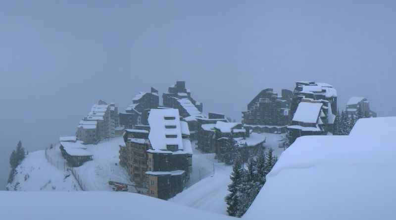 Further snow this morning for Avoriaz - Photo: avoriaz.com
The rain/snow limit will begin quite low in places (especially in the more enclosed valleys), but will rise to 1200-1400m later in the day. Snowfall totals will again be quite modest - just a few cm for most - but 20cm+ is possible in some favoured locations. As with yesterday, the southern side of the Alps will remain dry with some bright or sunny spells.
Looking a bit further ahead and, with high pressure building from the west, many parts will be dry, bright and increasingly mild.
On Monday and Tuesday, however, weather fronts will continue to flirt with the north-eastern Alps (especially Austria), with showers and a little snow above 1600-2000m. These fronts should have moved away by Wednesday to allow all areas to enjoy some fine, dry and very mild early winter weather.
Updated: 9.50am Saturday 28 November 2015 - More snow, more openings
It’s snowing lightly first thing this morning across some north-western parts of the Alps - for now, mostly in the northern French and Swiss Alps (e.g. Avoriaz, Engelberg), but this will extend into parts of northern and western Austria as the day progresses.
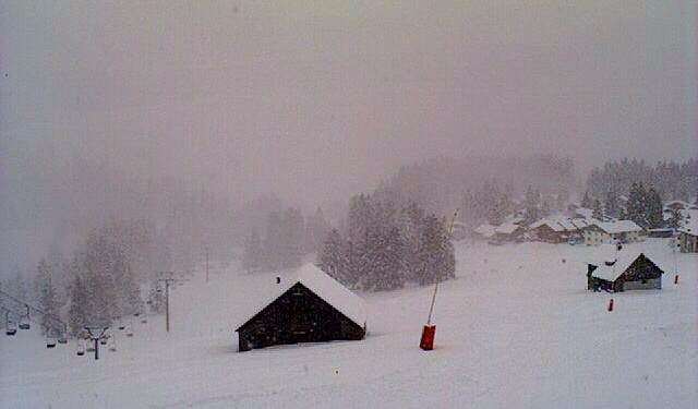
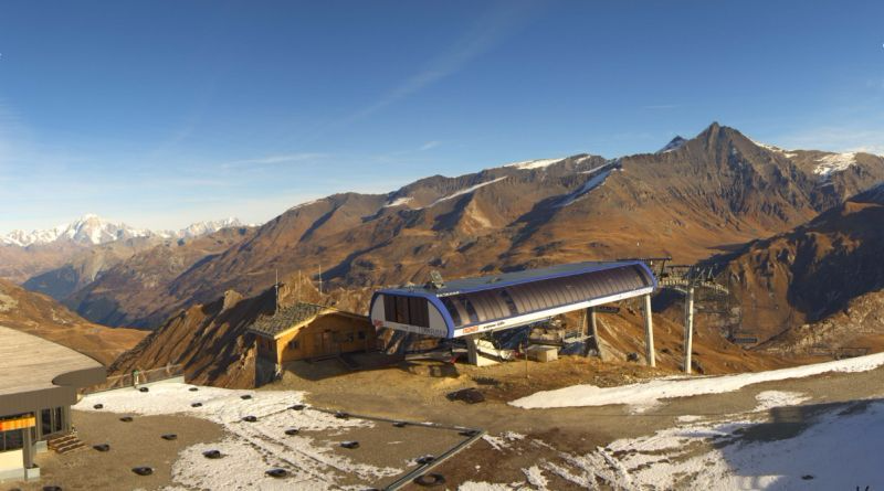
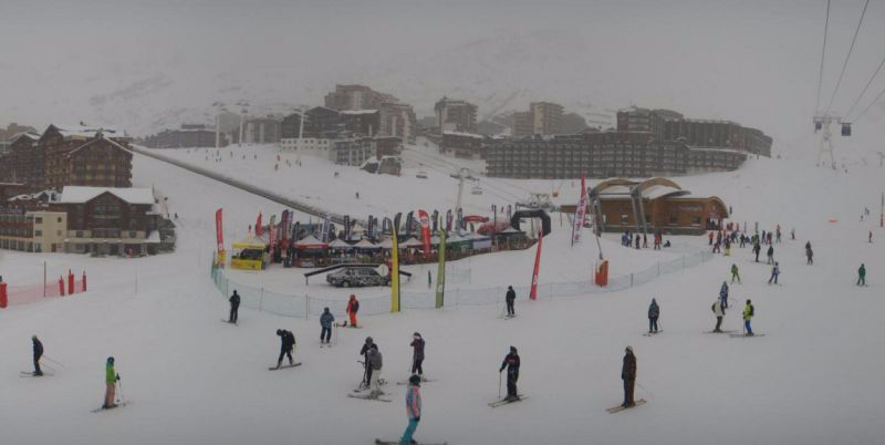 Val Thorens officially opens today - Photo: valthorens.com
Compared to recent storms, snowfall totals will be modest - typically 2-10cm in the above mentioned regions, locally a bit more. The rain/snow limit will start very low, rising slowly to 500-800m later in the day. The southern side of the Alps will stay mostly dry with some bright or sunny spells.
Tomorrow, it’s a bit of a repeat performance, with further showers across some northern parts of the Alps. It will turn milder, however, with the rain/snow limit rising to 1300m close to the northern foothills later in the day. Next week it will turn milder with increasing amounts of sunshine.
Lots more resorts open for the season today, the biggest name among them being Val d’Isère which, unlike this time last year, does have enough snow to link to Tignes. Among the most extensive options for skiing this weekend (at least on-piste) are Sölden, Ischgl, Obergurgl, Val d’Isère, Tignes and Val Thorens. However, there are literally dozens more options now, both in the Alps and the Pyrenees.
Updated: 9.50am Friday 27 November 2015 - Best day of the season so far?
The sun is mostly back and, for anyone lucky enough to be skiing in the northern half of the Alps today, snow conditions are the best we have seen so far this season…
 View from the (as yet unopen) Combloux side of the Megève ski area - Photo: combloux.com
The deepest, freshest snow right now is actually in the central northern Swiss Alps, where some 60-80cm of new snow has fallen above 1500m in the last few days. Sadly, there isn’t much lift-served skiing available in the area yet, but Engelberg will reopen tomorrow (Saturday) when skiing to the village should be possible.
Elsewhere in the Alps, more and more resorts are opening all the time. Andermatt and Verbier are two big Swiss names that have seen plenty of snow recently and get underway today. In France, Val d’Isère, Val Thorens (officially), Chamonix and Alpe d’Huez are just a few that will join them tomorrow - but there are lots more, including some in the Jura, Massif Central and the Pyrenees.
Ironically, the ski resort offering the greatest number of pistes right now (81km) is Austria’s Ischgl, where snowfall has not been especially prevalent (just a 30cm upper base) - testament to the area’s excellent snow making and snow preservation qualities. However, it may well be eclipsed this weekend by L’Espace Killy (Val d’Isère/Tignes).
 Lots of snow in Damüls in the Austrian Vorarlberg - Photo: damuels.at
As we have been saying all week, there is less snow on the southern side of the Alps, although the colder weather has allowed the snow cannons to operate at full throttle and here there are also a clutch of partial openings, including Livigno on Saturday.
After today’s sunny break, further snow is expected at times over the weekend (again mostly across the northern Alps), before the weather settles down and turns warmer. Find out more in our detailed forecast later today.
Updated: 9.40am Thursday 26 November 2015 - Snow getting serious in parts of the northern Alps…
There has been further heavy snow across the northern Alps - especially the northern Swiss Alps. At 8am this morning, the SLF (the Swiss institute for snow) reported 24 hour snowfall totals of 46cm at 2110m above Grindelwald and 62cm at 2140m above Engelberg, with an impressive 42cm of fresh snow at resort level (1050m)!
 Lots of snow ahead of Val Thoren’s official opening this weekend - Photo: facebook.com/valthorens.resort
The northern French Alps have also seen significant new snow in the last 24 hours - 22cm for instance in Val d’Isère (1850m) and 29cm in Châtel (1200m) - as have parts of Austria, with the heaviest in the west (Tirol, Vorarlberg).
Once again though, large swathes of the southern Alps (which include much of Italy) have seen little or no meaningful snow - more about this in our detailed snow report later today.
 At least 40cm of new snow in Avoriaz in the last 24 hours alone - Photo: avoriaz.com
Today, any snow flurries should die away from the northern French and western Swiss Alps, but continue across other northern parts of the Alps - heaviest in north-eastern Switzerland and the Austrian provinces of Vorarlberg, Tirol, Salzburgland and Upper Austria. The southern side of the Alps will stay mostly dry.
The weather in the Alps looks like it should clear up for a while on Friday, which means there should be some wonderful skiing conditions in the resorts that are both open and have seen plenty of recent snow. Tignes is as good a bet as any, with the long Double M run to resort now operational.
Further snow is then expected over the weekend (again mostly in the north), with more settled and increasingly warm weather set to return next week.
 A typical scene (even at relatively low altitude) in northern Switzerland right now. This is Amden - Photo: amden-wissen.ch
Updated: 9.30am Wednesday 25 November 2015 - More snow in the north-western Alps!
The next storm has arrived, and is delivering further snow to low altitudes across the north-western half of the Alps. The southern side of the Alps (including most of Italy) will again miss most of the action, but at least it is cold, which will allow snow making to continue at somewhere near full capacity.
 Steady snow in Les Saisies (Savoie) this morning - Photo: lessaisies.com
It began snowing in the northern French, northern and western Swiss Alps early last night. By first thing this morning there was already at least 15cm+ of fresh on the slopes of resorts such as Avoriaz, Gstaad and Engelberg.
These same areas will see further snowfalls to low altitudes at times today. It will also spread a little further east to affect some western and northern parts of the Austrian Alps (e.g. Lech), but most of the southern Alps (that means most of Italy) will again miss out.
On Thursday, the focus of the snow will shift further east towards the north-eastern Swiss Alps (e.g. Braunwald), and northern and western Austria (Vorarlberg, Tirol, Salzbergland, Upper Austria) before everywhere settles down again (temporarily) on Friday.
Over the next 36 to 48 hours we can expect between 20cm and 50cm of new snow across the northern French, and northern and western Swiss Alps. In Austria (away from the south) the range will be more like 10-30cm though locally a bit more is possible. As we have already mentioned, however, most of the southern Alps (which includes Italy, away from the extreme north-west) will only see negligible snowfall totals, with many places missing out altogether.
 Most of the new snow is again in the north-western Alps. This is Villars - Photo: villars.ch
Looking further ahead and, after a mostly fine day on Friday, further snow is expected over the weekend (guess what - mostly again for the northern and western Alps) before the weather settles down for an extended period next week.
Back to the here and now, and Courchevel will open three slopes today for free as part of their pre-season build up. A whole clutch of other resorts also plan to get started over the weekend, including Val Thorens, Val d’Isère, Ischgl, Andermatt, Verbier and Alpe d’Huez (to name just a few).
A special mention to the Pyrenees, where there is also plenty of snow with at least a dozen resorts planning to open at the weekend, including Baqueira Beret, Formigal and Les Angles.
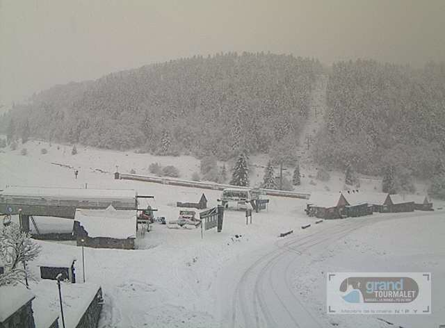 Plenty of fresh snow in the Pyrenees too. This is the Grand Tourmalet area - Photo: grand-tourmalet.com
Updated: 1.45pm Tuesday 24 November 2015 - New storm incoming!
After a couple of days of settled and often quite sunny weather, the next band of snow will reach the western Alps tonight, moving erratically eastwards tomorrow. With cold air in place over the Alps the snow will fall to low levels (generally 500-900m), lower still in the more enclosed valleys.
 Lots of snow at the top of the Transarc gondola in Les Arcs (2600m) - Photo: lesarcs.com
This latest storm will linger until Thursday, and will again favour the north-western half of the Alps, with somewhere between 20-40cm expected across the northern French Alps (e.g. Avoriaz), the northern and western Swiss Alps (e.g. Wengen, Verbier), and western Austria (e.g. St Anton). The southern Alps (which includes most of Italy) will, as before, miss most of the action.
After a drier interlude on Friday, more snow is expected over the weekend. But thereafter, with high pressure reasserting its influence, the weather in the Alps looks set to remain dry for some time to come.
A whole clutch of resorts will be opening for the first time this weekend. There are too many to mention here, but among the bigger names are Val d’Isère, Val Thorens, Verbier, Andermatt and Ischgl. In theory, conditions will be pretty good for late November, but with further fresh snow forecast, visibility could be challenging at times.
Note that the Pyrenees have also seen significant snow and will be offering several options this weekend, including Baqueira Beret, Formigal and Les Angles (to name just a few).
By contrast, most of the southern Alps (e.g. Sestriere, Livigno, Selva) are still relatively snowless - with some consolation that temperatures are low enough to churn out large quantities of artificial snow, something the Italians are particularly expert at.
Updated: 9.30am Monday 23 November 2015 - First storm over, next storm in sight
The first big winter storm of the season is over. The next significant snow is due mid-week, again mostly in the northern and western Alps.
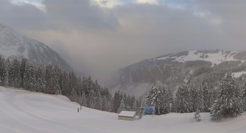
 View from La Plagne this morning, looking towards Mt Blanc - Photo: la-plagne.com
As things stand, we have decent quantities of snow (for November) across much of the north-western half of the Alps (especially at altitude), but not so much further south. For the time being it is cold, however, allowing snow cannons to operate at full throttle in all areas.
A quick look back at Sunday, and while many places were dry, it was bitterly cold with snow showers continuing to affect some northern parts of the Aps, especially the western Austrian and northern Swiss Alps where another 40cm was reported in the Glarus region (e.g. Braunwald).
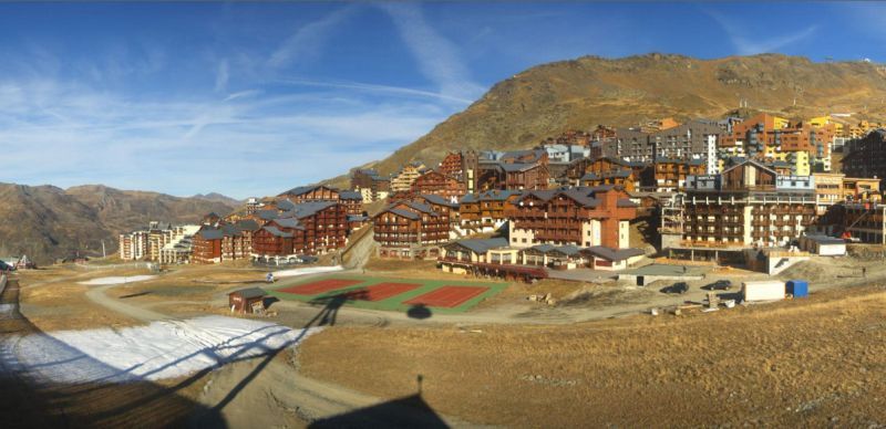
 Looking good in Val d’Isère with just five days left until opening! - Photo: valdisere.com
Over the last three days, the most favoured areas in terms of snowfall have been the northern French Alps (e.g. Val d’Isère, La Plagne, Val Thorens, Chamonix, Avoriaz), the northern and western Swiss Alps (e.g. Verbier, Crans Montana, Mürren, Engelberg), and the far western Austrian Alps (e.g. Lech). These areas have seen about 30-60cm of new snow at 2000m (locally more), and 60-100cm close to 3000m, with 120cm in one or two spots.
Generally speaking, the further south and east you go, the less new snow there has been from this storm. Indeed, except for the far north-west (e.g. Cervinia, Courmayeur, La Thuile), the Italian Alps saw negligible amounts of snow. The far southern French Alps (e.g. Isola 2000) and the south-east of Switzerland (e.g. St Moritz) also missed out, as did parts of southern Austria.
Looking further ahead and it will stay on the cold side now until the next storm, which is due mid-week and will again favour the northern and western Alps. Thereafter it is likely to stay unsettled, but may start to turn a little warmer.
 Not everywhere has much snow yet. This is Kronplatz in the Dolomites - Photo: foto-webcam.eu
Updated: 9.40am Sunday 22 November 2015 - Winter is in control, but not everywhere has lots of snow
It is bitterly cold and there is lots of new snow across the north-western half of the Alps, but not so much in the south, and in some places no new snow at all. Today, the heaviest snow showers are concentrated across the northern Swiss Alps, as well as the far west of Austria.
 Lots of snow at the top of the Bellevarde Express in Val d’Isère - Photo: valdisere.com
To briefly recap what has been happening over the last couple of days - Friday was very wet across the north-western Alps (by that we mean the northern French Alps, most of Switzerland away from some central southern and south-eastern regions,and the far west of Austria). However, as we were still on the warm side of the polar front, it only snowed above about 2300-2500m.
On Friday night, the cold front came through and the rain/snow level dropped to around 900-1200m by Saturday morning. Saturday and Saturday night saw bands of snow showers affect these same “north-western” areas with snow to increasingly low levels (all levels by Saturday night).
 Winter has arrived in Zermatt! - Photo: Zermatt Tourism
So how much snow has fallen since Friday?
At 3000m, parts of the French Savoie/Haute Savoie and the Swiss Valais have seen over 1m, very locally 1.2m. At 2000m accumulations in these same regions have more typically been around 25-40cm, and at 1000m around 5-20cm.
The northern Swiss Alps (e.g. Mürren, Engelberg), the western Austrian Alps (e.g. Lech), and the far north-western Italian Alps (e.g. Courmayeur) have seen more in the range of 25-50cm at altitude (locally a bit more).
So what about the rest of the Alps?
Generally speaking, the further south and east you are (especially south) the less new snow has fallen.
With one or two notable exceptions, snowfall in Italy has been negligible. The exceptions being the far north-west where there was some significant snow in the likes of Cervinia, Courmayeur and La Thuile. The far southern French Alps (e.g. Isola 2000) have also missed out, as has the far south-east of Switzerland (e.g. St Moritz).
Austria’s fortunes have been mixed. In the Vorarlberg and western Tirol (e.g. Lech, St Anton) there has been some significant snow, typically 25-40cm at altitude, but these figures decrease notably the further east you go.
Today (Sunday) we will see further snow flurries to very low levels across the northern fringes of the Alps, heaviest in Switzerland (e.g. Engelberg) and the far west of Austria (e.g. Warth-Schröcken). Further south there will be good spells of sunshine, but it will be bitterly cold everywhere.
The forecast for the week ahead is interesting to say the least. After a mostly fine start, the second half of the week will again become very unsettled, with further snow in places, heaviest in the north and west.
 Not so much snow in the eastern Austrian Alps. This is Zell-am-See - Photo: foto-webcam.eu
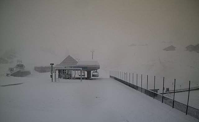
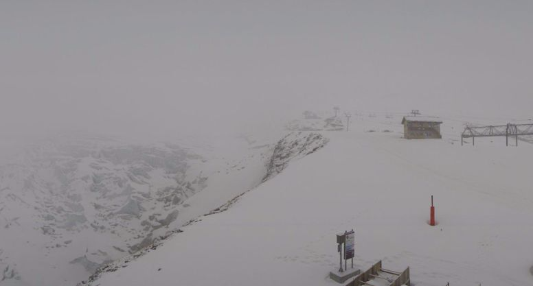
Updated: 8am Saturday 21 November 2015 - Winter has arrived!
Winter has finally arrived, with some welcome snow for many (though certainly not all) parts of the Alps this morning. It follows a very wet day in the north-western half of the Alps yesterday, when the rain/snow limit was a little higher than initially forecast - between 2300m and 2500m for much of the day.
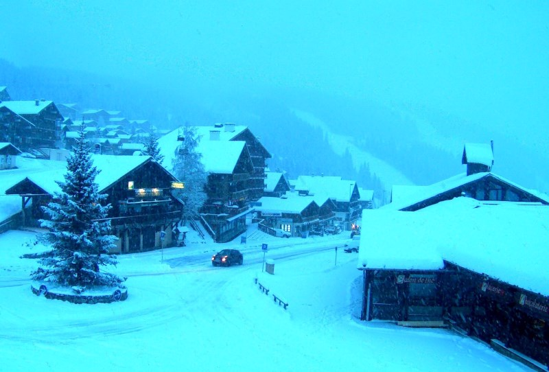
 Winter is back in Méribel - Photo: merinet.com
Yesterday at high altitude there was a lot of snow in the northern French and the northern and western Swiss Alps - such as on the glaciers in Tignes, Zermatt and Glacier 3000.
There were also some significant falls for the western Austrian Alps (e.g. Sölden), as well as the far north-west of Italy (e.g. Cervinia). Generally speaking, however, any precipitation was less significant on the southern side of the Alps.
Overnight, the cold front came through and rapidly lowered the rain/snow limit from about 2200m yesterday evening to around 1000m first thing this morning. Today, there will be further snow showers to increasingly low levels (400-600m later), heaviest and most frequent across the northern half of the Alps later in the day.
As there is still plenty of action to come (for the northern Alps at least) over the next 24 hours, we will have a more detailed round-up, including plenty of figures, in our update tomorrow (Sunday).
Just before we go however, it is worth pointing out that the forecast for next week is also very promising with further snow for many, especially from mid-week onwards.
A few snowy webcam shots this morning...
 Cervinia, Italy - 21 November 2015 - Photo: cervinia.it
 Grimentz, Switzerland - 21 November 2015 - Photo: valdanniviers.ch
 Champéry, Switzerland - 21 November 2015 - Photo: telechampery.ch
Updated: 9.25am Friday 20 November 2015 - Big storm begins
The most anticipated storm of the “season” so far is finally here! However, we will, for today at least, remain on the warm side of the polar front, which means that the rain/snow level will remain relatively high, (between 2000m and 2400m), before plummeting tonight.
 Steady snow already falling at altitude in Saas-Fee this morning - Photo: saas-fee.ch
The heaviest precipitation today will be across the northern French Alps (Haute Savoie, Savoie), the northern and western Swiss Alps (Valais, Vaud, Bernese Oberland) and the far western Austrian Alps (Vorarlberg, west Tirol). All these areas could see 25-50cm of snow above 2500m today alone, with as much as 80cm possible on the northern side of the Massif de Mt Blanc. With one or two exceptions (notably the north-west Aosta valley), the southern side of the Alps will see less precipitation.
As the cold front starts to move south tonight, the precipitation will intensify further, the temperature will plummet and snow will fall to increasingly low levels across the northern half of the Alps (perhaps 700-900m by dawn).
Tomorrow (Saturday) will be bitterly cold, with further snow showers piling into the northern half of the Alps. Once again, the southern Alps will miss the bulk of the snow, though there will as always be some exceptions, notably in the extreme north-west (La Thuile, Courmayeur, Cervinia) where some moderate falls of snow are also possible. It will become increasingly cold with snow falling to 500-700m as the day progresses, lower still perhaps later in the day. These showers are likely to continue on Saturday night and in places into Sunday (which will be colder still).
 Radar from early this morning showing rain/snow already affecting much of the north-western Alps - Photo: meteosuisse.com
Over the next three days, we can expect over 1m of snow above 2500m in parts of the northern French, northern and western Swiss Alps, locally 1.5m or more! At 1500m these same areas can expect between 25cm and 50cm with, a dusting possible right into the northern lowlands (600m or less) by Sunday.
Many other parts of the Alps will see a useful fall, including most of the Swiss Alps, the western Austrian Alps (especially the Vorarlberg and western Tirol) and the north-western Aosta valley. Most other parts of Italy, however, as well as the far south of Austria and the far southern French Alps will only see very modest accumulations (no snow at all even for some).
Another important thing to note is that it will often be very windy during this period, especially in the western half of the Alps, with extreme irregularities in the way the snow accumulates.
Needless to say, conditions at altitude will become very hazardous and extreme caution is advised if you are considering any mountain activity (including driving), especially in the north-western half of the Alps.
We will be posting a more detailed country by country forecast later today...
Updated: 9.40am Thursday 19 November 2015 - Are you ready for winter?
After nearly three weeks of mostly dry, sunny and exceptionally mild weather in the Alps, we are on the brink of a dramatic change, that will see temperatures fall by some 15-20°C by Sunday!
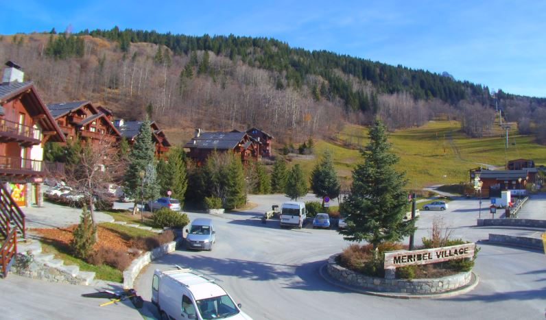 One last day of scenes like this before winter takes hold. This is Méribel - Photo: merinet.com
There will also be plenty of snow, heaviest across the north-western half of the Alps (e.g. Tarentaise, Mt Blanc, Valais, Bernese Oberland), where some parts will see accumulations of well over 1m (at altitude) between Friday and Sunday.
Before we start though, we still have one last dry, mostly sunny and very mild day to get through with freezing levels not far off 3000m. Later in the day, cloud will thicken in the north-western Alps heralding the big change in the weather tomorrow.
Friday will see copious amounts of precipitation hit the north-western Alps but, as we will still be on the warm side of the polar front, the rain/snow limit will remain relatively high - between 1800m and 2200m for much of the day, before it lowers later.
The main cold front will then cross the Alps on Friday night, allowing with a more pronounced drop in temperature, with snow falling to increasingly low altitudes. Saturday will be bitterly cold with frequent and heavy snow showers piling into the northern half of the Alps, always heaviest in the north-west and settling at all skiing altitudes.
 Cold and unstable arctic air sweeping across western Europe - Image: meteociel.com
With some exceptions, such as the far north-west of Italy (Cervinia, Courmayeur, La Thuile), the southern Alps will miss the heaviest of the snow, with just modest accumulations here and there. However, the big drop in temperature will allow snow-making to start in earnest, some compensation at least for those areas (such as the Dolomites) likely to miss the best of action in this first wave of storms.
It will also remain very cold on Sunday, with further snow showers in places, mostly in the north.
So how much snow can we expect over the next three days?
Well, over 1m is certainly possible above 2000m in the northern and western Alps - i.e. the French Tarentaise (eg. 3 Valleys, Val d’Isère), Mt Blanc (Chamonix), Grand Massif (Flaine) and perhaps also some western parts of Switzerland (e.g. Verbier). These figures will drop off the further south and east you are, but some significant snowfall is also expected in western Austria (e.g. St Anton) and some north-western parts of Italy (e.g. Cervinia).
The only areas that are not likely to see significant snowfall at this stage are the far southern French Alps (e.g. Isola 2000) and south-western Italian Alps (e.g. Limone) and the central and eastern Italian Alps (e.g. Dolomites).
One other important point to note is that it will become very windy during this period, especially at altitude, with white-out conditions at times.
So, all in all, it’s a very wintry picture this weekend in the Alps. Be prepared for winter conditions on the roads, severe at times, especially in France, Switzerland and western Austrian on Saturday.
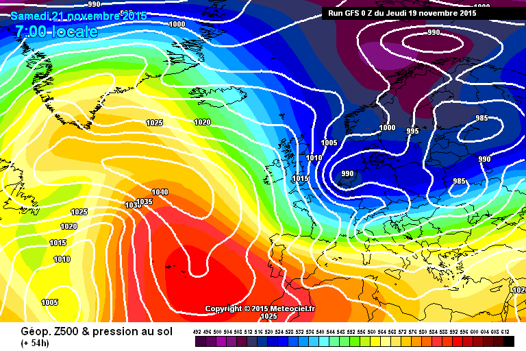
Updated: 10.15am Wednesday 18 November 2015 - Big storm to begin Friday
The upcoming “big storm” has been on the cards for at least a week now, and is certain to arrive in the Alps on Friday. From now on, it’s all about fine tuning the detail. The biggest headache we are faced with this morning is trying to work out where the rain/snow limit will lie on Friday.
 Almost no snow left below glacier level in Austria. This is near Heiligenblut - Photo: wallackhaus.at
Friday’s forecast is tricky because, for most of the day, the Alps will be lying on the warm (southern) side of the polar front (as seen in the chart below).
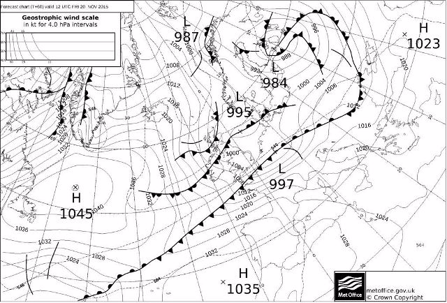 On Friday, the Alps will still be on the warm side of the polar front, which means that the rain/snow limit will remain relatively high - Image: metoffice.gov.uk
There will be copious amounts of precipitation across the north-western Alps (e.g. Tarentaise, Mt Blanc, Portes du Soleil, Valais, Bernese Oberland), but any snow (at least to start with) is likely to remain above 2000m. That said, there is quite a spread of opinion among the various forecasts, so it would be worth preparing for a rain/snow limit anywhere between 1700m and 2300m.
Then, as the cold front approaches, we are likely to see a dramatic drop in temperature on Friday night, starting in the north-west but affecting much of the Alps by Saturday. This will allow snow to fall to very low altitudes, first across the north-western Alps, then later, further east as well.
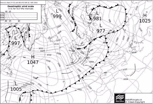 Early on Saturday morning, the cold front will move through the Alps and the rain/snow limit will plummet - Image: metoffice.gov.uk
The rest of the weekend then looks very cold and windy, with further showers or longer spells of snow to low altitudes, again mostly across the northern half of the Alps, but also affecting the far north-west of Italy (Aosta).
The southern side of the Alps, especially the central and eastern Italian Alps (e.g. Dolomites) will only see very modest snowfalls (if any) and the best chance of sunny spells.
Snowfall quantities are always difficult to predict, but at high altitude, say above 2500m, 1m or more of snow is still on the cards by Sunday in some favoured north-western parts of the Alps (e.g. Tarentaise, Mt Blanc, western Valais). Most other parts of Switzerland, the western Austrian Alps (e.g. Ischgl) and the far north-western Italian Alps (e.g. Cervinia) should also do well but, with some exceptions, the southern Alps will see less snow, especially in the Dolomites.
Back to the here and now and we still have a couple of days of relatively benign weather to get through, with very mild temperatures, plenty of sunshine and just a few areas of cloud here and there.
Snow conditions on the glaciers remain OK, but have deteriorated a little over recent days, mostly due to wind. All this is about to change however with the arrival of the big storm on Friday. Stay tuned!
Updated: 9.15am Tuesday 17 November 2015 - The excitement builds!
The Alps are all set for a dramatic return to winter this weekend. However, as is always the case a few days out, there is still some fine tuning to be done regarding who will see the heaviest of the snow…
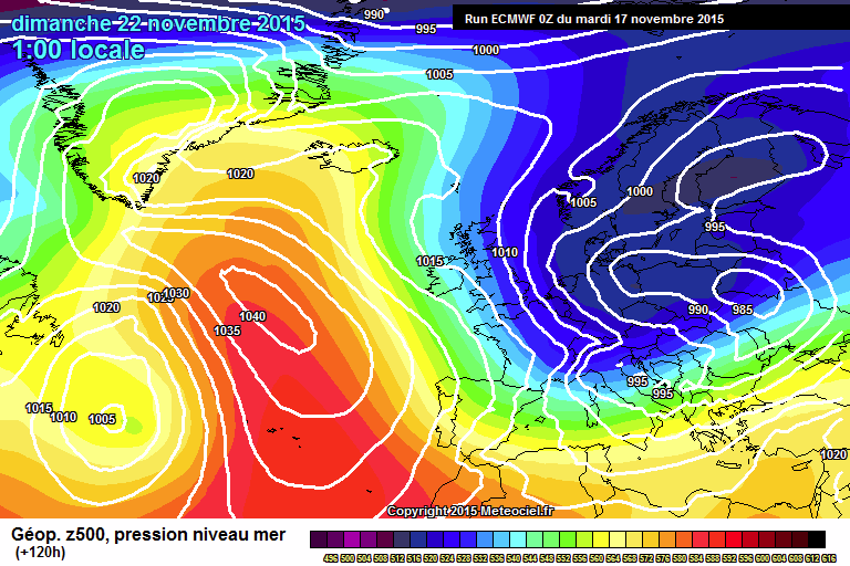 ECM pressure chart for Sunday showing unstable arctic air engulfing the Alps - Image: meteociel.com
The action will begin on Friday, with weather fronts piling in on a strong, but relatively mild (at least to begin with), westerly airflow which will favour the high internal mountain ranges of the western Alps such as the Vanoise, the Mont Blanc and parts of the Swiss Valais.
However, over the weekend, snow will fall to increasingly low altitudes as colder arctic air digs in from the north, even if, generally speaking, the precipitation starts to loses some of its intensity.
As things stand though, it is still the northern and western Alps that are likely to see the heaviest snow from the upcoming storms, with accumulations in the southern Alps generally much more modest. That said, there is still room for a few surprises.
In terms of numbers, it is entirely plausible that we will see over 1m of snow above 2200m in parts of the north-western Alps between Friday and Sunday. As a rule, quantities will decrease the further south and east you are, though there will of course be some exceptions as microclimates come into play.
One thing we can be sure about is that the big change in temperature will at least allow the snow cannons to get going - some compensation for areas forecast to see less snow in this first wave of storms, such as the Dolomites.
Back to the here and now and we will have three days of relatively benign weather to get through - mostly dry and very mild, but sometimes quite cloudy in the northern Alps, with the odd shower here and there. The best of the sunshine will be in the central and southern Alps.
We will be posting a more detailed country by country snow forecast later today…
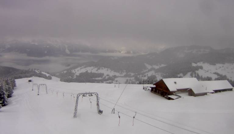
 Very little snow below glacier level in Tignes at the moment, but it’s all change this weekend - Photo: tignes.net
Updated: 9.30am Monday 16 November 2015 - Winter to return next weekend
Confidence is now very high that winter will return to the Alps next weekend - and in a big way! It’s still too early to go into precise detail, but while all regions are likely to see at least some snow, the heaviest falls are currently forecast to hit the northern and western Alps - at least in the first instance.
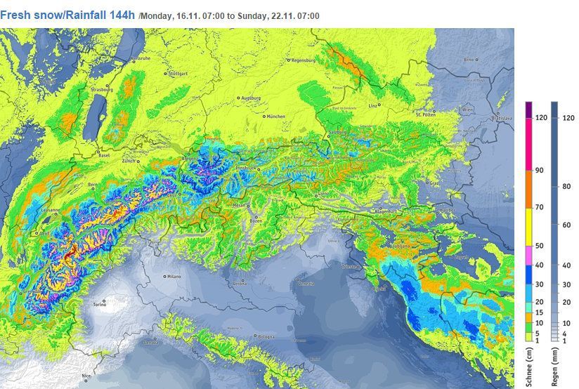 Estimated snowfall in the Alps between now and Sunday - Image: bergfex.com
Before we get there though, we do have several more days of very mild weather to get through.
Today will be mostly sunny, but there will be some cloud around at times this week, especially across the northern fringes of the Alps, with a few showers (and a dusting of high altitude snow) here and there. Most of the Alps will, however, be dry until Friday, at which point the first “serious” weather fronts will start to move in from the north-west.
The end of the week/weekend is forecast to be a very stormy affair for the Alps, with lots of snow, mostly above 2000m at first on Friday, but dropping to low altitudes as the colder polar air digs in on Saturday.
As you can see from the chart, the greatest snowfalls are expected in the northern French, northern and western Swiss, and western Austrian Alps. However, this detail is subject to change so keep an eye on our daily updates.
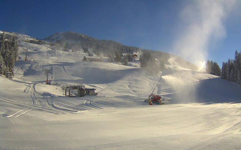
 Waiting for snow in Val Thorens, but it will arrive this weekend - Photo: valthorens.com
Back to the here and now, and there are of course a number of ski areas (mostly glaciers) open for skiing across the Alps.
The most extensive and varied ski terrain can be found at Hintertux, Sölden, Stubai, Zermatt/Cervinia and Saas-Fee. Val Thorens is the biggest name scheduled to open this coming weekend. Right now there is hardly any snow but significant quantities are forecast for Friday, Saturday and Sunday, so we will be watching this situation with interest.
We will have further updates on the approach of winter in our daily bulletin tomorrow…
Updated: 7.45am Sunday 15 November 2015 - All eyes on next weekend
This morning confidence is increasing that we will see a major snow event in the Alps next weekend. However, before we get there, we have another mild week in store. There will be plenty more sunshine too, but also a few showers - mostly mid-week and across the northern fringes of the Alps.
 A sight for sore eyes. This morning’s European weather model (ECM) suggests that we will see widespread heavy snow to low levels next weekend - Image: meteociel.com
So how certain is it that we will see widespread heavy snow in the Alps next weekend?
Well, nothing is 100% guaranteed this far out, but “very likely” is the answer, given the consistency of all the main weather models over the last few days.
Essentially what will happen is that the area of high pressure, that has dominated proceedings so far in November, will gradually pull away to the south-west allowing a more mobile Atlantic airflow to move across the Alps. This will then turn north-westerly, and eventually northerly over the weekend as successive fronts pile in and introduce increasingly cold and unstable polar air right across Western Europe.
Back to the here and now and there are about 15 ski areas open across the Alps today. There are some areas of cloud around first thing this morning, especially in the east where there was the faintest of high altitude dustings in places last night (as in Ischgl, pictured below).
 The faintest of dustings for Ischgl last night - Photo: ischgl.com
For most places today though, it will be dry and mild with sunny spells, the best of these in the west. The greatest extent and variety of skiing on offer remains in Hintertux, Stubai, Sölden, Zermatt/Cervinia and Saas-Fee.
Updated: 9am Saturday 14 November 2015 - Variable cloud, but most places dry
As expected, a weakening cold front brought a few light showers to the north-eastern Alps last night, but any snowfall was negligible and most of the Alps stayed dry.
 A few clouds in the Tuxertal this morning - Photo: foto-webcam.eu
Today, showers will clear the north-eastern fringes of the Austrian Alps (snow 1300m) to leave a mostly dry and bright day, with the best of the sunshine in the western half the Alps.
Tonight, a warm front will skirt the northern Alps and again bring a few drops of rain (snow 2000m) to northern Austria. Most places will, however, stay dry again and the temperatures will begin to rise.
Looking further ahead, and the weather models still look very promising for next weekend with widespread heavy snow a distinct possibility for the Alps. Given the timescale involved, it still pays to be cautious, but as things stand the prospects for the second half of November are looking very good.
In the meantime, we can expect another mild week, though it will rather changeable, with occasional showers, mostly in the northern and western Alps.
Updated: 9.25am Friday 13 November 2015 - Change is getting closer…
Let’s get straight to the point. When will it next snow in the Alps? Well, the short answer is tonight and tomorrow, but only a dusting for some eastern parts. If it’s serious snow we are talking about, then we need to look towards the back end of next week…
 View from the Mölltal glacier in Austria this morning - Photo: gletscher.co.at
After another mostly sunny and very mild day in the mountains, a very weak cold front will bring increasing cloud to the northern side (particularly the north-eastern side) of the Alps later today, with some light precipitation expected across parts of Austria and eastern Switzerland tonight and first thing tomorrow. The rain/snow limit will start at around 1800m before falling to 1200-1500m early tomorrow, but any accumulations will be extremely modest.
Looking further ahead and, after a settled start to next week, a more mobile but still quite mild westerly flow will take hold of the Alps mid-week, with showers here and there (heaviest in the north-west Alps) and a little snow above 2000-2500m.
It’s later in the week and towards the weekend that the weather starts to get really interesting, with the distinct possibility of some more widespread snow to lower levels. However, this is still a long way off so more precise detail and timings are impossible to pin down at this stage.
In the meantime, the best skiing conditions in the Alps this weekend are likely to be in the west (due to better weather) particularly in Tignes, Zermatt and Saas-Fee. Further east, there may be more cloud at times, especially in Austria on Saturday morning.
Weather aside, the most varied and extensive terrain in the Alps right now can be found in Hintertux, Sölden, Stubai, Saas-Fee and Zermatt/Cervinia.
Updated: 9.25am Thursday 12 November 2015 - More of the same, but change is a step closer…
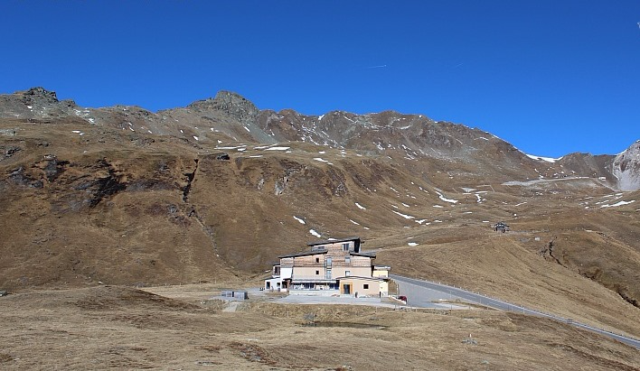
Welcome to our daily summary of weather and snow conditions in the Alps. There is cloud/fog trapped in some of the lower valleys this morning but, in the mountains, the sun is shining and for most of the Alps it will be another glorious day with freezing levels close to 4000m.
 Austria’s highest mountain, the 3798m Grossglockner - Photo: foto-webcam.eu
After another mostly fine, albeit slightly cooler day tomorrow, a cold front will move into the northern Alps on Friday night. It will, however, be an extremely weak affair, with just a dusting of snow at altitude early on Saturday for Austria and eastern Switzerland.
Looking further ahead and the pattern change that we have been banging on about for some time now is still on the cards, even if there are still questions over detail and timing. It does, however, look increasingly likely that there will be some more widespread snowfall for many parts of the Alps later next week.
In the meantime, snow conditions on the glaciers remain good, even if there is now very little snow left (from the October storms) below 2500m. Check out this video from Zermatt yesterday to give you an idea of just how fun can be had out of season!
Our pick of the best alternative glacier destinations to ski in right now are Saas-Fee, Sölden, Stubai, Hintertux and Kaprun.
Non-glacial Obergurgl also opens today with a choice of 10 runs - though a lack of snow means that you have to download from the mid-station to get back to resort.
Updated: 9.25am Wednesday 11 November 2015 - Still balmy, but change is afoot…
Not for the first time this week, there is some patchy cloud in the eastern Alps this morning. For the vast majority of regions, however, it’s another sunny day with freezing levels as high as 4300m in the west!
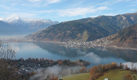
 Early morning mist across the lake at Zell-am-See this morning - Photo: zellamsee-kaprun.com
The next weather action of any note will be the arrival of a cold front across the northern Alps on Friday night/Saturday. However, this will be a very weak affair, with just a dusting of snow here and there across parts of Austria and perhaps the far northern/eastern Swiss Alps.
Looking further ahead and things are starting to fall into place for a more sustained pattern change later next week. It’s not a done deal yet by any means, but it does look like the jet stream will move further south and start steering depressions across the Alps, rather than the British Isles (as has been the case recently).
In the meantime, anyone lucky enough to have been skiing on the glacier this week will no doubt have enjoyed some excellent conditions, especially in the western Alps (e.g. Tignes, Zermatt, Saas-Fee) where there has been pretty much wall to wall sunshine. These resorts should also hang on to the best of the brightness this weekend, while more in the way of cloud will affect the eastern Alps, notably Austria.
As many people will be aware, snow conditions in North America are rather different right now with significant snowfalls prompting a flurry of openings across the west. We will bring you more news on that in our detailed snow report later today…
Updated: 9.30am Tuesday 10 November 2015 - Still exceptionally mild
Once again, areas of cloud are affecting the eastern Alps this morning, especially in Austria (where it is also windy), but these should gradually disperse as the day wears on. Further west, it is another day of almost unbroken sunshine and exceptionally mild temperatures.
 View from the bottom of Saas-Fee’s summer ski area - Photo: saas-fee.ch
Indeed, just when you thought that freezing levels couldn’t get any higher, they could reach 4400m in the French Alps today, with temperatures again surpassing 20˚C in some of the lower valleys.
This fine, often sunny and very mild weather will continue for most of the week, before a weakening cold front moves from the north-west towards the weekend. This front may bring a little snow to the north-eastern Alps (probably only in Austria) over the weekend, but quantities are likely to be very modest, and most of the Alps will stay dry. It will, however, turn cooler, albeit not for very long.
Looking further ahead and the outlook remains uncertain with continuing signs of a more pronounced pattern change later in the month, but it is still too early to say whether this will constitute a pronounced return to winter.
In the meantime, snow conditions on the glaciers remains good, especially in the western Alps today, where you will find the lightest winds and the best of any sunshine.
We will be posting a more detailed ski weather forecast later today…
Updated: 9.15am Monday 9 November 2015 - Mostly sunny and still far too warm
Yesterday was absurdly warm in the Alps, with several all-time November records broken. In Val d’Isère (1850m) the mercury reached 19.5˚C.
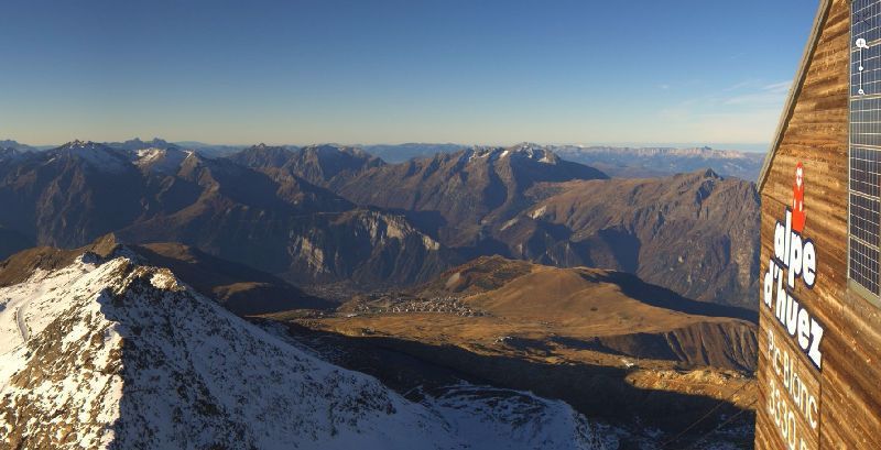 View from the top of the Alpe d’Huez ski area this morning - Photo: alpedhuez.com
Today, except for some areas of cloud across the central and eastern Austrian Alps, it will again be mostly sunny and exceptionally warm for November with freezing levels not far off 4000m.
The big question now, however, is are we going to see a return to winter any time soon?
Certainly not this week is the short answer. A cold front may bring a little snow to the north-eastern Alps this weekend, but, looking at the latest weather models, any significant snow is out of question until 18 - 20 November at the very earliest. Even then, any serious change to the current pattern is not yet convincing, with high pressure remaining stubbornly close to the Alps.
In the meantime, snow conditions on the glaciers are still good (as much to do with the weather as the snow) with at least 15 areas open across the Alps. Among the best of these are Hintertux, Stubai and Sölden in Austria, Zermatt and Saas-Fee in France and Cervinia in Italy, all of which can offer at least 30km of pistes.
Below glacier level, a few areas of snow remain from the October storms (mostly on north facing slopes above 2300-2500m) but, generally speakin,g it is very green and winter seems a long way off.
That said, it’s still far too early to panic - some of the best years have not got going properly until well into December, and last year’s very late start (where there was virtually no snow at all in the north-western Alps until after Christmas) was a once in a generation event. Stay tuned…
Updated: 10am Sunday 8 November 2015 - Still mostly sunny, and exceptionally mild
There is still a little cloud in the far north-eastern Austrian Alps this morning, otherwise it’s another glorious day in the mountains, with freezing levels reaching a remarkable 4000m in places.
 Warm and sunny again for most. This is the Berggasthof Wallackhaus near Heiligenblut in Austria - Photo: wallackhaus.at
The air in place over the Alps right now is so warm and dry that we may well see some records fall today, with temperatures into the low 20˚C’s in some of the lower valleys. Snow conditions on the glaciers remain good - thanks in large part to the October storms - but there is now very little natural snow below 2500m, and winter proper seems a long way off.
The weather is set to remain fine and unseasonably warm for much of this week. A little snow is possible across the north-eastern Alps next weekend, but it is not expected to be significant and high pressure will quickly reassert its grip across the region. After that, it’s really too early to be sure.
Regular followers of weathertoski will know that we have hinted at a more sustainable pattern change later in the month, but right now the longer term weather charts are still not completely convincing.
In the meantime, if you are lucky enough to be out in the Alps, enjoy the fabulous weather. Some of the best winters don’t get going until well into December and it is far too early to be panicking yet!
Updated: 11.30am Saturday 7 November 2015 - Cloudy in the far north-eastern Alps, otherwise mostly fine
It’s a rather cloudy morning in the far north-eastern Alps, with the odd rain shower in the Salzburgland and Upper Austria. Elsewhere it’s another fine, sunny and very mild day, with freezing levels between 3500 and 4000m.
 Any early snow has all but disappeared in the Livigno valley - Photo: valtline.it
This mostly fine and exceptionally warm weather will continue to affect the Alps all of next week. Indeed, freezing levels will surpass 4000m at times and, with temperatures in some lower valleys getting into the low 20°C’s, we could even see some records being broken.
So what does this all mean for snow conditions in the Alps?
Well, conditions on the glaciers remain good thanks to the repeated October snowfalls. Any thoughts about laying a serious base below glacier level, however, have (for the most part) now evaporated, with very little natural snow left below 2500m.
There have been a handful of non-glacial resorts in operation - Sulden in the Sudtirol being one of the better examples. Obergurgl still plans to open next weekend, with limited terrain on the top half of the ski area.
For the vast majority of Alpine ski resorts, however, winter proper still looks a long way off. As we have mentioned for some time now, there is hope of a pattern change in the second half of November, but we are still too far away to be certain that this will deliver any serious snowfall.
In the meantime, if you are lucky enough to be out in the Alps, enjoy the (mostly) beautiful weather and relax - it’s only early November, after all!
Updated: 9.30am Friday 6 November 2015 - Mostly fine, very mild
There’s another fine day in store for most of the Alps, with lots of sunshine in the south. Further north, there will be some high cloud circulating at times, but it will stay dry. It will remain very mild everywhere, with freezing levels as high as 3800m in the west.
 Fine again for most parts of the Alps. This is Zell am See - Photo: foto-webcam.eu
Snow conditions on the glaciers remain good, but much of the lower lying snow from October’s storms has now melted. The best skiing options right now (in terms of extent available) remain Hintertux, Stubai, Sölden, Zermatt and Saas-Fee.
Over the next few days the weather is set to get milder still, with freezing levels as high as 4200m in places early next week - truly exceptional for November. A change to more wintry conditions is possible around the middle of the month, but this is still a long way off and will need to be confirmed over the next few days.
Updated: 8.20am Thursday 5 November 2015 - Sun, sun, sun!
It’s going to be a glorious day in the Alps, with virtually wall to wall sunshine at altitude and freezing levels close to 3000m. Over the weekend it is set to get warmer still, with freezing levels approaching 4000m!
 Glorious sunshine for most of the Alps today. This is the Aletsch glacier in Switzerland - Photo: foto-webcam.eu
For the time being, snow conditions on the glaciers remain very good, but any lower lying snow from October’s storms continues to melt. The best skiing options right now (in terms of extent available) remain Hintertux, Stubai, Sölden, Zermatt and Saas-Fee.
So when will it next snow in the Alps?
Well, the weather models have been very consistent in suggesting that there will be no serious precipitation for the next week at the very least, possibly much longer. However, there are signs of a pattern change around the third week of November, with a cooler, more unstable air mass trying to invade from the north or north-west.
We should stress that this is still a long way off, but it is something worth keeping an eye on.
Updated: 9.15am Wednesday 4 November 2015 - Some cloud in the north-west, otherwise mostly fine
Yesterday’s showers in the western and south-western Alps have moved away, leaving most areas with a dry and (in the mountains at least) sunny day.
 Some cloud at times in Tignes today, but it should stay dry - Photo: tignes.net
However, a very weak weather front is approaching the north-western Alps, which means more in the way of cloud here. It will be mild, though not quite as balmy as in some recent days, with freezing levels generally between 2800m and 3100m.
As expected, yesterday’s showers didn’t amount to very much, with just a few centimetres of snow here and there in higher parts of the French, western Italian and south-western Swiss Alps. However, most regions remained dry, and there was lots of sunshine further east, notably in Austria and the eastern Italian Alps.
Looking further ahead and there is no sign of winter any time soon, with high pressure tightening its grip once more, leading to lots of fine and increasingly warm weather across the Alps.
For the time being, snow conditions on the glaciers remain very good, but any lower lying snow from October’s storms continues to melt. The best skiing options right now (in terms of extent available) remain Hintertux, Stubai, Sölden, Zermatt and Saas-Fee.
Updated: 9.15am Tuesday 3 November 2015 - Mostly fine but some showers in the south-western Alps
Cloudier conditions with a few showers are expected in the south-western Alps today, but further east it will remain largely sunny and exceptionally mild for the time of year.
 Cloudier with the chance of the odd shower later in Tignes today - Photo: tignes.net
Most of the showers will be in the southern French and far western Italian Alps, perhaps moving further north into the French Savoies and the south-west of Switzerland. However, they won’t amount to very much, with any just a dusting of snow above 2500m here and there, and 10-15cm very locally.
For the majority of the Alps though, it will be another fine day with lots of sunshine in central and eastern regions, which will send temperatures soaring towards 20°C in some of the lower valleys (e.g. Kitzbühel).
So, today, the best skiing conditions will be in the eastern Alps (i.e. Austria), where there will be wall to wall sunshine. By contrast, Tignes, Cervinia/Zermatt and Saas-Fee will be cloudier at times, with the chance of the odd shower.
The weather in the Alps is set to remain very mild and mostly fine for the rest of this week, and well into next. Snow conditions on the glaciers should remain good, but any snow lower down the mountain will continue to melt.
Our pick of the skiing options right now remains Hintertux, Sölden and Stubai (Austria), and Zermatt and Saas-Fee (Switzerland).
Updated: 9.20am Monday 2 November 2015 - Warm and sunny at altitude
High pressure remains dominant to the east of the Alps, and continues to drag some exceptionally mild air across western Europe. Indeed, the temperature hit 21.7°C in Bourg St Maurice yesterday, its all-time record for November, with 12.3°C in Val d’Isère.
 Surprise opening for Davos this weekend.
Today, there will be very little change in the weather, with almost wall to wall sunshine and exceptionally high temperatures in the mountains (typically +10°C at 2000m, with freezing levels close to 3500m).
Skiing conditions remain excellent on the glaciers but, needless to say, any low lying snow from recent storms continues to disappear at the rate of knots.
Tomorrow, Tuesday, it will become cloudier for a time with a few showers in the south-western Alps, but most areas will remain fine, dry, and mild - as they will do for the foreseeable future.
At least four new resorts opened their doors for skiing this weekend, including Glacier 3000, Engelberg, Davos and Laax in Switzerland, albeit in a very limited capacity. Engelberg, however, is now closed again for maintenance, at least until 14 November, while Davos and Laax are currently only opening at weekends, subject to snow.
In Italy, Cervinia is now also open on a daily basis, but Passo Stelvio has now closed for the winter. Les 2 Alpes in France has also closed after its half term “preview”, but will open again in early December.
Right now the most extensive skiing options are in Zermatt and Saas-Fee (Switzerland) as well as Hintertux, Sölden and Stubai (Austria).