

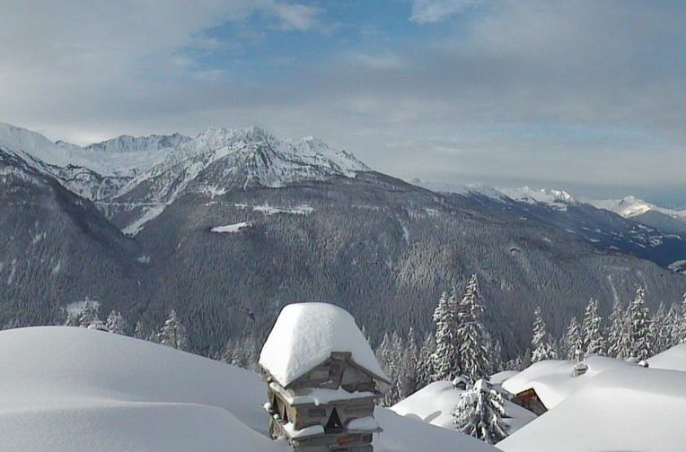
Updated: 10.50am Friday 31 March 2017 - Another mostly fine and very warm day in the Alps
It’s another mostly fine and very warm day in the Alps, especially in the northern and north-eastern valleys where it could reach 24°C (in Innsbruck, for example) this afternoon.
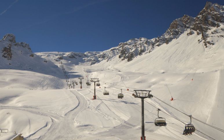
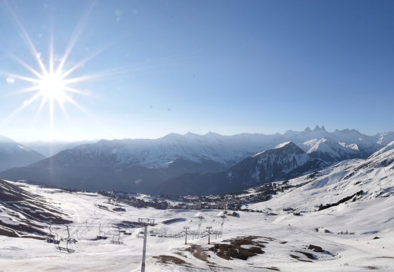
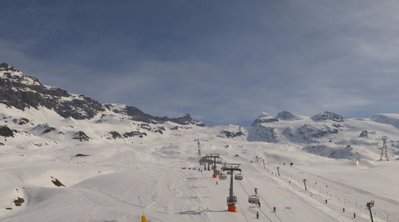 Great spring skiing in Cervinia – 31 March 2017 – Photo: cervinia.it
Over the weekend, the weather will turn cooler and more unsettled in the western Alps with some snow in places. On the whole, snowfall totals will be modest but some moderate falls are possible close to the high border areas between France and Italy (e.g. Val d’Isère, Bonneval-sur-Arc, Sestriere, Isola 2000) as well between Italy and south-west Switzerland (e.g. Cervinia, Monte Rosa).
By contrast, most of the northern French Alps, most of the Swiss Alps (away from the far south), the central and eastern Italian Alps, as well as all of Austria, will see little if any new snow. Next week will also see a return to fine and mostly sunny weather across the board.
For more on current snow conditions in the Alps please see yesterday’s snow report.
Updated: 11.15am Thursday 30 March 2017 - Another glorious day in the Alps
It’s another glorious spring day for most of the Alps, with plenty of sunshine and just a few areas of high cloud drifting around. It will be warm too, with freezing levels close to 3000m and afternoon temperatures into the low 20°C’s in some of the lower valleys.
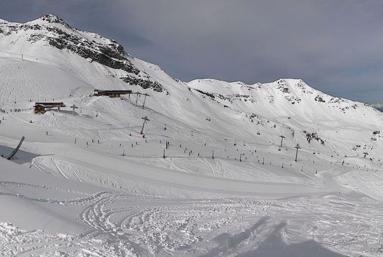
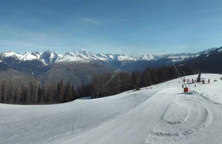 Another glorious day in the La Plagne area – 30 March 2017 – Photo: montalbert.com
This fine spring weather will temporarily break down over the weekend as cooler and more unsettled conditions move in from the west. There will be some snow in places, with the high border areas between France and Italy, and south-west Switzerland and Italy again most favoured. The eastern Alps will largely miss out and the weather will settle down again everywhere next week.
Expect typical spring-snow conditions if you are out in the Alps over the next couple of days, with hard early snow followed by increasingly soft or slushy snow as the day goes on – especially lower down and on slopes exposed to the sun. You can still ski on cold wintry snow all day long but only on the highest north-facing slopes, above 2500m or so.
Updated: 9.55am Wednesday 29 March 2017 - Spring weather continues
Spring continues to reign in the Alps, as it will do for most of the week. Today will see virtually unbroken sunshine in the western Alps, a few areas of cloud in the eastern Alps but nothing significant. It will also be warm, with temperatures close to 20°C in some lower valleys this afternoon.
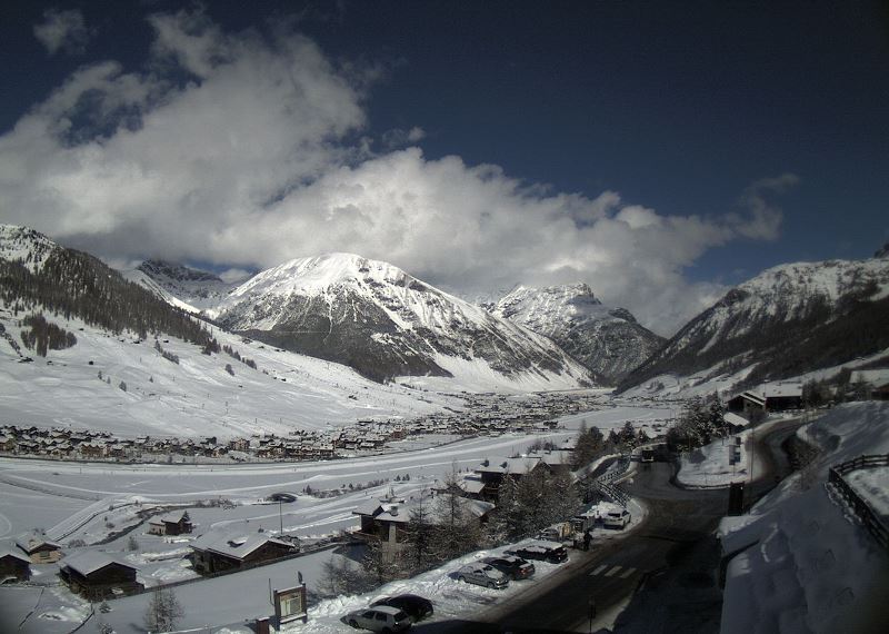
 Fabulous conditions in Val d’Isère right now – 29 March 2017 – Photo: valdisere.com
It will remain mostly fine for the rest of the week, with just a few areas of cloud blotting out the sun from time to time. Temperatures will continue to rise, peaking on Friday in the northern/north-eastern Alps. Over the weekend, a cold front will introduce cooler air and some snow (1400/1600m) to western parts of the Alps, particularly in France and the far west of Italy.
As for snow conditions, you can still find some powder at high altitude in the western Alps, especially with the help of a good guide (note though that the risk of avalanche off-piste remains considerable).
For most skiers, however, freeze-thaw conditions are the order of the day, with hard pistes at the start of the day. The snow then softens at a rate dependent on altitude and orientation, first on east/south-eastern facing slopes, then south then west. If you want your snow to remain firm ALL day, then you need to stick to north-facing slopes above 2300-2500m, give or take.
Updated: 10am Tuesday 28 March 2017 - Back to full spring mode!
All Alpine regions are back in full spring-mode today, with lots of sunshine and temperatures that could reach or surpass 20°C in some lower valleys this afternoon.
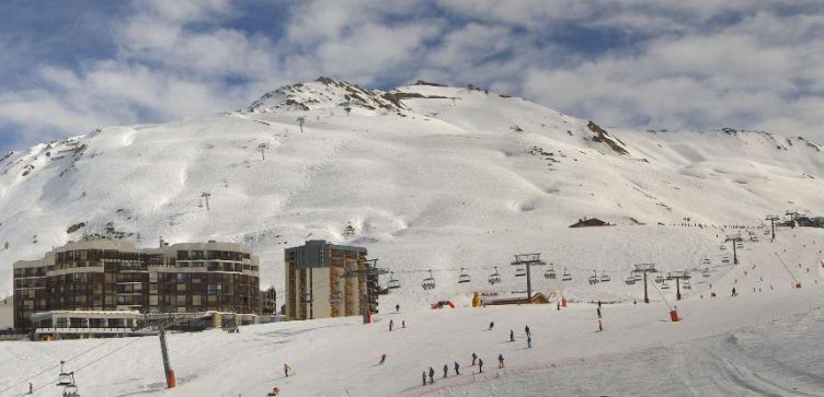
 Fabulous conditions up high in Courchevel – 28 March 2017 – Photo: courchevel.com
You can still find powder at high altitude in the western/south-western Alps following the weekend dumps. However, a good guide is highly recommended, not least due to the considerable avalanche danger off-piste.
For most skiers, however, the freeze-thaw cycle is the order of the day. With mostly clear skies overnight, early morning snow conditions are generally hard/icy. The snow then softens at a rate depending on height/orientation, first on east/south-east facing slopes, then south, then west.
If you want your snow to stay “wintry” all day long then you need to be sticking to north-facing slopes above 2300m or so. This figure will increase as it turns even warmer later in the week, with temperatures expected to reach 25°C or more in some northern valleys by Thursday/Friday.
Not surprisingly, natural snow cover is now very patchy at low altitudes. Higher up, however, there is still (generally) plenty of snow, especially in the western Alps. The obvious exception to this rule is the Dolomites (south-eastern Alps) where, even at altitude, natural snow cover is limited.
Some of the best resorts to be heading to over the Easter period include (but are not limited to) Val Thorens, Val d’Isère, Tignes, Val Cenis, Montgenèvre, Sestriere, Monte Rosa, Cervinia and Saas-Fee.
Updated: 10.25am Monday 27 March 2017 - Spring is back!
Sunshine is dominating the weather in the Alps again, following an unsettled few days which saw significant snow for some south-western parts of the Alps.
 Magnificent conditions in Tignes today – 27 March 2017 – Photo: tignes.net
The heaviest snowfall was on Saturday/Saturday night and in the Piedmont, as well as the far south-east of the French Savoie, with 60cm reported at altitude in L’Espace Killy and up to 90cm in Bonneval-sur-Arc. Note that while you can find some excellent off-piste in these areas today, the risk of avalanche is high, so a good local guide is always recommended.
But while snow conditions are currently excellent at altitude in these south-western/western parts of the Alps (e.g. Isola 2000, Sestriere, Val Cenis, Val d’Isère, Val Thorens, Cervinia, Monte Rosa), the northern and north-eastern Alps (e.g. Adelboden, Engelberg, Saalbach, Zell-am-See) have remained largely dry and very mild in recent days. This has led to increasingly patchy natural snow cover at lower altitudes where there is something of an “end of season” feel.
Warm and sunny weather for much of this week will mean free-thaw conditions for all regions, with the most consistent snow quality on the highest and most north-facing terrain. More on this in our detailed snow report later today…
Updated: 9am Sunday 26 March 2017 - Big snowfalls for some western parts of the Alps
The snow that has been falling at altitude over some south-western parts of the Alps over the last few days intensified late yesterday, as forecast, and spread a bit further north and west to affect many of the big Savoie resorts such as the Paradiski and the 3 Valleys. However, it was the border areas that saw the most snow, with 20cm at resort level in Val d’Isère this morning and 50-60cm reported at altitude!
 20cm at resort level and 50cm-60cm of new snow at altitude in Val d’Isère – 26 March 2017 - Photo: facebook.com/radiovaldisere.com
Examples of other resorts that are particularly snowy right now (especially at altitude) include Val Cenis, Sestriere, Zermatt, Saas-Fee and the Monte Rosa region - basically most resorts close to the French/Italian and south-west Swiss/Italian border.
Further north and east (most of Switzerland away from the far south, Austria and most of the central/eastern Italian Alps), there has been little if any precipitation in recent days with a continued thaw at low and medium altitude. The weather will now settle down right across the Alps with plenty of warm spring sunshine expected this week.
Updated: 8.20am Saturday 25 March 2017 - More snow for some south-western parts of the Alps, but settling down everywhere next week
The south-western Alps will continue cloudy today with further showers (snow 1700-2100m), becoming heavier later in the day and spreading a little further north and west tonight (e.g. into parts of the northern French Alps and south-west Switzerland). The rain/snow limit will also fall a little tonight.
 Fresh snow in Sestriere this morning, with more to come today – 25 March 2017 – Photo: vialattea.it
The heaviest snow will be along the French/Italian border from the Queyras/Monte Viso region northwards through the Milky Way (e.g. Sestriere), towards the Haute-Maurienne (e.g. Bonneval-sur-Arc). Val d’Isère and Tignes may also see some significant snow tonight as the precipitation moves a little further north-west, though whether resorts like the 3 Valleys, Les Arcs or La Plagne get anything meaningful remains to be seen.The Aosta valley (e.g. Pila, Cervinia, Monte Rosa) will also see further snow though not generally in huge quantities.
While there has been significant snow (at altitude) in some south-western parts of the Alps over the last few days, most regions have been dry and very mild which means that snow conditions are generally poor at low altitude. That doesn’t mean that it isn’t possible to find some enjoyable piste skiing, especially in areas where there has been a decent overnight refreeze.
Overall, however, spring is most definitely in charge. What’s more, we are looking at a return to settled, mostly sunny and increasingly warm conditions across all Alpine regions next week.
Updated: 7.20am Friday 24 March 2017 - Further snowfalls for higher parts of the south-western Alps
The weather in the Alps is stuck in a bit of a rut right now, with showers or longer spells of rain/snow in the south-western Alps. Further north and east it is generally drier and brighter, particularly in Switzerland and Austria (away from the far south).
 Snowing in the Monte Rosa region yesterday with more likely over the next couple of days – 24 March 2017 – Photo: facebook.com/monterosaSki
Today the heaviest precipitation will be in the southern French and south-western Italian Alps, especially close to the border between the Mediterranean and the Haute-Maurienne (e.g. Isola 2000, Limone, Prato Nevoso, the Queyras, Sestriere, Prali, and Bonneval-sur-Arc). It will be mild, however, which means that the rain/snow limit will be somewhere around 1800-2100m. Snowfall totals will generally be quite modest, but 20-30cm is possible (very locally) above 2200m in the Piedmont.
On Saturday there will be only subtle changes in the weather with precipitation still affecting the south-western Alps, if anything increasing with intensity later in the day and perhaps spilling over the border a little more into the south-eastern Savoie (e.g. Val d’Isère).
Throughout this period many other parts of the Alps will be mostly dry with variable cloud and mild or very mild temperatures, particularly in the far north and north-east where there should be good sunny spells.
Snow conditions remain very mixed across the Alps, generally poor or very poor at low altitudes, and best in areas where there is plenty of skiing above 2200m, preferably even higher if you want consistently wintry snow.
As mentioned earlier, there is fresh snow falling at attitude in the south-western Alps (e.g. Isola 2000, Sestriere, Pila, Cervinia and Monte Rosa), however bad weather means that it will be difficult to make the most of it until Sunday, at the earliest. The off-piste is also becoming particularly perilous in these regions, with the risk of avalanche taking a while to abate next week.
Updated: 7.55am Thursday 23 March 2017 - Further snow at altitude for some south-western parts of the Alps
There has been some fresh snow at altitude in the south-western Alps over the last 24 hours, with more due today. For most Alpine regions, however, it will be dry with variable cloud and relatively mild temperatures.
 Cloudy today in Val d’Isère, with the chance of snow showers – 23 March 2017 – Photo: valdisere.com
Most of today’s snow will fall in the high border areas between Italy and France, and Italy and central-southern/south-west Switzerland. Resorts affected include Airello, Bosco Gurin, Zermatt, Cervinia, the Monte Rosa region, the Milky Way, Val d’Isère and Val Cenis. However, because the rain/snow limit will be quite high (generally 1700-2000m), most of the snow will fall at altitude rather than at resort level.
On Friday and Saturday, there will be further snow at times in the south-western Alps, possibly heavy at times, especially later on Saturday when there may be a major “Retour d’est” bringing significant falls to the likes of Val d’Isère, Val Cenis and Bonneval-sur-Arc (to be confirmed). For most of the Alps, however, it will be dry with variable cloud and the best of the sunshine in the north and east.
Snow conditions in the Alps continue to be very mixed – generally poor at low altitudes, thanks to the mild temperatures. It will be possible to find fresh “dry” snow in the south-western Alps over the next few days, but only above 2200m or so, below which the going will remain on the heavy side.
Updated: 8.25am Wednesday 22 March 2017 - Heavy snow for some south-western parts of the Alps over the next few days
The weather situation in the Alps is quite complex at the moment, with slow moving fronts undulating across the western Alps. Overall there is quite a lot of cloud around, but some sunny breaks will develop here and there. There are also some showers, these heaviest in the high border areas between Italy and central-southern/south-west Switzerland.
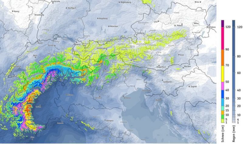 Expected snowfall totals between now and Sunday show the high border areas of the south-western Alps clearly favoured – Photo: bergfex.com
The heaviest precipitation today will fall roughly in a triangle to the east of Zermatt, to the south of Andermatt and to the west of Madesimo. However, showers will break out in other central and south-western parts of the Alps from time to time, especially later in the day. The rain/snow limit will be around 1400-1800m.
Over the next couple of days the weather will remain rather unsettled, especially in the south-western Alps, with the focus for the heaviest rain/snow moving a little bit further west – mostly to the Italian Piedmont (e.g. Alagna, Sestriere) but also parts of the Aosta Valley (e.g. Pila, Champoluc) and possibly the high border areas between France and Italy (e.g. Bonneval-su- Arc, and maybe even Val d’Isère). Some of these high border areas could see over 1m of new snow by the end of Saturday, but it will be relatively localised with big variations from one valley to the next.
Note that it will stay relatively mild with the rain/snow limit generally between 1400m and 1800m on the southern side of the Alps, but a bit higher further north. The northern and eastern Alps will see less in the way of precipitation over the coming days, with some places (especially in Austria) remaining dry. It will also continue to be mild.
Not surprisingly, snow conditions will main mixed over the next few days - generally poor (soft or wet snow) at lower altitudes, but with significant fresh snow above 2000 for parts of the south-west.
Updated: 8am Tuesday 21 March 2017 - Turning unsettled again, but still not particularly cold
After a mostly fine day yesterday, the weather in the Alps is turning more unsettled again today and will remain rather changeable for much of the week.
 The weather is changing again in the Alps. This is Alpe d’Huez – 21 March 2017 – Photo: alpedhuez.net
Most places will start dry with some sunny spells here and there. However, there is already more in the way of cloud around than there was yesterday and, generally speaking, cloud cover will increase as the day goes on. There will also be some showers, especially later in the day, heaviest in the central-southern Alps (e.g. Andermatt, Madesimo). The rain/snow limit may start close to 2000m before falling a bit tonight.
Tomorrow will see showers becoming a little more widespread (snow 1300-1800m) but still heaviest in the same central-southern Alpine regions, where some significant falls are possible.
Snow conditions remain very mixed across the Alps. Many lower slopes have taken a hammering from the warm temperatures in recent days, but at altitude there is still plenty of decent skiing to be had, especially on-piste.
Updated: 9.45am Monday 20 March 2017 - Mostly fine and quite warm today
Last weekend’s storm, which brought bad weather to (mostly) the northern half of the Alps, saw a higher rain/snow limit than initially forecast.
 Mostly fine and very mild today in the Alps – 20 March 2017 – Photo: merinet.com
The heaviest precipitation fell on Saturday, though snow generally only fell above 1800-2200m. Up to 50cm of new snow was recorded on the higher peaks of the Austrian Tirol and Salzburgland but, with rain lower down, the quality of the skiing was seriously affected. The southern Alps escaped with only a few showers and plenty of dry if rather mild weather.
Today the weather will be mostly fine and very mild across the Alps, with freezing levels close to 3000m in the west. It will turn more unsettled again mid-week with some snow at altitude here and there, set to be heaviest in the central-southern Alps (e.g. Bosco-Gurin, Madesimo).
Updated: 9.40am Saturday 18 March 2017 - Rain or snow in the northern Alps, especially in the north-east
After a week of mostly fine, spring-like weather it’s all change in the Alps today as a cold front moves in from the north. Expect showers or longer periods of rain/snow across the northern Alps today, especially in Austria, with the driest, brightest weather in the south.
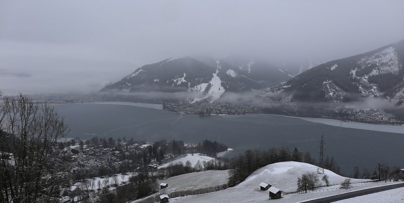
 Cloudy in Zell-am-See today, with rain low down and snow at altitude – 18 March 2017 – Photo: foto-webcam.eu
The heaviest precipitation will be in Austria, especially in the western Tirol and Vorarlberg (e.g. St Anton), as well as parts of Upper Austria and the Salzburgland (e.g. Kaprun). Above 2000m these regions might see 20-40cm of new snow today, very locally a bit more.
Generally speaking, the northern Alps will see between 10cm and 20cm above 2000m, though the north-west (e.g. Chamonix, Verbier) may only see a dusting. As mentioned previously, the southern Alps will see little if any precipitation.
The rain/snow limit will be close to 2000m in the northern French and western Swiss Alps, and between 1200m and 1600m in the eastern Swiss and Austrian Alps, but temporarily a bit lower in places.
Not surprisingly, snow conditions across the Alps are very mixed right now, and soggy at low altitude in the north where it is raining in many places.
The weather will improve tomorrow, and it should be mostly fine across the Alps at the start of next week. It will, however, turn a bit more unsettled as the week goes on with bits and pieces of snow in places. However, no really significant or widespread snow is expected at this stage.
Updated: 7.50am Friday 17 March 2017 - Turning more unsettled
The weather in the Alps has been mostly fine this week, with plenty of sunshine and just a few areas of cloud drifting around from time to time. This weekend will see a change, with snow in places, mostly across the central/eastern Swiss Alps as well as Austria (away from the far south). However, this morning’s weather models indicate that precipitation totals have been downgraded again.
 Another sunny one in La Toussuire, France – 17 March 2017 – Photo: la-toussuire.com
Generally speaking, the northern and north-eastern Alps are looking at about 5-20cm of new snow above 1800m on Saturday, with 25cm+ very locally (such as in the higher reaches of the Arlberg/Vorarlberg). The far western Swiss Alps and northern Alps may also see a dusting, but most of the southern Alps will stay dry. The rain/snow limit will be around 1200-1700m, but a little lower for a time in parts of Austria.
Next week should start fine but it will turn increasingly unsettled (and chilly) in the western Alps mid-week, with some snow at times. The eastern Alps should be drier and milder, at least initially.
Not surprisingly, snow conditions are pretty mixed across the Alps with a rapid thaw in progress at lower altitudes. That said, there is still some very good skiing to be had, particularly at altitude in the west (e.g. Val d’Isère, Val Thorens, Cervinia).
Updated: 10.30am Wednesday 15 March 2017 - Mostly fine this week, snow for some this weekend
The weather in the Alps will remain mostly fine until the end of the week. However, it will turn more unsettled this weekend, with some snow in places, mostly across the Swiss and Austrian Alps.
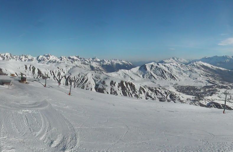
 Mostly fine today in the Alps with just a few clouds here and there. This is Tignes – 15 March 2017 –Photo: tignes.net
Today it is mostly fine, though there are some areas of cloud drifting around blotting out the sun here and there. Freezing levels will range from about 2300m in the eastern Alps to over 3000m in the west, where the freeze-thaw cycle will be most profound. The weather in the Alps will continue in a similar vein until Friday when the first signs of a breakdown will be apparent, with cloudier weather moving into the northern Alps later in the day.
Saturday will see precipitation across the northern half of the Alps, heaviest from central Switzerland eastwards into Austria. The rain/snow limit will fall to around 1200-1600m, perhaps a bit lower in some parts of Austria.
Above 1800m, snowfall totals are expected to be in the range of 15-30cm across the northern Swiss and Austrian Alps (from about the Bernese Oberland eastwards), with 40cm+ very locally (e.g. the Arlberg). However, the far western Swiss Alps (e.g. Verbier), as well as the northern French Alps, are only expected to see a dusting. The southern Alps (i.e. most of Italy) will also miss out.
Updated: 8.35am Tuesday 14 March 2017 - Mostly fine all week
High pressure will dominate the weather in the Alps this week. Weak fronts will try and move down from the north every so often, but will introduce no more than an a little cloud here and there. Expect plenty of sunshine, with chilly nights but pleasantly warm afternoons.
 Good cover at altitude in Les Sybelles, France – 14 March 2017 – Photo: sybelles.com
Yesterday we talked about the possibility of snow returning to some parts of the Alps next weekend. This might still happen, but the chance of widespread or significant snow seems to be diminishing. We will update you on this in our detailed snow forecast later today.
In the meantime, spring-snow conditions will rule across the Alps this week. Above about 2000m the snow should stay relatively firm on north-facing slopes for most of the day. Indeed you can still find some patches of powder above 2200-2400m, with a good guide and a bit of effort.
On sunnier slopes and/or at low altitude, however, plan for a daily metamorphosis of the snow from hard to soft, at a rate dependent on altitude and orientation. Note also that the atmosphere is already very spring-like in some of the lower Alpine valleys, something that will only increase now as the snow-line retreats upwards, especially on south-facing slopes.
Before you panic, however, it is also worth noting that snow depths are still healthy at altitude across much of the Alps. One obvious exception is the south-east (Dolomites) where, if it wasn’t for snow-making, they would have seriously struggled all season.
Elsewhere though, Easter skiers are still “safe” so long as you have chosen your resort with a modicum of care – i.e. there is plenty of terrain above 2000m or so. What’s more, there is still time for a return to winter – it is not unusual to see significant snowfall in the Alps in late March or April.
Updated: 10.15am Monday 13 March 2017 - Spring has sprung
Spring has well and truly sprung in the Alps and it will continue to be mostly fine and sunny all week. Temperatures are also on the rise, with freezing levels reaching or surpassing 3000m in the west over the next few days.
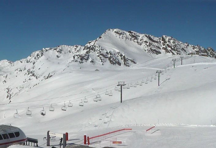
 Spring weather in Courchevel, but still plenty of snow – 13 March 2017 – Photo: courchevel.com
It is likely to turn more unsettled next weekend, with some snow, but it is too early to say how significant this might be. In the meantime, prepare for spring snow conditions in the Alps, especially at lower altitudes where the freeze-thaw cycle will be most pronounced.
Above 2000m or so, north-facing slopes should still remain relatively firm all day long. Lower down, however, expect softer or slushy snow conditions to develop, especially on the slopes that are most exposed to the sun. There will also be a continued thaw of any low-lying snow, especially off-piste, with temperatures approaching 20°C in some lower valleys as the week progresses.
That said, many parts of the Alps still have very respectable snow depths at altitude, so there is no need to panic if you are skiing at Easter, so long as you have chosen your resort with a modicum of care. The main exception is the south-eastern Alps (e.g. Dolomites) where natural snow cover has been very thin all season.
Updated: 11am Saturday 11 March 2017 - Turning increasingly spring-like
It’s a beautiful day across the Alps, with virtually wall to wall sunshine and spring-like temperatures at low altitude. This fine weather is likely to last all week (give or take), with no significant snow on the horizon.
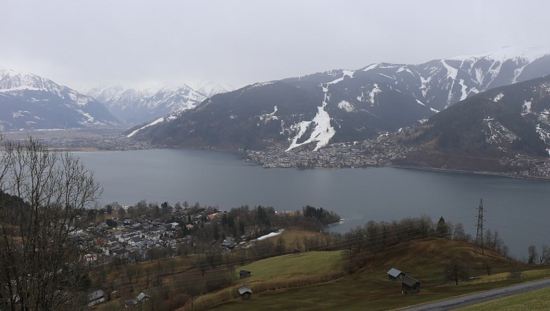
 It is turning increasingly spring-like in the lower valleys. This is Zell-am-See – 11 March 2017 – Photo: zellamsee-kaprun.com
We are now entering a period of freeze-thaw cycles with firm or icy conditions first thing followed by softening of the snow, at a rate dependent on altitude and exposure. The snow will stay firmest for the longest the higher and more north-facing you are. However, it will soften very quickly on low slopes exposed to the sun - firstly on those facing east/south-east, then on those facing south, before those facing west later in the day.
There will also be noticeable thaw of any low-lying snow outside the pistes over the next few days, especially (again) in areas exposed to the sun. In short, spring will start to take hold of the lower valleys.
That said, snow depths are actually quite respectable at altitude across most of the Alps - above average even in some French and western Swiss resorts - the main exception being the far south-east (e.g. the Dolomites) where snow cover has been thin all season.
This means that Easter skiers have absolutely no need to panic if they have chosen their resort with a modicum of care (i.e. one where there is plenty of skiing above 2000m or so).
Updated: 9.20am Friday 10 March 2017 - Weather and snow conditions in the Alps are constantly changing
It has been a complicated 24 hours of weather in the Alps, with lots of snow at altitude in the northern and north-eastern Alps, but also lots of rain lower down.
 Lots of new snow at altitude in the Bregenzerwald yesterday, but there was also rain lower down. This is Mellau – 10 March 2017 – Photo: mellau.at
This morning the Tirol Avalanche service reports between 30cm and 70cm of new snow above 2000m in the last 24 hours alone. However, below 1500m it fell as rain for much of this time before it eventually turned a bit colder overnight.
The central and eastern Swiss Alps also saw plenty of precipitation, with a rain/snow limit starting around 1500-1900m, only descending slowly later. By contrast, much of the southern and far western Alps stayed mostly dry.
Today any residual showers across the eastern Austrian Alps (snow 600-900m) will die away. Most other areas will be quite sunny once any early cloud has dissipated. It will also feel warm in the sun, with freezing levels close to 2500m in the west. Saturday will also be mostly fine and even milder.
Not surprisingly snow conditions in the Alps are quite mixed right now. If it’s powder you are after, there is plenty of it above 2000m in the Austrian and central/eastern Swiss Alps. Note, however, that the risk of avalanche off-piste is sky high. Lower down, the going is heavier due to mild temperatures and rain in places. Our best advice over the next day or two is to stick to the pistes and stay high.
Updated: 9.20am Thursday 9 March 2017 - Mild, rain or snow for many northern parts of the Alps
The weather has turned milder again with the arrival of a warm front across the northern Alps. This will bring a mixture of rain and snow to many northern Alpine resorts today, especially in Switzerland and Austria, with a rain/snow limit generally between 1700m and 2000m in the west, and 1100-1700m in the east.
 Soggy at low altitude in Austria today. This is Zell-am-See – 9 March 2017 – Photo: zellamsee-kaprun.com
Examples of resorts where (at village level at least) it will be a bit of a wash out today include Engelberg, Laax, St Anton, Saalbach and Kitzbühel (to name just a few). Above 1800m, however, these areas could see between 15cm and 40cm of new snow.
In the north-western Alps (e.g. Verbier, Portes du Soleil, Chamonix), any rain/snow will be much lighter and patchier. A few showers will also get through to the southern Alps (e.g. Dolomites) but many southern areas will stay dry, with the best of any sunshine in the south-western Italian Alps (e.g. Milky Way).
Snow conditions in the Alps are therefore very mixed again. At low altitudes across the northern half of the Alps it’s a bit soggy in places, even very soggy in eastern Switzerland and much of Austria. The best skiing today will probably be in the south-western Alps where it is mostly sunny (e.g. Sestriere, Isola 2000).
Over the next few days the weather in the Alps will remain rather changeable and quite mild, with Saturday likely to offer the most in the way of sunshine.
Updated: 10.10am Wednesday 8 March 2017 - Changeable, especially in the north
It is a mostly fine morning in the Alps, though generally speaking the weather remains unsettled, with the next set of weather fronts set to affect the northern Alps later today and tomorrow.
 Huge snowfalls in La Rosière over the last few days – 8 March 2017 – Photo: larosiere.net
A huge amount of snow has fallen across the north-western Alps over the last few days, with between 100cm and 150cm in some French resorts including Val d’Isère, Tignes, La Rosière, Flaine, Chamonix and Avoriaz (to name just a few). Most other parts of the Alps have also seen snow to a greater or lesser degree – lesser the further south-east you are.
In theory, snow conditions should be as good as they have been all season. However, in practice there are two caveats. The first being that the off-piste is highly dangerous, especially in the western Alps where so much fresh snow has fallen. Secondly, the weather will quickly turn milder again, with the arrival of a warm front across the northern Alps later today and tomorrow. This will affect mostly the Swiss and Austrian Alps (especially the north) with the rain/snow limit rising to 1400-1800m.
Expect low resorts in both these countries to turn a bit soggy again over the next 36 hours. That said, it will then turn colder again on Friday! In short - weather and snow conditions will remain very mixed over the next few days.
Updated: 10.10am Tuesday 7 March 2017 - Masses of new snow in many northern and western parts of the Alps
Many northern and western parts of the Alps are waking up to significant new snowfall this morning.
 Snowing hard in Châtel this morning – 7 March 2017 – Photo: chatel.com
Indeed parts of the northern French Alps (e.g. Val d’Isère, La Rosière, Chamonix, Avoriaz), as well as the extreme west of Switzerland (e.g. Les Crosets), have seen 50-70cm of new snow at altitude in the last 24 hours alone! Significant snow has also fallen in most other parts of the French and Swiss Alps, the western Italian Alps (e.g. Courmayeur) as well as the west of Austria (e.g. Lech).
Over the last 5-7 days we have seen well over 1m of new snow at altitude in the western Alps, with 150cm in some of the above mentioned areas. It hasn’t been especially cold, however, meaning that until recently, at least, the snow has had trouble settling in any great quantities at low altitude. Today, however, moderate snowfalls have reached even the lowest resorts, such as Megève and Morzine.
 Masses of new snow in Méribel – 7 March 2017 – Photo: merinet.com
This morning snow is still falling to low altitudes across many northern parts of the Alps, though it will slowly die away from the French and western Swiss Alps. In the central/eastern Swiss Alps, as well as in Austria, it should continue for most of the day. The central and eastern Italian Alps have missed most of the action from this latest storm and will be brighter today. The southern French and western Italian Alps (e.g Isola 2000, Sestriere) will also see increasing amounts of sunshine.
Needless to say, snow conditions will be fabulous once the weather settles down, especially in the western Alps where so much new snow has fallen. In the short term, however, the off-piste situation is highly dangerous with an avalanche danger rating of 4/5 across much of the northern French, western Swiss and far north-western Italian Alps.
Updated: 8.15am Monday 6 March 2017 - Huge snowfalls for western Alps
It’s a very snowy scene across the western Alps this morning, especially in the higher French resorts where significant snow fell over the weekend and much more is expected today.
 Heavy snow in Arc 1950 this morning – 6 March 2017 – Photo: lesarcs.com
Indeed, with snow forecast to continue all day and night, some parts of the northern French Alps (e.g. La Rosière, Val d’Isère, Avoriaz) could see an additional 50-70cm in the next 24 hours! More generally, we are looking at 30-50cm across a wide swathe of the French and western Swiss Alps (away from the far south). The rain/snow limit today will briefly rise to around 1200m in the middle of the day before it falls to low levels tonight.
Some snow will also get through to the eastern Swiss and western Austrian Alps later, but the southern Alps (with one or two exceptions like Courmayeur and La Thuile) will only see patchy precipitation here and there.
Tomorrow, the heaviest snow will move towards the central and eastern Swiss Alps (e.g. Mürren, Engelberg, Laax) as well as the western Austrian Alps (e.g. Lech).
Most parts of the Alps have seen significant snow in the last few days, the greatest accumulations being at altitude in the west, especially in France (e.g. Val d’Isère, Chamonix, Flaine, Avoriaz).
The major exception - where only a few centimetres of new snow have fallen - is parts of Austria, especially the low resorts of the northern and eastern Austrian Alps, such as Kitzbühel. However, these areas should see a moderate fall on Tuesday.
Note that the risk of avalanche is very high in the western Alps and will become critical in places over the next 24 hours.
Updated: 9.45am Sunday 5 March 2017 - More snow forecast, especially in the west
The weather in the Alps remains very unsettled, with further Atlantic storms moving from west to east over the next few days.
 Lots of snow in Livigno, with more forecast over the next few days – 5 March 2017 – Photo: valtline.it
This morning will see snow showers (900-1300m) across some southern and eastern parts of the Alps (e.g. Dolomites). The western Alps may start mostly dry but a more organised band of precipitation will move in later in the day (snow 1000-1200m) and last into the night. The heaviest snow will be at altitude in the northern French Alps (e.g. 3 Valleys, Flaine, Chamonix, Avoriaz) where 15-30cm of additional snow is likely by Monday morning.
Monday will remain very unsettled with a major storm slamming into the western Alps later in the day, especially affecting France, with an additional 30-60cm of snow likely in resorts such as Alpe d’Huez, Val d’Isère, 3 Valleys, Les Arcs, La Plagne, Chamonix, Flaine and the Portes du Soleil. On Tuesday, the focus for the heaviest snow will transfer east towards the northern Swiss and Austrian Alps (e.g. Mürren, Engelberg, Lech, St Anton).
All in all, snow conditions in the Alps are rapidly improving with plenty of new snow in most regions, including the south (e.g. Dolomites) where there was so little natural snow earlier in the season. However, high winds and poor visibility will make things challenging at times. Take great care off-piste, as the situation remains dangerous, especially (but not exclusively) in the western Alps.
Some low altitude resorts such as Morzine and Kitzbühel can still only offer very thin cover low down but most pistes are open and conditions should also continue to improve here over the next couple of days.
Updated: 5.30pm Friday 3 March 2017 - Lots more snow over the coming days…
The weather in the Alps remains in very unsettled mood with a succession of new storms forecast expected over the next few days.
 Looking good in Méribel this morning, albeit very mild lower down – 3 March 2017 - Photo: merinet.com
Many places have been dry today but have also become increasingly windy, especially on the northern side of the Alps (Foehn) where it is now exceptionally mild. At the same time cloud has increased in the south-western Alps (e.g. Sestriere) over the course of the day, with a few showers or flurries possible this evening.
Tonight and tomorrow the Foehn will become violent in some central and northern parts of the Alps (watch out for multiple lift closures). Any precipitation will intensify across the southern Alps, gradually moving further north and east through the weekend.
The rain/snow limit will start at around 1000-1500m in the southern Alps, and higher in the northern Alps, before descending to lower levels everywhere by Sunday. The first part of next week will remain unsettled with further snow for many, often to quite low levels.
Between now and the end of Sunday we can expect 40-70cm of new snow (locally more) at altitude in some southern and western parts of the Alps, including Chamonix, Val d’Isère and the Monte Rosa region. The further north and east you are (e.g. much of Austria) the less snow there will be initially, but these areas will get more into the action as we move into next week.
Updated: 10am Thursday 2 March 2017 - Remaining very unsettled
The weather in the Alps remains very unsettled with further storms moving in from the west over the next few days. Most areas will see plenty more snow between now and Monday, heaviest in the south and west.
 Lots of snow in the northern French Alps right now. This is Les Saisies – 2 March 2017 – Photo: lessaisies.com
Looking back over the last 48 hours, there has been lots of new snow across many parts of the Alps. The greatest snowfall totals have been in the northern French Alps (e.g. Avoriaz, Flaine, Chamonix) and the central Italian Alps (e.g. Bormio, Passo Tonale). These regions have seen 80cm or more at altitude. However, with fluctuating freezing levels, there has also been some rain at low altitude, especially in the western Alps. Note that the off-piste is often hazardous due to a combination of new snow, high winds and rapidly changing temperatures.
Today will see a few more snow showers (900-1400m) here and there, mostly in the northern French, Swiss and northern Austrian Alps. Then, after something of a reprieve on Friday, the next major storm will arrive on Friday night, influencing the weather over the weekend.
This storm will again bring significant quantities of snow to the western and southern Alps (e.g Val d’Isère, Zermatt, Monte Rosa, Bormio, Passo Tonale). The least snow over the next few days will be in the north-eastern Alps (e.g. Kitzbühel).
Updated: 11.10am Tuesday 1 March 2017 - Plenty of fresh (but often windblown) snow
It has been a very stormy 24 hours in the Alps with snow for most, heaviest in the northern French and some central Italian parts of the Alps.
 Fresh snow in La Plagne – 1 March 2017 – Photo: facebook.com/LaPlagne
Snowfall totals have generally been in the region of 10-40cm above 1600m, with one or two favoured spots such as Flaine and Passo Tonale seeing 50cm or more towards the top of their ski areas.
High winds have meant that the snow has been highly unevenly distributed, which will make the off-piste treacherous, at least in the short term.
Further snow showers are forecast today, heaviest in the northern French and western Swiss Alps (e.g. Avoriaz, Crans Montana). However, it will turn milder with the rain/snow limit creeping up towards or above 1000m.
Further snow showers (1200-1600m) are expected across the northern and western Alps on Thursday, before the action shifts towards the southern Alps (i.e. Italy) over the weekend. Stay tuned…