

Updated: 10.25am Friday 29 April 2016 - Mostly sunny, still relatively cold
There is cloud in some central-southern parts of the Alps this morning (e.g. eastern Piedmont, Ticino). Most other regions are sunny, even if the ambient temperatures remain chilly, with freezing levels struggling to reach 2000m.
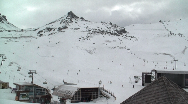
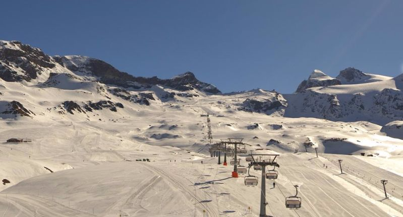
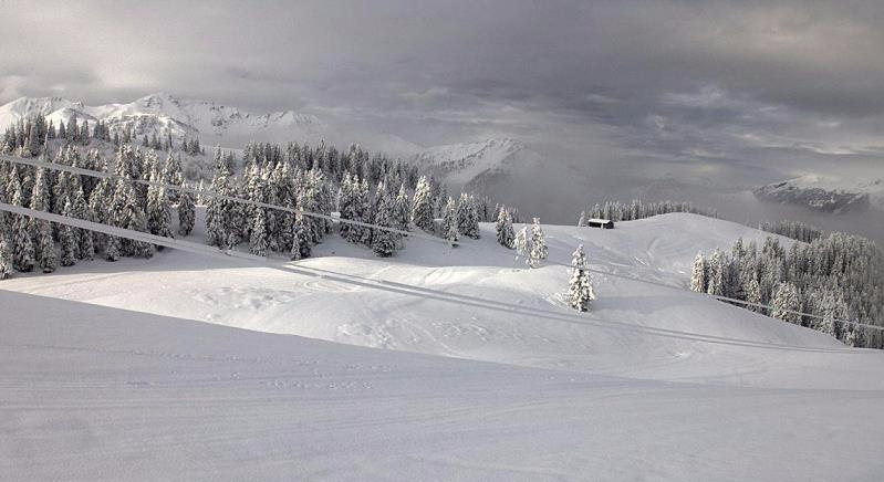
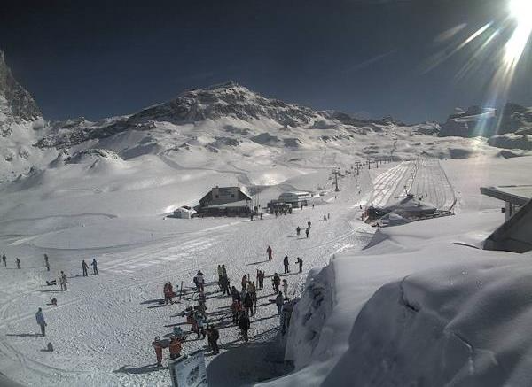
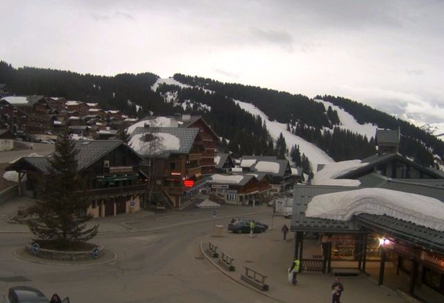
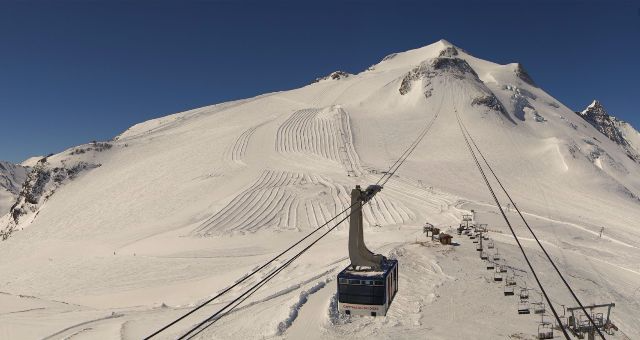 Perfect snow conditions on the Grande Motte glacier above Tignes this morning - Photo: tignes.net
The next storm will affect the Alps later on Saturday and on Sunday, with further significant snow in places. With low pressure forming close to or right over the Alps, it is difficult to say who will see the highest snowfall totals. Right now though, the western Alps are most in the firing line, especially the western Italian Alps on Sunday.
Snow conditions remain very good for the time of year in the few ski resorts still open (see below) and, if it’s powder you are after (and you are lucky enough to be in the Alps early next week), Tignes could be skiing as well as anywhere.
Note, however, that it will quickly warm up again with temperatures climbing back into the 20°C’s in the lower valleys by Wednesday.
Resorts remaining open are:
Austria:
- Ischgl - until 1 May
- Obertauern - until 1 May
- Kitzbühel - until 1 May
- Sölden - glaciers open until 8 May
- Pitztal - glacier open until 8 May
- Mölltal - glacier open until 8 May
- Stubai - glacier open until 29 May
- Hintertux - glacier open 365 days a year
- Kaunertal - glacier open until 29 May
- Kitzsteinhorn - glacier open until 24 July
- Dachstein - glacier open as long as snow conditions allow
France:
- Bonneval-sur-Arc - open until 30 April
- La Clusaz - open until 30 April
- Les 2 Alpes - open until 30 April
- Argentière - open until 1 May
- Val d’Isère - open until 1 May
- Tignes - open until 8 May (Grand Motte area only after 1 May)
- Val Thorens - open until 8 May
Italy:
- Cervinia - open until 1 May (plus weekends only until the end of May)
- Cortina - open until 1 May
- Livigno - open until 8 May
- Val Senales - glacier open until 8 May
Switzerland:
- Adelboden - open until 1 May
- Samnaun - open until 1 May
- Glacier 3000 (Les Diablerets) – open until 8 May
- St Moritz - Corvatsch open until 1 May, Diavolezza open until 22 May
- Engelberg - open until 22 May
- Zermatt - open all year-round (though skiing is very limited in early May due to maintenance)
Updated: 9.45am Wednesday 27 April 2016 - Yet more fresh snow for the Alps!
The Alps are still in the grip of winter, with further significant fresh snow in evidence this morning. Last night, the heaviest snow was across the northern Alps - especially the northern Swiss Alps (e.g. Engelberg). This morning it has transferred further east into Austria (e.g. Hintertux, Mölltal) and the Dolomites (e.g. Cortina).
 Serious snowfall in parts of Austria this morning. This is Zauchensee - Photo: facebook.com/skiinfo
There has been a further 36cm of snow in the last 24 hours at the “Titlis snow station” (2140m) above Engelberg in the northern Swiss Alps, bringing the total here to well over 1m since Saturday! Even down in town (1060m) there was another 16cm, remarkable for the end of April.
Other northern parts of the Alps have also seen some snow, to a greater or lesser extent, heaviest closest to the northern foothills. By contrast, the southern French and western Italian Alps have had little or no snow.
 Heavy snow in Grossarltal in the Salzburgland - Photo: facebook.com/skiinfo
This morning it is still snowing across a wide swathe of the Austrian Alps, as well as parts of the Dolomites - notably the east (e.g. Cortina). Elsewhere, the weather is brighter (though still cold) with just a scattering of showers. This brighter weather will spread to all but the far eastern Alps by the end of the day.
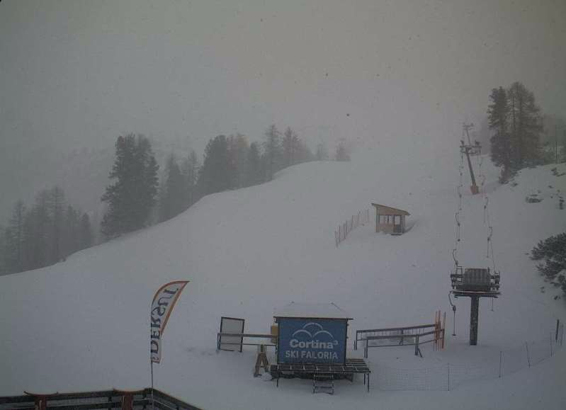 Late powder for Cortina - Photo: dolomitisuperski.com
Not surprisingly, snow conditions are remarkably good in the few ski resorts that are still open. If it’s powder you are after, then take your pick from any of the Austrian resorts (e.g. Obertauern, Hintertux, Stubai, Kaprun, Mölltal), though it may be better to wait until tomorrow for the weather to improve.
Argentière in France, Engelberg in Switzerland, and Cortina in Italy also have significant new snow and are worth considering if you happen to be in the area.
As for the weather forecast, further snow is forecast in places at the weekend.
Updated: 10.30am Tuesday 26 April 2016 - Remaining wintry
The weather in the Alps remains wintry, with below average temperatures and further snow in places.
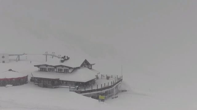
 Rather cloudy in Ischgl this morning, with snow forecast tonight - Photo: ischgl.com
On Tuesday, the heaviest snow will be across the northern Alps and later in the day/overnight. On Wednesday, the southern Austrian Alps and the Dolomites are likely to be most in the firing line.
Many other parts of the Alps are likely to see at least a little snow over the next 36 hours, though some south-western areas (i.e. the southern French and south-western Italian Alps) may stay dry. It will remain cold with the rain/snow level between 1000 and 1500m today, dropping to between 500m and 900m tonight and tomorrow.
Of the ski areas still open, we think that the Mölltal glacier in southern Austria could do best from this latest front, with 30-50cm of new snow possible by the end of tomorrow. Argentière and Engelberg are two other ski resorts to keep an eye on if it’s powder you are after.
Other ski resorts that remain open include Val d’Isère (until 1 May), Tignes (until 8 May), Val Thorens (until 8 May), Zermatt (all year round on the glacier), Cervinia (until 1 May), Livigno (until 8 May), Ischgl (until 1 May), Obertauern (until 1 May), and Hintertux (all year round on the glacier).
Updated: 10.50am Monday 25 April 2016 - Further heavy snow for some northern parts of the Alps
There have been further snowfalls across many northern parts of the Alps in the last 24 hours. The heaviest snow has been across the northern Swiss Alps where some areas (e.g. Trübsee above Engelberg) have seen over 50cm since Sunday morning/80cm since Saturday morning!
 Fresh snow in Morzine this morning! - Photo: chilloutmountain.com
Most other northern parts of the Alps have seen at least a little snow and, with cold arctic air flooding western Europe, it has fallen to as low as 500-700m.
Sadly, most resorts are now closed for the season, though there are of course still a few exceptions open, including for example:
- in France - Val d’Isère (until 1 May), Tignes and Val Thorens (until 8 May);
- in Italy - Cervinia (until 1 May) and Livigno (until 8 May);
- in Switzerland - Zermatt (glacier open all year); and
- in Austria - Ischgl and Obertauern in Austria (until 1 May).
 Lots of snow down to low altitude on the northern fringes of the Alps. This is Brauneck Garland in Germany, close to the Austrian border - Photo: foto-webcam.eu
Needless to say, snow conditions are excellent for the time of year, especially in the northern Alps where most of the fresh snow has fallen. Further south it has been drier and brighter, but here too temperatures are below average for late April.
It will remain unsettled for the rest of this week with further snow in many parts of the Alps.
Updated: 10.25am Sunday 24 April 2016 - Cold, with new snow for some northern parts of the Alps
There is still lots of cloud across the Alps this morning, thickest in the north with a scattering of snow showers here and there. The best of any brightness is on the southern side of the Alps.
 25cm of new snow and still going at Stand, Engelberg - Photo: titlis.ch
Many northern parts of the Alps have seen some fresh snow over the last 24 hours, although in most cases snowfall totals have been modest. The heaviest snow has been close to the northern edge of the Alps – Engelberg, for example, has 25cm of new snow above 2200m this morning and a dusting even at resort level (1000m). According to the Tirol avalanche report, the Stubai and Zillertal Alps have also seen 20-30cm of new snow at altitude.
By contrast, the southern side of the Alps have seen little if any snow this weekend and, protected by the Foehn, can look forward to some decent sunny breaks today.
Further north, one or two brighter intervals are also possible today, especially in the more internal valleys. However, generally speaking there will still be quite a lot of cloud, with further snow flurries here and there, especially in the northern Swiss and Austrian Alps. It will be cold with a rain/snow level between 500m and 900m.
It will remain cold and unsettled during the first part of next week with further snow in places, heaviest in the north-western half of the Alps.
Updated: 11.10am Saturday 23 April 2016 - Turning colder, some snow in places
It’s a mostly cloudy start to the day across the Alps, with just a few brighter breaks here and there, mostly in the south. In the north-western Alps there is some precipitation, which will extend more generally to the northern half of the Alps as the day goes on, with a rain/snow limit descending from 1800-2000m to 1500m, lower still tonight.
 Sunshine will be in short supply across the Alps today. This is near Kaprun, where snow showers are expected at altitude later - Photo: foto-webcam.eu
Tomorrow, the cooling trend will continue, with further snow showers, mostly across the northern half of the Alps where they will fall to between 500m and 1000m. The southern half of the Alps should see more in the way of sunshine.
Snowfall totals over the next 48 hours will be greatest in ski resorts close to the northern edge of the Alps which have plenty of high terrain, such as Argentière, and Engelberg.
It will remain unsettled and cold next week with further significant snow in places.
Updated: 10.45am Friday 22 April 2016 - Turning more wintry over the weekend
It’s another mild day in the Alps today, but it will turn colder over the weekend and into the first part of next week with some significant snow in places, especially in the north.
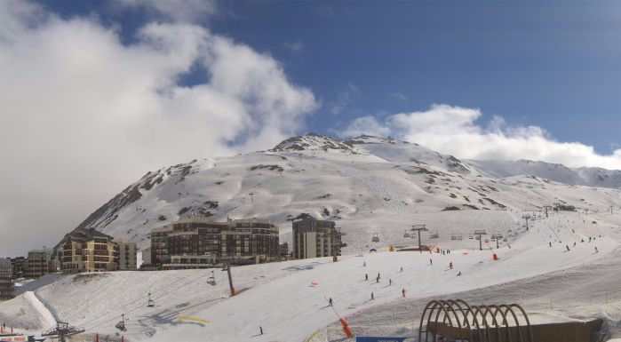
 Spring-conditions today, but turning more wintry again over the weekend. This is Livigno - Photo: mottolino.com
Back to today and many places will be dry, but there is now more in the way of cloud around than there has been over the past couple of days, especially in the west. Later in the day a few showers will break out, most of these in the western half of the Alps with a little snow above 2200m.
Tomorrow, showers will become more widespread across the northern half of the Alps with the rain/snow limit descending from 1900m to 1500m or lower later. On Sunday it will turn much colder with further snow showers, again mostly across the northern Alps and falling to between 500m and 800m.
Examples of resorts that could do particularly well from this latest storm (and are still open) include Argentière, Engelberg and Kaprun, all of which could see 50cm or more of new snow above 2200m in the next two to three days. What’s more, it will stay unsettled and relatively cold for much of next week, with further snow possible in all Alpine regions.
As for snow conditions, they will again be spring-like in today’s mild weather, but will improve rapidly over the weekend as colder air digs in from the north. Anyone lucky enough to be skiing in the Alps early next week will have a good chance of finding some powder, especially in the north.
Updated: 9.30am Thursday 21 April 2016 - Mostly fine, but turning colder and more unsettled towards the weekend
The eastern Alps can expect another warm and sunny today. Further west there is more in the way of cloud but, apart from the odd shower here and there later this afternoon, most places should stay dry.
 Perfect conditions on the Hintertux glacier this morning - Photo: facebook.com/Hintertux.Glacier
Snow conditions will be typically spring-like in the Alps, with only the highest north-facing slopes remaining firm all day long (2800m or above). However, it will become more wintry this weekend, especially in the northern Alps where 50cm+ of new snow is possible by Monday in a few favoured locations (e.g. on the Titlis, Engelberg).
On Friday, showers will become a little more widespread across the northern and western Alps, especially later in the day with snow around 2000-2200m.
On Saturday it will turn much colder with further showers, mostly across the northern half of the Alps, and snow reaching 1400m later in the day.
Similar weather is expected on Sunday, though the rain/snow limit will fall below 1000m in places.
Updated: 9.30am Wednesday 20 April 2016 - Temporarily sunny and warmer again
It’s a splendid day for most of the Alps, with lots of sunshine and (after a cool start) pleasantly warm afternoon temperatures.
 Fabulous skiing conditions in Cervinia today - Photo: cervinia.it
This follows an equally fabulous weather day in the western Alps yesterday when there was even more fresh snow around. By contrast, some eastern Alpine regions remained cloudy until last night, when skies finally cleared.
Snow conditions are also excellent for the time of year - you can even still find some powder on high north-facing slopes if you know where to look or have a good guide. Elsewhere, a good overnight refreeze means that the going is nice and firm early on.
 Excellent snow yesterday in Val Thorens - Photo: facebook.com/ValThorens
The snow will inevitably soften in the strong April sun, first on east-facing slopes, next on south-facing slopes, and then on west-facing slopes. However, with relatively low humidity today it should stay firm and grippy on north-facing slopes above 2500m or so for much of the day - even all day higher up.
After another relatively fine day tomorrow, the weather will turn more unsettled again from the north-west on Friday, and over the weekend, with further snowfall for some of the higher resorts. It will also turn colder, especially early next week.
Updated: 10.50am Tuesday 19 April 2016 - Bluebird for many parts of the Alps!
Some eastern parts of the Alps are still quite cloudy this morning but, generally speaking, there is plenty of sunshine on offer and, for some, significant fresh snow.
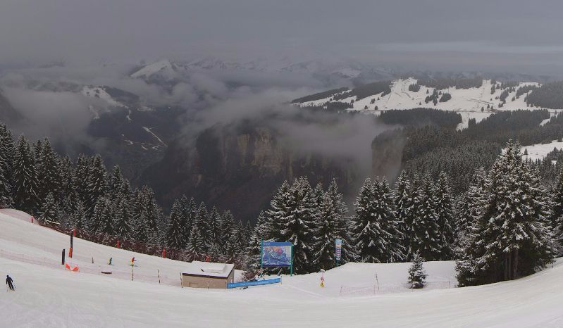
 Bluebird today in Avoriaz with around 30cm of fresh snow - Photo: avoriaz.com
This follows a major spring storm which, according the Tirol avalanche bulletin, has dumped as much as 75cm of snow in the last 48 hours on the main Alpine, Höhe Tauern and Zillertal ridges (e.g. Hintertux glacier).
Other areas to have done well include much of the rest of the Tirol (e.g. Ischgl), the eastern Swiss Alps (e.g. St Moritz), the central Italian Alps (e.g. Livigno) and the far northern French Alps (e.g. Avoriaz). All these areas have seen between 30cm and 60cm of new snow above 2000-2200m in the last couple of days.
Elsewhere, although there has been less snow, most places have seen at least a little at altitude, with a few flakes as low as 900m yesterday in the north-western Alps.
Not surprisingly, snow conditions are excellent at altitude in the Alps right now. However, with the strong April sun, the window of opportunity for skiing any powder will be short.
The weather will remain mostly fine over the next couple of days before turning more unsettled again towards the weekend. Indeed later in the weekend, and particularly early next week, it could become very wintry again as arctic air feeds down from the north.
Updated: 9.35am Monday 18 April 2016 - Winter bites back!
Many higher parts of the Alps are waking up to a significant covering of fresh snow this morning, with up to 50cm in some central and eastern parts of the Alps, such as the Hintertux glacier in the Tirol.
 50cm of new snow on the Hintertux glacier - Photo: facebook.com/hintertux.glacier
Many other parts of the Alps have at least a little fresh snow - the heaviest falls having been in the Austrian Tirol (e.g. Hintertux), the south-east of Switzerland (e.g. Davos, St Moritz) and the central Italian Alps (e.g. Livigno), all of which have seen between 25cm and 50cm (locally more) of new snow at altitude.
 South-eastern Switzerland also saw a lot of snow. This is Gruesch Danusa - Photo: gruesch-danusa.com
The rain/snow level started above 2000m yesterday, but fell to between 1000m and 1500m in most parts overnight (a bit higher in the south).
 Heavy snow in Sölden, though only the glaciers are still open - Photo: solden.com
Today, further snow showers are expected to fall to relatively low altitudes across many parts of the Alps, before the weather settles down again tomorrow. After a few days of sunnier and milder weather, another wintry blast is expected next weekend (watch this space).
Snow conditions in the Alps are remarkably good at altitude right now, especially in those areas that have seen significant snow - e.g. Livigno, St Moritz, Ischgl and all of the Austrian glaciers.
 Parts of Lombardy also saw significant snow. This is Livigno - Photo: valtline.it
Updated: 12.10pm Sunday 17 April 2016 - Rain/snow spreading to most parts of the Alps
Weathertoski is in Sölden in the Austrian Tirol where it was mild and cloudy first thing this morning. Later today we are expecting showers or longer spells of rain from the west, with a rain/snow limit dropping from 2000m to 1500m or lower tonight.
 Firm grippy snow on the glaciers in Sölden yesterday, as you would expect - Photo: weathertoski.co.uk
Most of the Alps will see some significant precipitation over the next 24 hours, with snow mostly between 1500m and 2000m, but temporarily as low as 1200m in places tonight.
Yesterday snow conditions were typically spring-like here in Sölden, with some excellent skiing on east-facing pistes early on before it softened up in the strong April sun. On north-facing slopes above 2400m the snow remained firm all day long, and on the glaciers (2700-3200m) it still felt like mid-winter.
Showers will clear the eastern Alps tomorrow, leaving the rest of next week looking quite sunny and warm.
Updated: 7.10am Saturday 16 April 2016 - Variable cloud, a few showers in the west
Weathertoski is in Sölden in the Austrian Tirol where it is partly cloudy first thing this morning with a temperature of about 4°C.
 Dry but partly cloudy in Sölden early this morning - Photo: weathertoski.co.uk
The weather is expected to stay mostly dry here in Austria today with variable cloud, some sunny spells and just the odd isolated shower (snow 2200m) here and there.
Showers are more widespread today in the western Alps, especially early on in the far north-west (e.g. the French Haute-Savoie), where the rain/snow limit is somewhere between 2000m and 2300m. The best of any sunshine today will be further east.
Snow conditions in the Alps are very variable today, with a dusting of new snow at high altitude in some western parts. Further east, where skies are brighter, we can expect a typical freeze-thaw cycle with firm snow to start with (especially where it was clear overnight), quickly softening up in the strong April sun.
Tomorrow (Sunday) showers will become heavier and more widespread from the west with a rain/snow limit lowering from 2000m to 1500m.
Updated: 9.30am Friday 15 April 2016 - Mild and changeable
The weather in the Alps remains rather changeable. Many places will be dry today, but there will be a few showers here and there, most frequent this afternoon with a little snow above 2000-2300m. The best of any sunshine, at least this morning, will be in the south-eastern Alps (Dolomites).
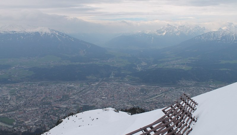 Changeable weather in the Alps over the next few days. This is Innsbruck - Photo: foto-webcam.eu
Snow conditions will be typically spring-like today, quickly softening up in areas exposed to the sun, only remaining firm and wintry all day long on north-facing slopes above 2400m or so.
The weather will remain unsettled but mild over the weekend, with further showers or longer spells of rain/snow in places, heaviest around and to the north of the main Alpine ridge. There will, however, be some drier, brighter spells, these most likely in the south-east.
Updated: 9.45am Thursday 14 April 2016 - Fresh snow for some
As expected a cold front has brought fresh snow to parts of the Alps in the last 24 hours, heaviest in the north where there has typically been 10-20cm above 2000m (locally a bit more). Further south the snow has been more hit and miss, but here too there have been some moderate accumulations in places.
 Fresh snow and brightening skies in the western Swiss Alps. This is the Aletsch glacier - Photo: foto-webcam.eu
Today there are still some showers across the central and eastern Alps (snow 1200-1600m) while the western Alps are drier and brighter. Snow conditions remain variable with some new snow to be enjoyed in places today, especially at altitude. Lower down, however, any snow will soften rapidly, especially in the west, which will see the most sun.
Friday will see plenty of fine weather across the Alps before it turns a little more unsettled again over the weekend, thanks to the mild south-westerly airflow.
Updated: 9.15am Wednesday 13 April 2016 - A little snow for some in the next 24 hours
First thing this morning many places are dry, but there are one or two isolated showers here and there, and some persistent rain in the far north-western Alps. The best of the sunshine is further south and east.
 Fine start over much of Austria but showers are expected later. This is the Mölltal glacier - Photo: foto-webcam.eu
As the day progresses, showers will become more widespread and intense in the north-western Alps, and will also pop up further east, though will be more scattered. The rain/snow limit will be close to 2000m, falling to 1500m in the west later as the cold front begins to move through.
This evening and tonight, the cold front will send more organised bands of showers (with possible thunder) west to east across all Alpine regions, clearing in the west later. The snow-line will sink to between 1300m and 1700m, with 10-20cm likely above 2000m across the northern half of the Alps - generally less in the south. On Thursday, it will start showery in the east (snow 1300-1500m) but with brighter weather in the west, which will slowly extend to all areas.
Snow conditions will be highly variable over the next couple days with a little powder at altitude, especially in the north.
Updated: 8.30am Tuesday 12 April 2016 - Spring-snow conditions continue in the Alps
It’s a fine start to the day across much of the Alps, though there are a few areas of cloud around, especially in the far northern Swiss and Austrian Alps.
 Typically spring-like conditions in the Alps again today. This is Laax - Photo: laax.com
Most places will continue to see plenty of sunshine today, but cloud will bubble up quite widely this afternoon with a few well scattered showers here and there (snow around 2000-2200m). On Wednesday and Thursday showers will become more widespread across the Alps, with a little fresh snow above about 1800-2000m.
Conditions in the Alps remain typically spring-like, with some good firm snow early in the day in resorts where skies have been clear overnight. The snow will then quickly soften up, first on east-facing slopes, then more acutely on south and west-facing slopes. On high north-facing slopes (above about 2400m) it is possible to find “wintry” snow all day long.
Updated: 9.40am Monday 11 April 2016 - Typically spring-like conditions
After a taste of winter on Friday and Saturday for some parts of the Alps, the wind is now coming from the south again which means milder temperatures for all.
 Lovely spring day in the eastern Alps. This is St Johann im Pongau - Photo: sanktjohann.com
Sunday was a lovely day for many regions, with plenty of sunshine and pleasantly warm afternoon temperatures. This fine weather will continue across most parts today, but it will become cloudier in the west, especially later in the day with one or two showers here and there (snow 2000m). The highest temperatures will be in the central and northern Alps where a weak to moderate Foehn wind will be blowing.
Snow conditions today will be typically spring-like, i.e. quite firm to begin with due to a reasonable refreeze in many places, but quickly softening up on slopes exposed to the sun.
After a broadly similar day tomorrow, with further scattered showers in the west, the weather will become more generally unstable on Wednesday. It will, however, remain relatively mild.
Updated: 9.45am Saturday 9 April 2016 - Up to 40cm of fresh snow in the Alps!
There has been further significant snow for some over the last 24 hours, as cold and warm air masses continue to do battle over the Alps.
 Perfect conditions in Cervinia this morning, with blue skies and 25cm of fresh snow - Photo: cervinia.it
Most (though not all) parts of the Alps have picked up at least a dusting from the latest storm. The heaviest snowfalls have been a bit hit and miss and, while they cannot be attributed to a particular corner of the Alps, one area that has done well this morning includes Zermatt, Cervinia and Saas-Fee where there is 25-40cm of new snow at altitude. Parts of the Austrian Tirol and the Italian Dolomites have also seen significant snow, especially high up.
This morning there is still a lot of cloud around with showers in places (snow 1000-1700m), these being most frequent in the eastern Alps. In the west there are a few sunny breaks, which should become a little more prevalent later.
Not surprisingly, snow conditions are highly variable in the Alps, with powder for some resorts, especially at high altitude, but ice or slush for others.
The weather will gradually improve over the next couple of days with increasing amounts of sunshine and warmer temperatures, before further fronts arrive from the west on Tuesday.
Updated: 10.30am Friday 8 April 2016 - Heavy snowfall for a lucky few
The weather situation is very complicated right now as warm and cold air battle it out over the Alps. This morning, some central-southern and eastern parts of Switzerland have woken up to a significant fall of snow - as much as 30-40cm in parts of Ticino and Graubünden in Switzerland (e.g. Laax).
 New snow in Lenzerheide in eastern Switzerland this morning - Photo: lenzerheide.com
Some parts of Austria have also seen a moderate fall of snow, especially in the south-west (10-15cm on the Hintertux glacier, for example), but in Lombardy and the Dolomites the rain/snow limit was much higher, with rain to 2000m or above.
Elsewhere in the Alps, showers have been much more hit and miss, with many places staying dry. However, any snow that has fallen has reached much lower altitudes on the northern side of the Alps than in the south-east, where the mild air is hanging on the longest.
Today, the bulk of the showers will again be concentrated in the south-eastern Alps, where they will be at their heaviest and most widespread later in the day. The rain/snow limit will again be around 2000m in the far south-east (e.g. Dolomites), before dropping this evening. Further north it will be between 700m and 1400m. On the whole, any precipitation will be lighter and more intermittent on the north-western side of the Alps, with some places staying dry although mostly cloudy.
The weather in the Alps will gradually improve over the weekend and turn warm again early next week.
Updated: 10.30am Thursday 7 April 2016 - Still variable, heavy snow for some tomorrow
The weather in the Alps remains highly variable this morning, with plenty of cloud around but also some good sunny breaks, especially at altitude in the west.
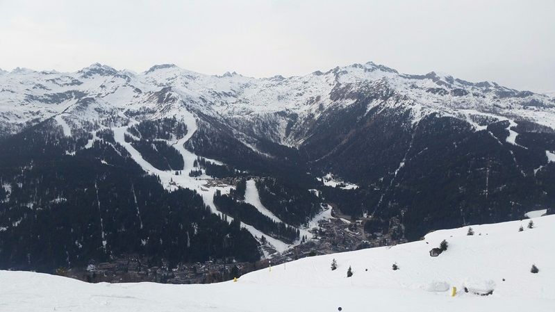
 A rare glimpse of the sun in Tignes this morning - Photo: tignes.net
Most places are dry, but there are a few showers across the eastern Alps this morning, and showers will become more widespread across the northern Alps again this afternoon and evening. The rain/snow line will start at around 1600m but fall to 1000-1300m tonight.
Conditions are still not great, especially lower down, but above 1800-2000m there is a little new snow here and there, with heavier falls in prospect tomorrow.
Tomorrow the weather situation will become more complicated as the fronts arriving from the north interact with an area of low pressure developing over Italy. Showers will become heavier and more widespread across the Alps, especially in south-east (e.g. Dolomites) with a rain/snow limit somewhere between 1400m and 2000m.
The north-western side of the Alps will see less intense precipitation, but a much lower snow-line (700-1200m).
Updated: 10.25am Wednesday 6 April 2016 - Variable weather, generally quite poor snow conditions
There is a lot of cloud across the Alps again this morning. Many places are dry but, as in recent days, there are some showers here and there - mostly in the north-western Alps, where the rain/snow limit is between 1600m and 2000m.
 A little fresh snow on the trees in Avoriaz, but the going remains “heavy” - Photo: avoriaz.com
The weather should gradually improve today in the western half of the Alps, with increasingly bright skies. The eastern Alps will, however, remain more generally cloudy even if any precipitation remains light and patchy.
Snow conditions remain highly variable across the Alps, but are generally poor due to a week or more of very mild and often quite cloudy weather (preventing good overnight refreezes). It will, however, turn colder as the week goes on with some significant snow possible on Friday, especially in the central and eastern Alps.
Updated: 9.40am Tuesday 5 April 2016 - Still very mild, with showers in the south and west
The Alps are still under the influence of a very mild south-westerly airstream that has led to a serious deterioration in snow conditions over the last week or so.
 Another grey but mild day expected in the western Alps. This is Les Saisies - Photo: lessaisies.com
This south/south-westerly airflow has been responsible for a lot of cloud across the southern and western Alps over the last few days, with bits and pieces of precipitation here and there, and a little snow at high altitude. It has also brought in some Sahara sand, which has left the snow a dirty orange/brown in places.
On the northern (and particularly north-eastern) side of the Alps, it has generally been brighter and very warm, thanks to the Foehn wind. Yesterday the temperature in Salzburg was just shy of 26°C, remarkable for early April.
Today, showers will become more widespread across the western and southern Alps, heaviest along the Swiss-Italian border regions, with a rain/snow limit between 2000m and 2300m. The warmest, sunniest weather will again be in the northern Austrian Alps where the Foehn will be at its strongest.
Needless to say, conditions remain poor across most of the Alps, with only the highest slopes (above 2500m) offering firm wintry snow for anything like most of the day. However, it will gradually turn colder this week with snow in places, and perhaps significant snow in the central and eastern Alps on Friday.
Updated: 11.30am Sunday 3 April 2016 - Very mild
The Alps are still under the influence of a warm southerly airflow. Most places will be dry, but there will be a few showers in the west and south-west, with a rain/snow limit between 2000m and 2300m.
 Bright skies but spring snow conditions in Madonna di Campiglio right now - Photo: weathertoski.co.uk
The best of the sunshine will be in the northern and eastern Alps today where, under the influence of the Foehn, we could see temperatures as high as 24°C in some central and northern Austrian valleys (e.g. Innsbruck).
Needless to say, snow conditions have deteriorated rapidly over the last few days and you need a ski resort with plenty of north-facing terrain above 2300m, preferably even higher, to stand any chance of the snow staying remotely firm all day long.
The weather in the Alps will stay very mild until the middle of next week, before colder air and some snow moves in from the north-west late on Tuesday.